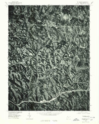
1975 Map of Ellenboro
USGS Topo · Published 1979About this map
Ellenboro and its surrounding Ritchie County landscape are captured in this 1975 orthophotoquad, which uses rectified aerial imagery to show the actual ground cover and settlement patterns of the late 1970s. The map reveals the intricate drainage system of Bonds Creek and Pike Creek, where winding valley roads connect small communities like Hebron and Pike. In the southern portion of the quadrangle, the concentrated development of Ellenboro and neighboring Lamberton highlights the primary transportation corridor of the era. Produced in cooperation with the Soil Conservation Service, this imagery provides a unique perspective on land use, showing the exact boundaries of wooded ridges and cleared valley floors that traditional topographic line maps often generalize. It is an essential resource for understanding the physical layout of these West Virginia hills during a period of established rural infrastructure.
Find a feature on this map
6 named features on this map. Tap any name to fly to it.
Don’t see what you’re looking for? This feature index may not catch every label — zoom into the map to look around manually.
Map Details
Editions of this 1975 Ellenboro Map
This is the sole edition of this map. No revisions or reprints were ever made.
Other maps of this area

1905 · West Union
USGS Topo · 1:62,500

1906 · Saint Marys
USGS Topo · 1:62,500

1906 · Holbrook
USGS Topo · 1:62,500

1907 · Harrisville
USGS Topo · 1:62,500

1924 · St Marys
USGS Topo · 1:62,500

1924 · Harrisville
USGS Topo · 1:62,500

1924 · West Union
USGS Topo · 1:62,500

1924 · Holbrook
USGS Topo · 1:62,500

1926 · Harrisville
USGS Topo · 1:62,500

1926 · Holbrook
USGS Topo · 1:62,500