Old Maps of Green Bay, Wisconsin
Explore 28 old maps of Green Bay, spanning from 1954 to today. These high-resolution historic maps reveal how streets, neighborhoods, landmarks, and natural features evolved over time — perfect for genealogy, metal detecting, research, and local history exploration.
What you can do with these maps:
- See how Green Bay changed over time: Compare historical maps to modern-day views to trace roads, homesites, rail lines & more.
- View detailed metadata: Each map includes creators, publishers, year, scale, and archive source.
- Overlay maps with satellite & LiDAR: Visualize the past alongside modern tools to explore terrain & human change.
- Trusted historical sources: Maps sourced from the USGS, Library of Congress, and other archives.
- Access maps your way: View online, download high-res files, or order prints for personal or research use.
Start exploring old maps of Green Bay to uncover forgotten places, hidden landmarks, and the deep history beneath your feet.
Green Bay, WI maps
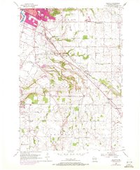
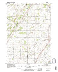
(28)- 1954 Map of De Pere, 1956 Print
 1954 De Pere1956 Print · USGSCovers Green Bay, including De Pere, Kaukauna, and other nearby areas2 unique versions available
 - 1954 Map of Green Bay West, 1956 Print
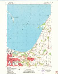
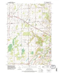
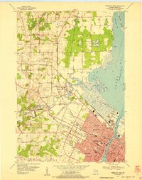 1954 Green Bay West1956 Print · USGSCovers Green Bay, including Howard, Suamico, and other nearby areas2 unique versions available
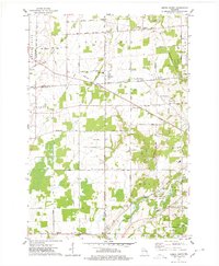
 - 1954 Map of Denmark, 1956 Print
 1954 Denmark1956 Print · USGSCovers Green Bay, including Allouez, Bellevue, and other nearby areas2 unique versions available
 - 1954 Map of De Pere, 1956 Print
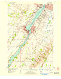 1954 De Pere1956 Print · USGSCovers Green Bay, including De Pere, Allouez, and other nearby areas2 unique versions available
 - 1954 Map of New Franken, 1956 Print
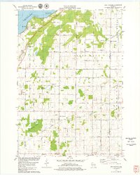
 1954 New Franken1956 Print · USGSCovers Green Bay, including Suamico, Little Suamico, and other nearby areas2 unique versions available
 - 1954 Map of Green Bay East, 1956 Print
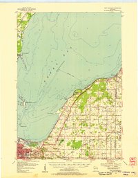
 1954 Green Bay East1956 Print · USGSCovers Green Bay, including Suamico, Humboldt, and other nearby areas2 unique versions available
 - 1954 Map of Manitowoc, 1968 Print
 1954 Manitowoc1968 Print · USGSCovers Green Bay, including Manitowoc, Allouez, and other nearby areas2 unique versions available
 - 1954 Map of Bellevue, 1972 Print
 1954 Bellevue1972 Print · USGSCovers Green Bay, including Allouez, Bellevue, and other nearby areas
 - 1954 Map of Green Bay, 1980 Print
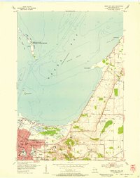
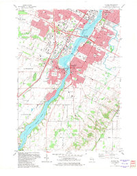
 1954 Green Bay1980 Print · USGSCovers Green Bay, including Howard, Suamico, and other nearby areas
 - 1955 Map of Green Bay, 1968 Print
 1955 Green Bay1968 Print · USGSCovers Green Bay, including Appleton, Oshkosh, and other nearby areas2 unique versions available
 - 1958 Map of Manitowoc
 1958 Manitowoc1958 Print · USGSCovers Green Bay, including Manitowoc, Allouez, and other nearby areas
 - 1974 Map of Oneida South, 1978 Print
 1974 Oneida South1978 Print · USGSCovers Green Bay, including De Pere, Oneida, and other nearby areas
 - 1974 Map of Oneida North, 1978 Print
 1974 Oneida North1978 Print · USGSCovers Green Bay, including Howard, Suamico, and other nearby areas
 - 1978 Map of New Franken, 1979 Print
 1978 New Franken1979 Print · USGSCovers Green Bay, including Humboldt, Montpelier, and other nearby areas2 unique versions available
 - 1982 Map of De Pere
 1982 De Pere1982 Print · USGSCovers Green Bay, including De Pere, Allouez, and other nearby areas
 - 1982 Map of Green Bay East
 1982 Green Bay East1982 Print · USGSCovers Green Bay, including Suamico, Humboldt, and other nearby areas
 - 1982 Map of Bellevue
 1982 Bellevue1982 Print · USGSCovers Green Bay, including Allouez, Bellevue, and other nearby areas
 - 1982 Map of Green Bay West, 1983 Print
 1982 Green Bay West1983 Print · USGSCovers Green Bay, including Howard, Suamico, and other nearby areas
 - 1984 Map of Sturgeon Bay, 1985 Print
 1984 Sturgeon Bay1985 Print · USGSCovers Green Bay, including Suamico, Sturgeon Bay, and other nearby areas2 unique versions available
 - 1984 Map of Appleton, 1985 Print
 1984 Appleton1985 Print · USGSCovers Green Bay, including Appleton, Oshkosh, and other nearby areas2 unique versions available
 - 1984 Map of Manitowoc, 1985 Print
 1984 Manitowoc1985 Print · USGSCovers Green Bay, including Manitowoc, Allouez, and other nearby areas2 unique versions available
 - 1984 Map of Shawano, 1985 Print
 1984 Shawano1985 Print · USGSCovers Green Bay, including Howard, Suamico, and other nearby areas2 unique versions available
 - 1992 Map of De Pere, 1996 Print
 1992 De Pere1996 Print · USGSCovers Green Bay, including De Pere, Allouez, and other nearby areas
 - 1992 Map of Oneida South, 1996 Print
 1992 Oneida South1996 Print · USGSCovers Green Bay, including De Pere, Oneida, and other nearby areas
 - 1992 Map of Oneida North, 1996 Print
 1992 Oneida North1996 Print · USGSCovers Green Bay, including Howard, Suamico, and other nearby areas
Showing maps 1-25 of 28
Top cities near Green Bay
- De Pere historical maps
- Howard historical maps
- Allouez historical maps
- Bellevue historical maps
- Suamico historical maps
- Ledgeview historical maps
See more
Top neighborhoods of Green Bay
- Preble historical maps
- Northeast Area historical maps
- Downtown historical maps
- Nicolet Drive historical maps
- Red Smith historical maps
- Imperial historical maps
See more
Frequently asked questions
- What are the different types of historical maps available for Green Bay?
- What is the oldest map of Green Bay?
- Where can I purchase historical maps of Green Bay for my home or office?
- Where can I download high-res historical maps of Green Bay?
- Are there historical topographic maps available for Green Bay?
- Is there historical aerial imagery available for Green Bay?
- Where are historical maps of Green Bay sourced from?