1900s (20th Century) Maps of Charlestown, Wisconsin
Explore 15 historic maps of Charlestown from the 1900s (20th Century). These maps offer a rare glimpse into what life looked like during the 1900s — showing old roads, neighborhoods, homes, and landmarks that have changed or disappeared over time.
Whether you're researching your family's past, planning a metal detecting trip, or studying how Charlestown's landscape evolved across the 1900s, these high-resolution maps are a powerful tool for exploring the history of this region.
- Focus on a specific era: All maps on this page are from the 1900s, giving you a focused view of this time period.
- See what’s changed: Compare century-old streets, trails, and buildings to today's modern landscape using overlays and satellite layers.
- Research with precision: Use these maps for genealogy, historical research, land use analysis, or educational projects.
- View, download, or print: Maps are fully viewable online in high resolution, and can be downloaded or printed for your own records.
Start exploring Charlestown's history through authentic maps from the 1900s. This is your window into the past.
Charlestown, WI maps
(15)- 1954 Map of Chilton, 1956 Print
 1954 Chilton1956 Print · USGSMid-century Calumet County is captured here during a period of transition for its rural school districts and thriving rail corridors. Genealogists can locate family landmarks such as St Lukes Church, Brillion Cem, and several schoolhouses like the Howe Sch.3 unique versions available
 - 1954 Map of Kiel, 1956 Print
 1954 Kiel1956 Print · USGSWisconsin's glacial landscape meets mid-century development in this survey of the four-county border region. Genealogists can trace family roots through numerous country churches like Holy Rosary Ch and schools including the Elder Grove Sch.2 unique versions available
 - 1955 Map of Green Bay, 1968 Print
 1955 Green Bay1968 Print · USGSCentral and Eastern Wisconsin are captured here in the mid-fifties, showing the industrial growth of the Fox Valley and Wisconsin River corridors. Genealogists and historians can trace rail lines like the Green Bay and Western through settlements like Weyauwega, Clintonville, and Pulaski.2 unique versions available
 - 1957 Map of Madison, 1967 Print
 1957 Madison1967 Print · USGSSouth-central Wisconsin in the mid-fifties reveals a landscape of industrial hubs and glacial lakes linked by a dense rail and highway network. Genealogists and historians can trace the development of lakeside communities and find notable sites like Badger Ordnance Works and the Horicon National Wildlife Refuge.3 unique versions available
 - 1960 Map of Madison
 1960 Madison1960 Print · USGSCentral and Southern Wisconsin are captured in the late fifties, showing the region as its rail-and-river network matured. Trace the paths of the Soo Line RR or locate family roots near Lake Mendota and Horicon National Wildlife Refuge.2 unique versions available
 - 1974 Map of Kiel, 1977 Print
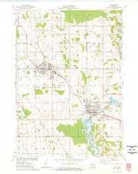 1974 Kiel1977 Print · USGSThe manufacturing corridor between Kiel and New Holstein comes into focus in the mid-seventies, highlighting a landscape shaped by rail and river. Genealogists and local historians can trace family-named roads and landmarks like Holy Rosary Cem, the SS Peter and Paul Cem, and the old Kilns.
 - 1974 Map of Chilton, 1977 Print
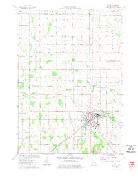 1974 Chilton1977 Print · USGSCalumet County in the mid-seventies remains a vital rail and agricultural hub centered on the city of Chilton. Genealogists and local historians can trace family-named roads like Ortlepp Road and Lau Road, or locate rural landmarks such as St Lukes Ch and Portland Cem.
 - 1974 Map of Marytown, 1977 Print
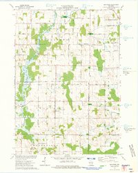 1974 Marytown1977 Print · USGSEastern Wisconsin dairy country is captured here in the mid-seventies at the meeting of Calumet, Fond du Lac, and Sheboygan counties. Genealogists can trace family farm locations near Marytown, Charlesburg, and the St Charles Cem.
 - 1974 Map of Potter, 1977 Print
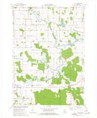 1974 Potter1977 Print · USGSCalumet and Manitowoc Counties are captured in the 1970s, showcasing a landscape of wetlands and rail corridors at the junction of four townships. Genealogists can trace family connections through sites like St Martin Ch, Rantoul Cem, and long-established homesteads along Schneider Road.
 - 1980 Map of Fond Du Lac
 1980 Fond Du Lac1980 Print · USGSThe Fox River Valley and Horicon Marsh meet here during the late twentieth century, showing a transition from lakeside industry to glacial conservation. Genealogists can locate family sites at Estabrook Cem or trace the rail lines through Ripon and Waupun.
 - 1984 Map of Appleton, 1985 Print
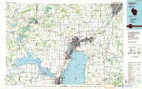 1984 Appleton1985 Print · USGSThe Fox River Valley in the mid-eighties shows a bustling corridor of industry and nature, from the shores of Lake Winnebago to the Oneida Indian Reservation. Trace local heritage through landmarks like Riverside Cem or explore the wetlands of Poygan Marsh State Wildlife Area.2 unique versions available
 - 1992 Map of Kiel, 1996 Print
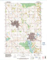 1992 Kiel1996 Print · USGSKiel and New Holstein appear at a peak of late-century growth where the Sheboygan River meets the Wisconsin Central rail line. Researchers can locate many family burial grounds like Eaton Cemetery or trace landmarks such as the Municipal Airport and the waters of Schildhauer Pond.
 - 1992 Map of Chilton, 1996 Print
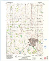 1992 Chilton1996 Print · USGSCalumet County during the early nineties shows a landscape where historic boundaries and river junctions define the community layout. Genealogists can trace family connections at St Augustine Cemetery or locate the old Fairground and Hayton settlement.
 - 1992 Map of Marytown, 1996 Print
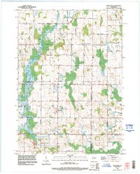 1992 Marytown1996 Print · USGSCalumet County land patterns and rural settlements are preserved here as they appeared in the early nineties. Genealogists and local historians can locate Marytown and Charlesburg, tracing family-named roads and sites like the Saint Charles Cemetery and the Old Indian Treaty Boundary.
 - 1993 Map of Potter, 1996 Print
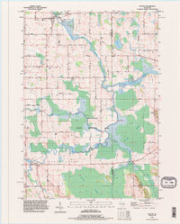 1993 Potter1996 Print · USGSEastern Wisconsin marshlands and river forks define the landscape in the 1990s as conservation efforts matured. Researchers can trace rural lineages via the Rantoul Cemetery, family-named routes like Schneider Road, and the villages of Potter and Hayton.
End of results
Showing maps 1-15 of 15
Top cities near Charlestown
- Kaukauna historical maps
- Harrison historical maps
- Taycheedah historical maps
- Chilton historical maps
- New Holstein historical maps
- Kiel historical maps
See more
Top neighborhoods of Charlestown
Frequently asked questions
- What are the different types of historical maps available for Charlestown?
- What is the oldest map of Charlestown?
- Where can I purchase historical maps of Charlestown for my home or office?
- Where can I download high-res historical maps of Charlestown?
- Are there historical topographic maps available for Charlestown?
- Is there historical aerial imagery available for Charlestown?
- Where are historical maps of Charlestown sourced from?