1970s Maps of Chippewa County, Wisconsin
Explore 36 historic maps of Chippewa County from the 1970s. These maps offer a rare glimpse into what life looked like during the 1970s — showing old roads, neighborhoods, homes, and landmarks that have changed or disappeared over time.
Whether you're researching your family's past, planning a metal detecting trip, or studying how Chippewa County's landscape evolved across the 1970s, these high-resolution maps are a powerful tool for exploring the history of this region.
- Focus on a specific era: All maps on this page are from the 1970s, giving you a focused view of this time period.
- See what’s changed: Compare century-old streets, trails, and buildings to today's modern landscape using overlays and satellite layers.
- Research with precision: Use these maps for genealogy, historical research, land use analysis, or educational projects.
- View, download, or print: Maps are fully viewable online in high resolution, and can be downloaded or printed for your own records.
Start exploring Chippewa County's history through authentic maps from the 1970s. This is your window into the past.
Chippewa County, WI maps
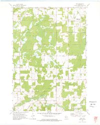
(36)- 1971 Map of Ladysmith SE, 1974 Print
 1971 Ladysmith SE1974 Print · USGSThe Jump River valley underwent significant change in the early seventies following the Holcombe power project. Trace the new shoreline of the Jump River Flowage and locate landmarks like the Willard Sch Townhall and Paradise Point.
 - 1971 Map of Sheldon, 1974 Print
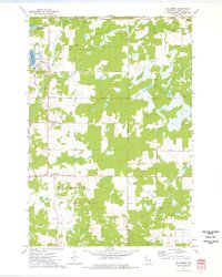
 1971 Sheldon1974 Print · USGSSheldon and Donald are shown in the early 1970s at the junction of the Jump and Little Jump Rivers. Local researchers can trace community landmarks like the Mennonite Ch, the Fairground, and the path of the SOO LINE RAILROAD.
 - 1971 Map of Flambeau Ridge, 1974 Print
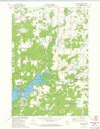
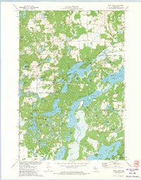
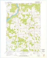
 1971 Flambeau Ridge1974 Print · USGSThe confluence of the Flambeau and Chippewa Rivers in northern Wisconsin is captured here during the early seventies. Local historians can trace lakeside developments and landmarks like St Francis Ch, the Flambeau Lookout Tower, and Pine Island.
 - 1972 Map of Fireside Lakes, 1974 Print
 1972 Fireside Lakes1974 Print · USGSThe Chippewa River valley straddles the Rusk and Chippewa County line in the early seventies, a landscape of dense woods and glacial kettle lakes. Genealogists and local historians can trace the rural layout of Big Bend through sites like the Mud Lake Cem, Island Lake Ch, and Hatch Landing.
 - 1972 Map of Chain Lake, 1974 Print
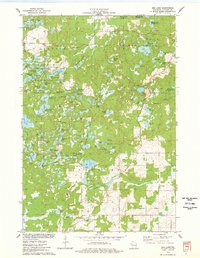
 1972 Chain Lake1974 Print · USGSThe Northwoods of Wisconsin are captured in the early seventies, showcasing a dense network of glacial lakes and wilderness along the Rusk and Chippewa county line. Researchers can trace remote campsites like Two Bear Camp and local landmarks like Stang Lookout Tower or the Townhall.
 - 1972 Map of Eau Claire West, 1975 Print
 1972 Eau Claire West1975 Print · USGSEau Claire was a bustling river and rail hub in the early seventies, centered around the Chippewa River and its industrial corridors. Researchers can trace historic local sites from the Univ of Wisconsin campus to the Lakeview Cemetery and the old Dells Dam.2 unique versions available
 - 1972 Map of Colfax South, 1975 Print
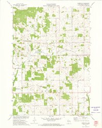
 1972 Colfax South1975 Print · USGSDunn County at the start of the 1970s shows a landscape defined by its river valleys and established rail lines. Genealogists and local historians can trace the foundations of Colfax and Elk Mound, and locate rural landmarks such as Big Elk Creek Ch and Evergreen Cem.
 - 1972 Map of Albertville, 1975 Print
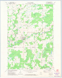
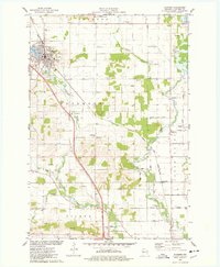
 1972 Albertville1975 Print · USGSChippewa County agriculture and industry meet in the early seventies, showing a landscape defined by the Soo Line and rural townships. Genealogists and local historians can trace family-named routes like Nelson Road and locate the original village site at Old Albertville.
 - 1972 Map of Fall Creek, 1975 Print
 1972 Fall Creek1975 Print · USGSThe Eau Claire River corridor is captured here in the early seventies, showing a landscape shaped by dairy farming and the rail-line economy. Genealogists can trace family footprints near St Bridgets Cem, Seymour Central Sch, and the village of Fall Creek.
 - 1972 Map of Chippewa Falls, 1975 Print
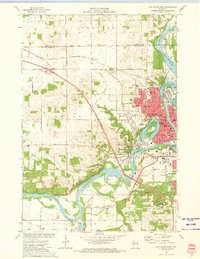
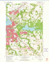
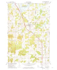
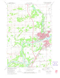 1972 Chippewa Falls1975 Print · USGSChippewa Falls is captured here in the early seventies as a thriving rail and industrial center along the Chippewa River. Genealogists and local historians can trace old family plots in Forest Hill Cemetery or locate landmarks like Old Badger Mills and the McDonell Central High School.2 unique versions available
 - 1972 Map of Lake Wissota, 1975 Print
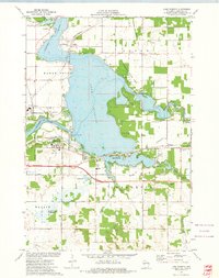 1972 Lake Wissota1975 Print · USGSLake Wissota and the eastern outskirts of Chippewa Falls are seen here in the early seventies as the area balanced recreation with industry. Trace local genealogy and infrastructure at Home Park Cem, Anson (Station), and the Soo Line railroad.
 - 1972 Map of Eau Claire East, 1975 Print
 1972 Eau Claire East1975 Print · USGSThe Eau Claire area in the early seventies shows a vibrant university city expanding around the Chippewa River. Genealogists and local historians can trace neighborhood growth through numerous school sites like Davey Sch and cemeteries including Calvary Cem.2 unique versions available
 - 1972 Map of Elk Creek Lake, 1975 Print
 1972 Elk Creek Lake1975 Print · USGSDunn and Eau Claire counties are captured here in the early seventies, where the Chippewa River winds through fertile bottomlands. Genealogists can locate several rural burial sites, including St Joseph and Peterson Cem, and trace the path of the Chicago and North Western railroad near Elk Mound.
 - 1973 Map of Colburn, 1976 Print
 1973 Colburn1976 Print · USGSChippewa County is captured here in the early seventies, showing a landscape defined by the winding Yellow River and the township boundaries of Estella and Delmar. Researchers can locate the small settlement of Colburn and trace family roots at the Walker-Jackson Cem near the riverbanks.
 - 1973 Map of Ruby, 1976 Print
 1973 Ruby1976 Print · USGSChippewa and Taylor counties in the early 1970s reveal a landscape of vast wetlands and managed wilderness. Genealogists and local historians can locate the Yellow River Cem and St Johns Ch near the banks of the Yellow River.
 - 1973 Map of Holcombe, 1976 Print
 1973 Holcombe1976 Print · USGSThe Holcombe area and the eastern Chippewa River valley are captured here in the early 1970s. Researchers can trace family sites at Estella Cem, follow the Old Railroad Grade, or locate landmarks like the Martle Ch.
 - 1973 Map of Huron, 1976 Print
 1973 Huron1976 Print · USGSWisconsin's lake country in the early 1970s is shown here at the intersection of Chippewa, Taylor, and Clark counties. Researchers can trace the Old Railroad Grade near Brownville or locate local landmarks like the Gilman Lookout Tower and Huron.
 - 1973 Map of Cornell, 1977 Print
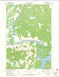
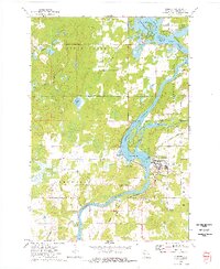 1973 Cornell1977 Print · USGSIn the early seventies, the Chippewa River valley centered around Cornell as a hub of industry and recreation. Local researchers can trace the Chicago and North Western rail line and explore the islands of Brunet Island State Park or the shores of Lake Holcombe.
 - 1973 Map of Crescent, 1977 Print
 1973 Crescent1977 Print · USGSChippewa County in the early seventies remains defined by its winding river valleys and rural crossroads settlements. Researchers can trace the heritage of small communities through landmarks like the Bohemian Cem, Cobban, and the Big Drywood Ch.
 - 1975 Map of Bob Lake, 1978 Print
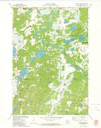
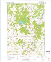
 1975 Bob Lake1978 Print · USGSChippewa County is seen here in the mid-seventies, featuring the glacial landforms of the Chippewa Moraine. Researchers can locate community anchors like the Cleveland Cem and Trinity Ch, or trace the winding course of the Rustic Road.
 - 1975 Map of Jim Falls, 1978 Print
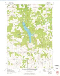
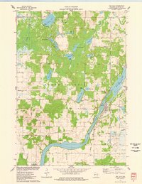 1975 Jim Falls1978 Print · USGSThe Chippewa River valley in the mid-1970s is shown here at its industrial and recreational peak. Local historians can trace the Chicago and North Western rail line and locate landmarks like the Copp Cem and the Substa Powerplant at Jim Falls.
 - 1975 Map of Colfax North, 1978 Print
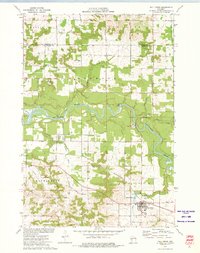
 1975 Colfax North1978 Print · USGSDunn County at the mid-point of the 1970s shows a landscape of river-bottom farms and quiet rural crossroads. Genealogists can trace family footprints through numerous sites like St Johns Ch, Evergreen Cem, and the village streets of Colfax.
 - 1975 Map of Bloomer, 1978 Print
 1975 Bloomer1978 Print · USGSBloomer and the surrounding townships of Tilden and Woodmohr are captured here in the mid-seventies, showing a landscape defined by the C & NW rail line. Genealogists can trace family names through sites like Tilden Cem, Eagleton Cem, and Scandinavian Ch.
 - 1975 Map of New Auburn, 1978 Print
 1975 New Auburn1978 Print · USGSWestern Wisconsin life in the mid-seventies centers on the village of New Auburn and its position along the Chicago and North Western railroad. Researchers can locate family sites at the New Auburn Cem, trace Duncan Creek, or explore the wooded Old Maids Bluff.
 - 1975 Map of Sand Creek, 1978 Print
 1975 Sand Creek1978 Print · USGSNorthwest Wisconsin in the 1970s shows a landscape defined by the winding Red Cedar River and the rural communities of Dunn and Barron Counties. Genealogists and local historians can trace family locations near Sand Creek, Cruikshank, and several early burial grounds including Zion Cem and Springbrook Cem.
Showing maps 1-25 of 36
Top cities of Chippewa County
- Chippewa Falls historical maps
- Lake Hallie historical maps
- Stanley historical maps
- Bloomer historical maps
- Eagle Point historical maps
- Anson historical maps
See more
Frequently asked questions
- What are the different types of historical maps available for Chippewa County?
- What is the oldest map of Chippewa County?
- Where can I purchase historical maps of Chippewa County for my home or office?
- Where can I download high-res historical maps of Chippewa County?
- Are there historical topographic maps available for Chippewa County?
- Is there historical aerial imagery available for Chippewa County?
- Where are historical maps of Chippewa County sourced from?