2020s Maps of Lewiston, Wisconsin
Explore 6 historic maps of Lewiston from the 2020s. These maps offer a rare glimpse into what life looked like during the 2020s — showing old roads, neighborhoods, homes, and landmarks that have changed or disappeared over time.
Whether you're researching your family's past, planning a metal detecting trip, or studying how Lewiston's landscape evolved across the 2020s, these high-resolution maps are a powerful tool for exploring the history of this region.
- Focus on a specific era: All maps on this page are from the 2020s, giving you a focused view of this time period.
- See what’s changed: Compare century-old streets, trails, and buildings to today's modern landscape using overlays and satellite layers.
- Research with precision: Use these maps for genealogy, historical research, land use analysis, or educational projects.
- View, download, or print: Maps are fully viewable online in high resolution, and can be downloaded or printed for your own records.
Start exploring Lewiston's history through authentic maps from the 2020s. This is your window into the past.
Lewiston, WI maps
(6)- 2022 Map of Briggsville, 2022 Print
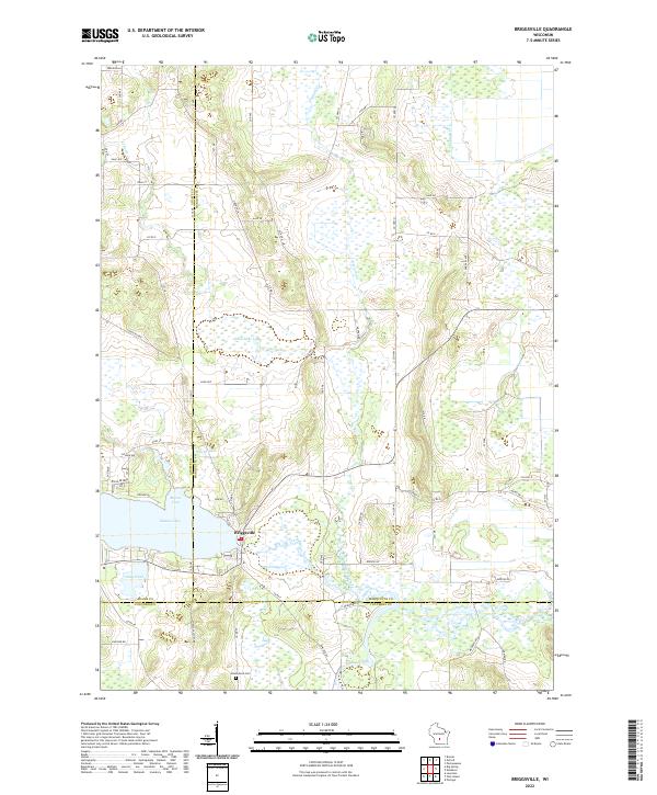 2022 Briggsville2022 Print · USGSBriggsville and the surrounding tri-county marshlands are captured in this recent survey. Local researchers can trace family landmarks and agricultural history near Mason Lake, Greenwood Cem, and the descriptively named Cheese Factory Rd.
 - 2022 Map of Lewiston, 2022 Print
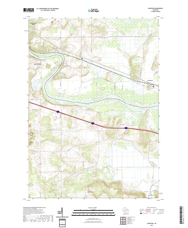 2022 Lewiston2022 Print · USGSWisconsin Dells and the surrounding rural townships are shown here in the early twenty-first century, spanning the river-cut landscape of Sauk and Columbia counties. Researchers can trace local heritage through sites like Newport Lutheran Cem and the natural geography of the North Range and Lower Narrows.
 - 2022 Map of Big Spring, 2022 Print
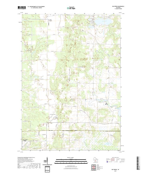 2022 Big Spring2022 Print · USGSThe rural borderlands of Adams and Columbia counties are captured here in a period of modern local development. Researchers can trace the water-carved landscape of Big Spring Creek and locate community landmarks like New Christ Church and Jordan Lake.
 - 2022 Map of Endeavor, 2022 Print
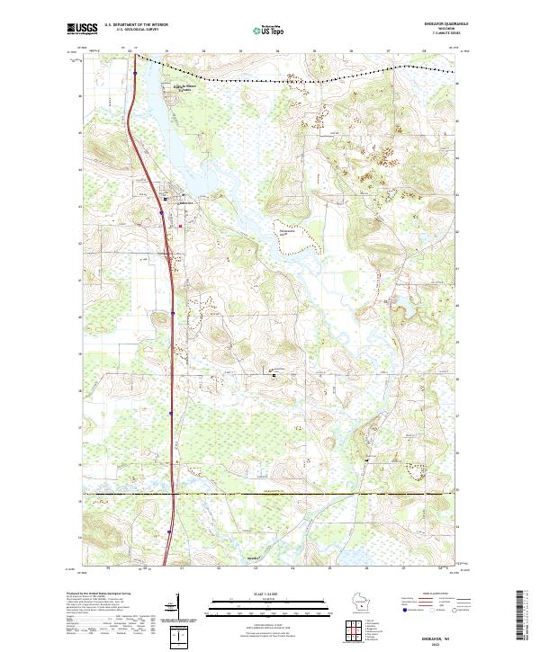 2022 Endeavor2022 Print · USGSEndeavor and the surrounding riverlands of Marquette County are captured here in the early 2020s. Genealogists and local historians can trace family locations near Hill Crest Cem, the southern settlement of Anacker, and the wetlands of the Fox River.
 - 2022 Map of Pine Island, 2022 Print
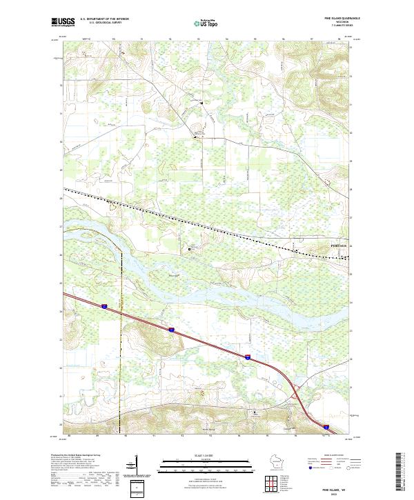 2022 Pine Island2022 Print · USGSThe confluence of the Wisconsin and Baraboo rivers near the Columbia and Sauk county line is shown in great detail here. Genealogists and local historians can locate family plots at Cummings Cem and Saint Michaels Cem or trace the early paths of Levee Rd.
 - 2022 Map of Portage, 2022 Print
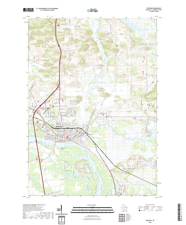 2022 Portage2022 Print · USGSPortage and the surrounding wetlands are shown at a time when the historic canal route between the Fox River and Wisconsin River still defines the city's layout. Researchers can trace local lineage through several sites, including Old Fort Winnebago Cem, Oak Grove Cem, and Saint Mary's Cem.
End of results
Showing maps 1-6 of 6
Top cities near Lewiston
- Baraboo historical maps
- Portage historical maps
- Lake Delton historical maps
- Wisconsin Dells historical maps
- Poynette historical maps
- Dekorra historical maps
See more
Frequently asked questions
- What are the different types of historical maps available for Lewiston?
- What is the oldest map of Lewiston?
- Where can I purchase historical maps of Lewiston for my home or office?
- Where can I download high-res historical maps of Lewiston?
- Are there historical topographic maps available for Lewiston?
- Is there historical aerial imagery available for Lewiston?
- Where are historical maps of Lewiston sourced from?