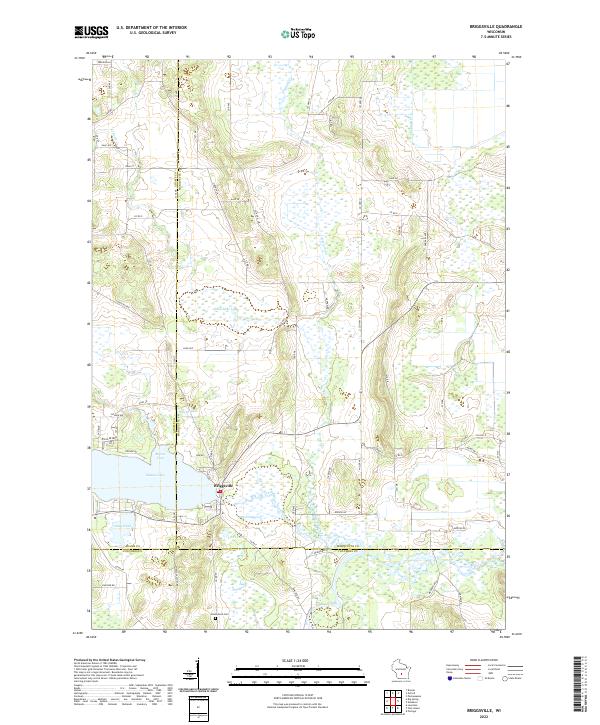
2022 Map of Briggsville
USGS Topo · Published 2022About this map
Mason Lake and the settlement of Briggsville form the heart of this landscape at the intersection of Adams, Marquette, and Columbia counties. This region is defined by an intricate network of wetlands and water bodies, where Neenah Creek and its South Branch weave through a terrain marked by Big Slough and Amey Pond. The map reveals a rural economy rooted in dairy and agriculture, specifically noted by the presence of Cheese Factory Rd. Local history is preserved at the Greenwood Cem south of the village center, while the geography of the shoreline is detailed through features like Morris Cove and McCall Lake. Small ponds such as Little Lake and Mud Lake dot the marshlands, illustrating the complex hydrology that has shaped the development and land use of this tri-county border area.
Find a feature on this map
50 named features on this map. Tap any name to fly to it.
Don’t see what you’re looking for? This feature index may not catch every label — zoom into the map to look around manually.
Map Details
Editions of this 2022 Briggsville Map
This is the sole edition of this map. No revisions or reprints were ever made.
Other maps of this area

1902 · Portage
USGS Topo · 1:62,500

1902 · Briggsville
USGS Topo · 1:62,500

1957 · Madison
USGS Topo · 1:250,000

1958 · Briggsville
USGS Topo · 1:62,500

1960 · Madison
USGS Topo · 1:250,000

1961 · Oxford
USGS Topo · 1:62,500

1961 · Montello
USGS Topo · 1:62,500

1962 · Portage
USGS Topo · 1:62,500
1975 · Pine Island
USGS Topo · 1:24,000
1975 · Lewiston
USGS Topo · 1:24,000