Old Maps of Lewiston, Wisconsin for Hiking & Exploration
Hike through history with 20 historic maps of Lewiston. Explore old trails, ghost towns, and forgotten backroads — perfect for outdoor adventurers and local explorers.
- Rediscover forgotten places: Map out old mining camps, roads, and footpaths that no longer exist on modern maps.
- Layer with modern tools: Combine with LiDAR or satellite views to plan hikes through historical terrain.
- Made for exploration: Popular among hikers, overlanders, and local history lovers.
Use these maps to find adventure and explore the hidden past of Lewiston.
Lewiston, WI maps
(20)- 1902 Map of Portage
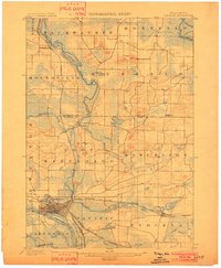 1902 Portage1902 Print · USGSPortage and the surrounding marshlands of Columbia County appear here at the turn of the century, centered on the strategic divide between the Wisconsin River and Fox River. Genealogists and rail historians can trace the early footprints of Portage, the canal-era site of Fort Hope, and rural communities like Pardeeville and Marcellon.3 unique versions available
 - 1902 Map of Briggsville
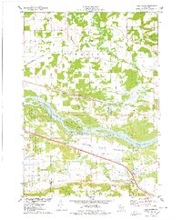
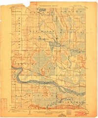 1902 Briggsville1902 Print · USGSThe Wisconsin River valley at the turn of the century shows a landscape of river-and-rail industry. Trace the early township developments of Lewiston and Douglas, or locate original landmarks like the Levee and Big Spring.4 unique versions available
 - 1957 Map of Madison, 1967 Print
 1957 Madison1967 Print · USGSSouth-central Wisconsin in the mid-fifties reveals a landscape of industrial hubs and glacial lakes linked by a dense rail and highway network. Genealogists and historians can trace the development of lakeside communities and find notable sites like Badger Ordnance Works and the Horicon National Wildlife Refuge.3 unique versions available
 - 1958 Map of Briggsville, 1959 Print
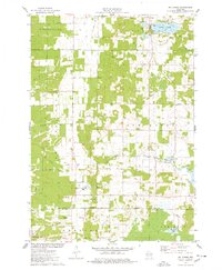
 1958 Briggsville1959 Print · USGSThe rural landscapes of south-central Wisconsin are captured here in the late fifties, showcasing the crossroads of three counties. You can trace family history through numerous country schools like Stafford Sch and landmarks such as Douglas Ch.3 unique versions available
 - 1960 Map of Madison
 1960 Madison1960 Print · USGSCentral and Southern Wisconsin are captured in the late fifties, showing the region as its rail-and-river network matured. Trace the paths of the Soo Line RR or locate family roots near Lake Mendota and Horicon National Wildlife Refuge.2 unique versions available
 - 1962 Map of Portage, 1964 Print
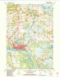
 1962 Portage1964 Print · USGSPortage and its surrounding river country are captured here in the early sixties, showing the vital connection between the Fox and Wisconsin Rivers. Genealogists can trace family roots through the Old Fort Winnebago Cem and rural settlements like Marcellon and Endeavor.
 - 1975 Map of Pine Island, 1978 Print
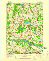
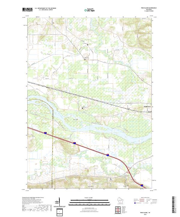
 1975 Pine Island1978 Print · USGSThe Wisconsin River and its intricate sloughs define this rural landscape in the mid-seventies, just as the local wildlife areas were becoming established. Researchers can find old community anchors like Lewiston Sch, the Welsh Cem, and the path of the Chicago Milwaukee St Paul and Pacific railroad.
 - 1975 Map of Lewiston, 1978 Print
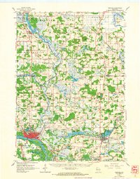
 1975 Lewiston1978 Print · USGSThe Wisconsin River valley in the mid-1970s shows a landscape of small crossroads settlements and heavy rail infrastructure. Genealogists and local historians can trace family locations near Pecks Corners, the Fairfield Center Sch, and Hillcrest Cem.
 - 1975 Map of Big Spring, 1978 Print
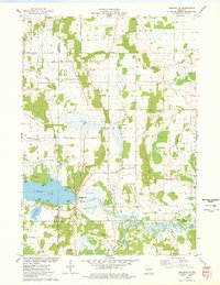
 1975 Big Spring1978 Print · USGSSettled between Adams and Columbia counties in the mid-1970s, this area shows a mix of rural town halls and lakefront recreation. Genealogists can trace local roots at Davis Corners Ch or explore the early lakeside developments of Jordan Lake and Big Spring.
 - 1975 Map of Briggsville, 1978 Print
 1975 Briggsville1978 Print · USGSBriggsville and the surrounding lake country are captured in the mid-seventies just as the region's recreational and agricultural identities converged. Genealogists and historians can locate the Douglas Ch, Greenwood Cem, and a local Cheese Factory near the shores of Mason Lake.
 - 1984 Map of Portage
 1984 Portage1984 Print · USGSPortage thrived as a vital river junction in the 1980s, where a historic Canal and lock connected the state's major waterways. Genealogists can locate several burial grounds including Old Fort Winnebago Cem and trace the Old Indian Treaty Boundary.2 unique versions available
 - 1984 Map of Endeavor
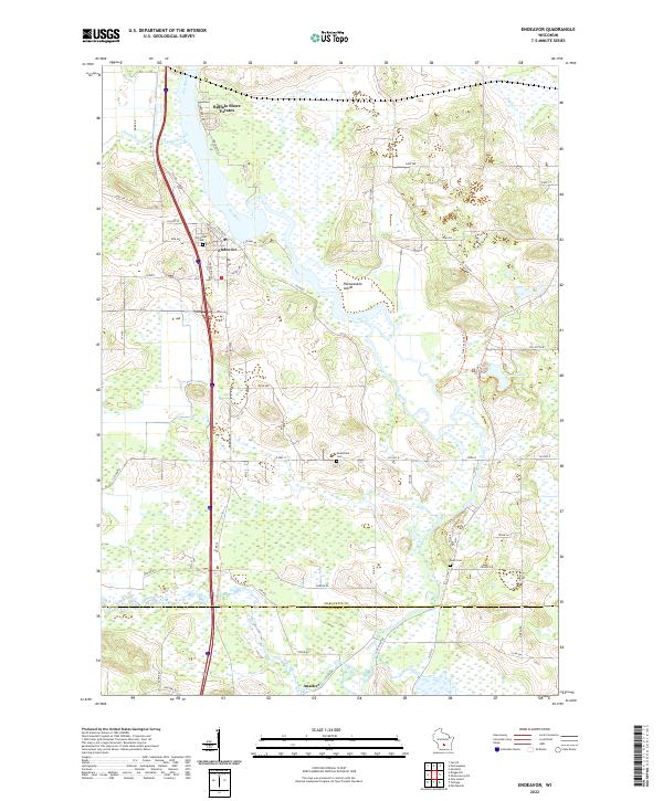
 1984 Endeavor1984 Print · USGSThe riverine corridor of Marquette County is documented here in the mid-1980s as it transitions from the village of Endeavor into expansive wetlands. Genealogists and local historians can trace family sites at the Moundville Ch, Rood Cem, and the shores of Ennis Lake.
 - 1985 Map of Wisconsin Dells
 1985 Wisconsin Dells1985 Print · USGSCentral Wisconsin in the mid-eighties was a landscape of intricate river bends, rail junctions, and sprawling marshlands. Researchers can trace historic routes along the Soo Line or locate family landmarks near Lyndon Station, Buffalo Lake, and Puckaway Lake.
 - 1990 Map of Wisconsin Dells, 1991 Print
 1990 Wisconsin Dells1991 Print · USGSCentral Wisconsin's river valleys and lake country are captured in detail here during the late twentieth century. Researchers can trace the rail-and-water geography connecting Wisconsin Dells and Portage with landmarks like Blackhawk Island and Buffalo Lake.
 - 2022 Map of Briggsville, 2022 Print
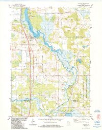
 2022 Briggsville2022 Print · USGSBriggsville and the surrounding tri-county marshlands are captured in this recent survey. Local researchers can trace family landmarks and agricultural history near Mason Lake, Greenwood Cem, and the descriptively named Cheese Factory Rd.
 - 2022 Map of Lewiston, 2022 Print
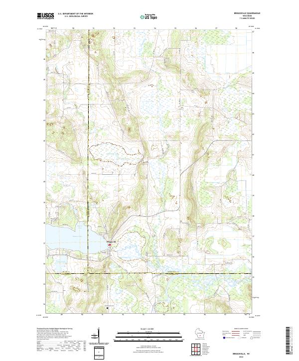
 2022 Lewiston2022 Print · USGSWisconsin Dells and the surrounding rural townships are shown here in the early twenty-first century, spanning the river-cut landscape of Sauk and Columbia counties. Researchers can trace local heritage through sites like Newport Lutheran Cem and the natural geography of the North Range and Lower Narrows.
 - 2022 Map of Big Spring, 2022 Print
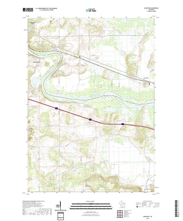
 2022 Big Spring2022 Print · USGSThe rural borderlands of Adams and Columbia counties are captured here in a period of modern local development. Researchers can trace the water-carved landscape of Big Spring Creek and locate community landmarks like New Christ Church and Jordan Lake.
 - 2022 Map of Endeavor, 2022 Print
 2022 Endeavor2022 Print · USGSEndeavor and the surrounding riverlands of Marquette County are captured here in the early 2020s. Genealogists and local historians can trace family locations near Hill Crest Cem, the southern settlement of Anacker, and the wetlands of the Fox River.
 - 2022 Map of Pine Island, 2022 Print
 2022 Pine Island2022 Print · USGSThe confluence of the Wisconsin and Baraboo rivers near the Columbia and Sauk county line is shown in great detail here. Genealogists and local historians can locate family plots at Cummings Cem and Saint Michaels Cem or trace the early paths of Levee Rd.
 - 2022 Map of Portage, 2022 Print
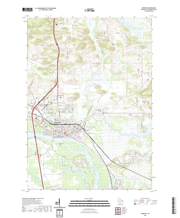 2022 Portage2022 Print · USGSPortage and the surrounding wetlands are shown at a time when the historic canal route between the Fox River and Wisconsin River still defines the city's layout. Researchers can trace local lineage through several sites, including Old Fort Winnebago Cem, Oak Grove Cem, and Saint Mary's Cem.
End of results
Showing maps 1-20 of 20
Top cities near Lewiston
- Baraboo historical maps
- Portage historical maps
- Lake Delton historical maps
- Wisconsin Dells historical maps
- Poynette historical maps
- Dekorra historical maps
See more
Frequently asked questions
- What are the different types of historical maps available for Lewiston?
- What is the oldest map of Lewiston?
- Where can I purchase historical maps of Lewiston for my home or office?
- Where can I download high-res historical maps of Lewiston?
- Are there historical topographic maps available for Lewiston?
- Is there historical aerial imagery available for Lewiston?
- Where are historical maps of Lewiston sourced from?