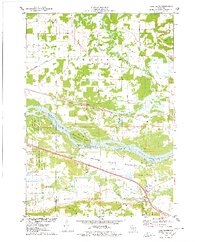
1975 Map of Pine Island
USGS Topo · Published 1978About this map
The Wisconsin River dominates this mid-1970s landscape, carving through the heart of the region and creating the prominent landmass of Pine Island. This area serves as a significant ecological corridor, largely preserved within the Pine Island State Wildlife Area. To the south, the Baraboo River meanders toward its confluence, flanked by the marshes of Leech Creek. The settlement pattern reflects a deeply rooted rural community, particularly in the townships of Lewiston and Caledonia.
Find a feature on this map
43 named features on this map. Tap any name to fly to it.
Don’t see what you’re looking for? This feature index may not catch every label — zoom into the map to look around manually.
Map Details
Editions of this 1975 Pine Island Map
This is the sole edition of this map. No revisions or reprints were ever made.
Other maps of this area

1895 · Baraboo
USGS Topo · 1:62,500

1901 · Poynette
USGS Topo · 1:62,500

1902 · Portage
USGS Topo · 1:62,500

1902 · Briggsville
USGS Topo · 1:62,500

1908 · Baraboo
USGS Topo · 1:62,500

1957 · Madison
USGS Topo · 1:250,000

1958 · Briggsville
USGS Topo · 1:62,500

1959 · Baraboo
USGS Topo · 1:62,500

1960 · Madison
USGS Topo · 1:250,000

1962 · Poynette
USGS Topo · 1:62,500