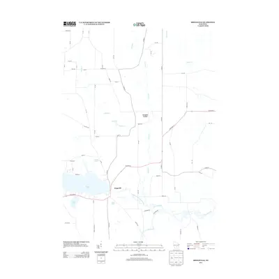
2013 Map of Briggsville
USGS Topo · Published 2013About this map
Mason Lake and the surrounding wetlands of Columbia County dominate this landscape, which centers on the community of Briggsville. This area is defined by a complex network of waterways, where Neenah Creek and the South Branch Neenah Creek converge near the Big Slough. The settlement at Douglas Center sits further north, connected by a grid of rural roads that reflect the region's agricultural history. Local infrastructure is notably anchored by landmarks such as Cheese Factory Rd, pointing toward the dairy heritage of rural Wisconsin. Several smaller bodies of water, including McCall Lake, Amey Pond, and Little Lake, are scattered throughout the low-lying terrain, illustrating the glacial hydrography of the Lewiston area in the early 21st century.
Find a feature on this map
54 named features on this map. Tap any name to fly to it.
Don’t see what you’re looking for? This feature index may not catch every label — zoom into the map to look around manually.
Map Details
Editions of this 2013 Briggsville Map
This is the sole edition of this map. No revisions or reprints were ever made.
Other maps of this area

1902 · Portage
USGS Topo · 1:62,500

1902 · Briggsville
USGS Topo · 1:62,500

1957 · Madison
USGS Topo · 1:250,000

1958 · Briggsville
USGS Topo · 1:62,500

1960 · Madison
USGS Topo · 1:250,000

1961 · Oxford
USGS Topo · 1:62,500

1961 · Montello
USGS Topo · 1:62,500

1962 · Portage
USGS Topo · 1:62,500
1975 · Pine Island
USGS Topo · 1:24,000
1975 · Lewiston
USGS Topo · 1:24,000