Old Maps of Wyocena, Wisconsin
Explore 19 old maps of Wyocena, spanning from 1901 to today. These high-resolution historic maps reveal how streets, neighborhoods, landmarks, and natural features evolved over time — perfect for genealogy, metal detecting, research, and local history exploration.
What you can do with these maps:
- See how Wyocena changed over time: Compare historical maps to modern-day views to trace roads, homesites, rail lines & more.
- View detailed metadata: Each map includes creators, publishers, year, scale, and archive source.
- Overlay maps with satellite & LiDAR: Visualize the past alongside modern tools to explore terrain & human change.
- Trusted historical sources: Maps sourced from the USGS, Library of Congress, and other archives.
- Access maps your way: View online, download high-res files, or order prints for personal or research use.
Start exploring old maps of Wyocena to uncover forgotten places, hidden landmarks, and the deep history beneath your feet.
Wyocena, WI maps
(19)- 1901 Map of Poynette
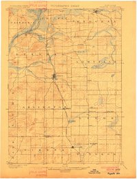 1901 Poynette1901 Print · USGSWisconsin's rural heartland comes into focus at the dawn of the twentieth century, anchored by the railway corridor and the winding river. Researchers can trace the early footprints of Poynette, Wyocena, and Dekorra alongside small junctions like Morrisonville and Arlington.3 unique versions available
 - 1902 Map of Portage
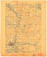 1902 Portage1902 Print · USGSPortage and the surrounding marshlands of Columbia County appear here at the turn of the century, centered on the strategic divide between the Wisconsin River and Fox River. Genealogists and rail historians can trace the early footprints of Portage, the canal-era site of Fort Hope, and rural communities like Pardeeville and Marcellon.3 unique versions available
 - 1955 Map of Randolph, 1956 Print
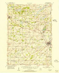
 1955 Randolph1956 Print · USGSDodge and Columbia counties are seen here in the mid-fifties, dominated by prairie farming and the rail lines connecting towns like Friesland and Cambria. Researchers can trace the heritage of rural education and faith through sites like Penrhos Sch and Rosedale Ch.2 unique versions available
 - 1955 Map of Columbus, 1956 Print
 1955 Columbus1956 Print · USGSColumbia County’s dairy and rail corridor is captured here in the mid-fifties, centered on the growing community of Columbus. Genealogists can trace family names at St Joseph Cem or locate the many country schools like McKinley Sch and Hampden Sch.2 unique versions available
 - 1957 Map of Madison, 1967 Print
 1957 Madison1967 Print · USGSSouth-central Wisconsin in the mid-fifties reveals a landscape of industrial hubs and glacial lakes linked by a dense rail and highway network. Genealogists and historians can trace the development of lakeside communities and find notable sites like Badger Ordnance Works and the Horicon National Wildlife Refuge.3 unique versions available
 - 1960 Map of Madison
 1960 Madison1960 Print · USGSCentral and Southern Wisconsin are captured in the late fifties, showing the region as its rail-and-river network matured. Trace the paths of the Soo Line RR or locate family roots near Lake Mendota and Horicon National Wildlife Refuge.2 unique versions available
 - 1962 Map of Poynette, 1964 Print
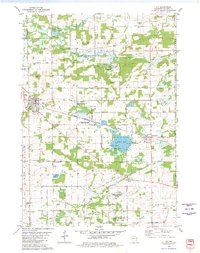
 1962 Poynette1964 Print · USGSIn the early sixties, the farming communities of Columbia and Dane Counties were evolving alongside the new interstate highway. Genealogists can locate family sites and rural landmarks like Hillside Cem, Leeds Center, and the Arlington Prairie Ch.2 unique versions available
 - 1962 Map of Portage, 1964 Print
 1962 Portage1964 Print · USGSPortage and its surrounding river country are captured here in the early sixties, showing the vital connection between the Fox and Wisconsin Rivers. Genealogists can trace family roots through the Old Fort Winnebago Cem and rural settlements like Marcellon and Endeavor.
 - 1980 Map of Rio, 1981 Print
 1980 Rio1981 Print · USGSColumbia County is shown in the early 1980s as a vital intersection of rail transport and wildlife conservation. Genealogists and local historians can trace family locations near Rio and Doylestown, or locate landmarks like the Bonnett Prairie Cemetery and St. Joseph Cemetery.
 - 1980 Map of Sand Spring Creek, 1981 Print
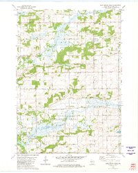 1980 Sand Spring Creek1981 Print · USGSColumbia County’s rural townships are shown in the early 1980s as the landscape transitions from the Fox River marshes to productive farmland. Genealogists and local historians can trace family road names and locate the Portage Prairie Cem or the Rosedale Ch along the Chicago Milwaukee St Paul and Pacific line.
 - 1984 Map of Wyocena
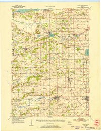
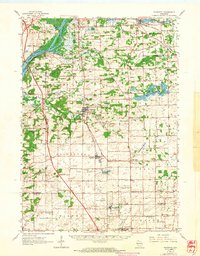
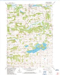 1984 Wyocena1984 Print · USGSThe village of Wyocena and the surrounding Columbia County wetlands are captured here in the mid-1980s. Local researchers can trace family landmarks like Rocky Run Cem, the Poynette State Game Farm, and the path of the Milwaukee St Paul and Pacific railroad.
 - 1984 Map of Pardeeville
 1984 Pardeeville1984 Print · USGSMid-century Columbia County reveals a landscape shaped by glacial waters and early Wisconsin history. Genealogists and local historians can trace family roots at Comstock Cemetery, locate the Marcellon School, or follow the historic INDIAN TREATY BOUNDARY.
 - 1985 Map of Wisconsin Dells
 1985 Wisconsin Dells1985 Print · USGSCentral Wisconsin in the mid-eighties was a landscape of intricate river bends, rail junctions, and sprawling marshlands. Researchers can trace historic routes along the Soo Line or locate family landmarks near Lyndon Station, Buffalo Lake, and Puckaway Lake.
 - 1990 Map of Wisconsin Dells, 1991 Print
 1990 Wisconsin Dells1991 Print · USGSCentral Wisconsin's river valleys and lake country are captured in detail here during the late twentieth century. Researchers can trace the rail-and-water geography connecting Wisconsin Dells and Portage with landmarks like Blackhawk Island and Buffalo Lake.
 - 1991 Map of Madison
 1991 Madison1991 Print · USGSMadison and its iconic glacial lakes are captured here during a time of steady urban expansion and regional growth. Researchers can trace the mid-century development of the University of Wisconsin, locate family sites near Forest Hill Cem, or explore the footprint of the Badger Army Ammunition Plant.
 - 2022 Map of Pardeeville, 2022 Print
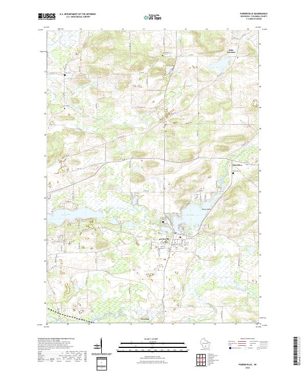 2022 Pardeeville2022 Print · USGSColumbia County’s glaciated terrain and river networks are preserved here in the early twenty-first century. Researchers can locate family sites near Marcellon Cemetery or trace the early paths of Military Road and the banks of Swan Lake.
 - 2022 Map of Rio, 2022 Print
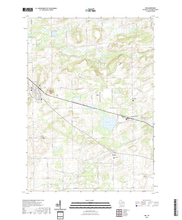 2022 Rio2022 Print · USGSColumbia County’s dairy and wetland landscapes are captured here in the early twenty-first century, centered on the villages of Rio and Doylestown. Genealogists can locate several historic burial sites, including Ohio Cem, Bonnet Prairie Cem, and Otsego Cem.
 - 2022 Map of Wyocena, 2022 Print
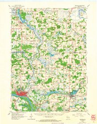
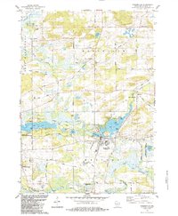
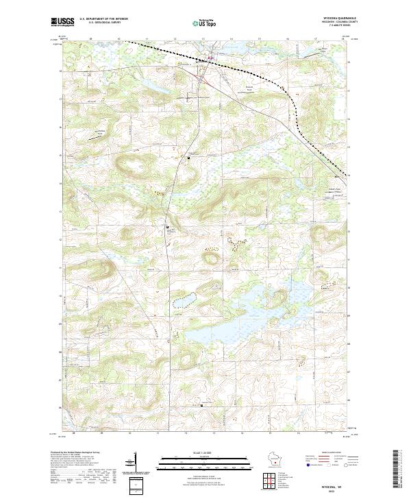 2022 Wyocena2022 Print · USGSThe village of Wyocena and the surrounding Columbia County wetlands are shown here in the early twenty-first century. Genealogists can locate family plots at the Rocky Run Catholic Cem or trace the shoreline of Wyona Lake and Mud Lake.
 - 2022 Map of Sand Spring Creek, 2022 Print
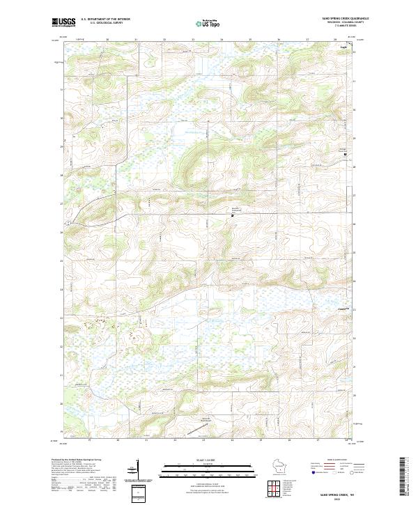 2022 Sand Spring Creek2022 Print · USGSColumbia County at the turn of the 2020s shows a landscape defined by the winding Fox River and extensive marshlands. Family historians can trace local landmarks like Portage Prairie Cem and Rosedale Presbyterian Cem or the rural outskirts of Cambria.
End of results
Showing maps 1-19 of 19
Top cities near Wyocena
- Portage historical maps
- Windsor historical maps
- Lodi historical maps
- Poynette historical maps
- Dekorra historical maps
- Pardeeville historical maps
See more
Frequently asked questions
- What are the different types of historical maps available for Wyocena?
- What is the oldest map of Wyocena?
- Where can I purchase historical maps of Wyocena for my home or office?
- Where can I download high-res historical maps of Wyocena?
- Are there historical topographic maps available for Wyocena?
- Is there historical aerial imagery available for Wyocena?
- Where are historical maps of Wyocena sourced from?