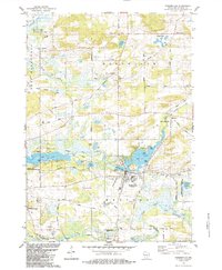
1984 Map of Pardeeville
USGS Topo · Published 1984About this map
Pardeeville and the surrounding Columbia County landscape are defined by a complex network of glacial lakes and the meandering Fox River. The 1980s terrain shows a community deeply tied to its waters, with Park Lake and Swan Lake serving as central hubs for local activity, alongside smaller bodies like Cuff Lake and Becker Lake. A significant historical marker, the Indian Treaty Boundary, cuts diagonally across the northern townships of Winnebago and Marcellon, tracing an older frontier through the modern grid of county roads.
Find a feature on this map
61 named features on this map. Tap any name to fly to it.
Don’t see what you’re looking for? This feature index may not catch every label — zoom into the map to look around manually.
Map Details
Editions of this 1984 Pardeeville Map
This is the sole edition of this map. No revisions or reprints were ever made.
Other maps of this area

1901 · Poynette
USGS Topo · 1:62,500

1902 · Portage
USGS Topo · 1:62,500

1955 · Randolph
USGS Topo · 1:62,500

1955 · Columbus
USGS Topo · 1:62,500

1957 · Madison
USGS Topo · 1:250,000

1960 · Madison
USGS Topo · 1:250,000

1962 · Poynette
USGS Topo · 1:62,500

1962 · Portage
USGS Topo · 1:62,500
1980 · Rio
USGS Topo · 1:24,000
1980 · Marquette
USGS Topo · 1:24,000