Old Maps of Petty Acres, Pleasant Springs for Academic Research
Study the evolution of Petty Acres with 13 high-resolution historic maps. Whether you're teaching, researching, or modeling changes in land use, these maps provide essential visual documentation of urban, environmental, and geographic change.
- Analyze long-term change: Track patterns in development, transportation, and natural features.
- Ideal for environmental or urban studies: Support academic projects with primary historical map data.
- Use in the classroom or lab: Educators and researchers rely on these maps to bring historical context to life.
These maps are a powerful tool for teaching, research, and visualizing how Petty Acres has changed over the decades.
Petty Acres, Pleasant Springs maps
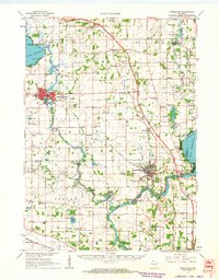
(13)- 1890 Map of Stoughton
 1890 Stoughton1890 Print · USGSSouthern Wisconsin during the 1890s shows a landscape of thriving river towns and expanding rail networks. Researchers can trace early family homesteads near Stebbinsville, Cooksville, and Fulton Center while following the historic route of the Chicago Milwaukee and St Paul Railroad.6 unique versions available
 - 1954 Map of Rockford
 1954 Rockford1954 Print · USGSThe Rock River valley and the Illinois-Wisconsin borderlands are captured here in the mid-1950s during a period of robust industrial and agricultural activity. Genealogists and historians can trace rail-era corridors like the Illinois Central RR and locate landmarks from Big Foot Prairie to Lake Geneva.
 - 1955 Map of Rockford
 1955 Rockford1955 Print · USGSThe Rock River valley and southern Wisconsin dairy country are shown here in the mid-fifties as the region's manufacturing centers grew. Genealogists and historians can trace the paths of the Chicago and North Western RR and Illinois Central RR through hubs like Rockford and Beloit.
 - 1958 Map of Rockford, 1974 Print
 1958 Rockford1974 Print · USGSNorthern Illinois and southern Wisconsin are shown here in the mid-twentieth century as rail-dependent industrial towns began to interface with growing lakefront communities. Genealogists can trace family roots through settlements like Saylesville and Tess Corners or locate historical landmarks like the Rockford Ordnance Depot.4 unique versions available
 - 1961 Map of Stoughton, 1963 Print
 1961 Stoughton1963 Print · USGSDane and Rock Counties during the early sixties center on the tobacco-processing hubs of the Rock River valley. Genealogists and local researchers can trace family lands near Hanerville, identify remote schools like Bass Lake Sch, or locate historic burials at Jensen Cem and South Porter Cem.2 unique versions available
 - 1961 Map of Stoughton, 1964 Print
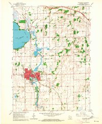 1961 Stoughton1964 Print · USGSStoughton and the southern Dane County countryside appear in the early sixties as a bustling rail-and-river hub. Researchers can locate local landmarks like the Martin Luther Childrens Home, Nelson Airport, and the Skaalen Cem along the Yahara River.3 unique versions available
 - 1963 Map of Rockford
 1963 Rockford1963 Print · USGSThe mid-century industrial corridor along the Rock River is shown here during a period of rapid post-war growth. Researchers can trace the extensive rail lines of the Chicago and North Western or locate local landmarks like the Rockford Ordnance Depot and Holy Hill.
 - 1981 Map of Monroe
 1981 Monroe1981 Print · USGSSouthern Wisconsin and the Illinois borderlands come into focus in the early 1980s, showcasing a landscape defined by dairy farming and river valleys. Genealogists can trace family roots through historic hubs like Monroe, Stoughton, and Brodhead, or locate regional landmarks such as Yellowstone Lake and the Sugar River.
 - 2010 Map of Stoughton, 2010 Print
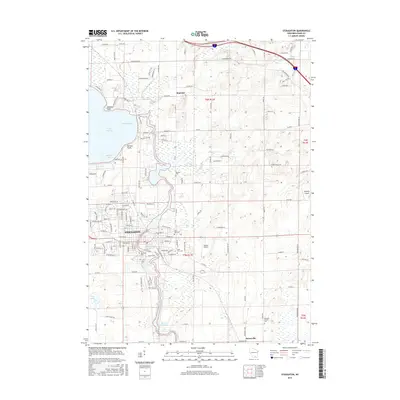
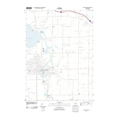 2010 Stoughton2010 Print · USGSCovers Petty Acres, including Stoughton, Pleasant Springs, and other nearby areas
 - 2013 Map of Stoughton, 2013 Print
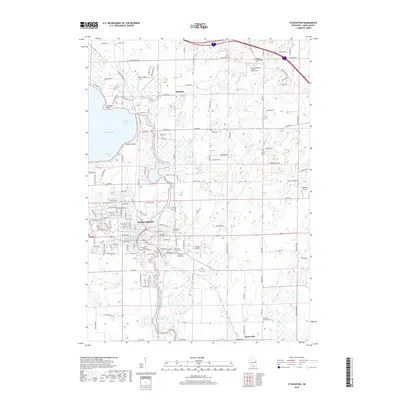
 2013 Stoughton2013 Print · USGSCovers Petty Acres, including Stoughton, Pleasant Springs, and other nearby areas
 - 2016 Map of Stoughton, 2016 Print
 2016 Stoughton2016 Print · USGSCovers Petty Acres, including Stoughton, Pleasant Springs, and other nearby areas
 - 2018 Map of Stoughton, 2018 Print
 2018 Stoughton2018 Print · USGSCovers Petty Acres, including Stoughton, Pleasant Springs, and other nearby areas
 - 2022 Map of Stoughton, 2022 Print
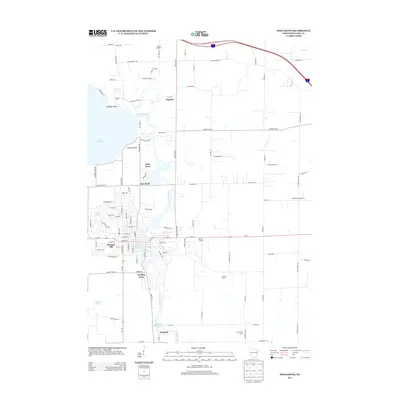
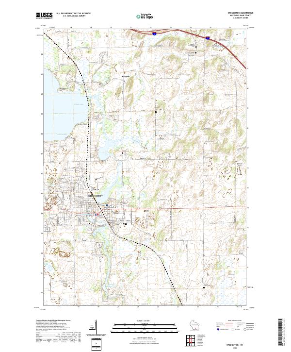 2022 Stoughton2022 Print · USGSStoughton and the Yahara River corridor are shown in the early twenty-first century as they balance urban growth with a deep-rooted agricultural landscape. Genealogists can trace family sites across numerous burial grounds like Skaalen Cem, Bovre Cem, and Wheeler Prairie Cem.
End of results
Showing maps 1-13 of 13
Top cities near Petty Acres
- Madison historical maps
- Janesville historical maps
- Sun Prairie historical maps
- Fitchburg historical maps
- Waunakee historical maps
- Stoughton historical maps
See more
Frequently asked questions
- What are the different types of historical maps available for Petty Acres?
- What is the oldest map of Petty Acres?
- Where can I purchase historical maps of Petty Acres for my home or office?
- Where can I download high-res historical maps of Petty Acres?
- Are there historical topographic maps available for Petty Acres?
- Is there historical aerial imagery available for Petty Acres?
- Where are historical maps of Petty Acres sourced from?