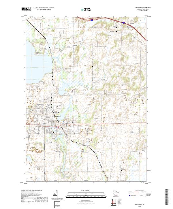
2022 Map of Stoughton
USGS Topo · Published 2022About this map
Stoughton serves as the focal point of this Dane County landscape, where the Yahara River winds southward through the center of town. This modern survey illustrates the persistent importance of the river, connecting Lake Kegonsa and its distinctive bays, like Atkinson Bay, to the industrial and municipal layout of the city. The area is densely packed with local history markers, particularly its numerous cemeteries including Riverside Cem and Saint Ann Catholic Cem, which reflect the community's multi-denominational heritage.
Find a feature on this map
146 named features on this map. Tap any name to fly to it.
Don’t see what you’re looking for? This feature index may not catch every label — zoom into the map to look around manually.
Map Details
Editions of this 2022 Stoughton Map
This is the sole edition of this map. No revisions or reprints were ever made.
Historical Maps of Petty Acres Through Time
4 maps found