1900s (20th Century) Maps of Windsor, Wisconsin
Explore 17 historic maps of Windsor from the 1900s (20th Century). These maps offer a rare glimpse into what life looked like during the 1900s — showing old roads, neighborhoods, homes, and landmarks that have changed or disappeared over time.
Whether you're researching your family's past, planning a metal detecting trip, or studying how Windsor's landscape evolved across the 1900s, these high-resolution maps are a powerful tool for exploring the history of this region.
- Focus on a specific era: All maps on this page are from the 1900s, giving you a focused view of this time period.
- See what’s changed: Compare century-old streets, trails, and buildings to today's modern landscape using overlays and satellite layers.
- Research with precision: Use these maps for genealogy, historical research, land use analysis, or educational projects.
- View, download, or print: Maps are fully viewable online in high resolution, and can be downloaded or printed for your own records.
Start exploring Windsor's history through authentic maps from the 1900s. This is your window into the past.
Windsor, WI maps
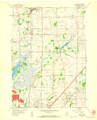
(17)- 1901 Map of Poynette
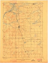 1901 Poynette1901 Print · USGSWisconsin's rural heartland comes into focus at the dawn of the twentieth century, anchored by the railway corridor and the winding river. Researchers can trace the early footprints of Poynette, Wyocena, and Dekorra alongside small junctions like Morrisonville and Arlington.3 unique versions available
 - 1904 Map of Madison, 1954 Print
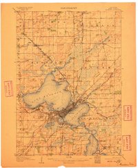
 1904 Madison1954 Print · USGSDane County's capital and its surrounding chain of lakes are shown here at the turn of the century. Genealogists and local historians can trace the early footprints of the University of Wisconsin, the Fair Grounds, and settlements like Token and Norway Grove.
 - 1905 Map of Sun Prairie, 1959 Print
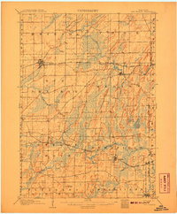
 1905 Sun Prairie1959 Print · USGSIn the early twentieth century, this part of Dane County was a thriving network of rail-stop towns and dairy farms. Genealogists and historians can trace the original rail paths of the Milwaukee Road through settlements like Sun Prairie, Deerfield, and Marshall.
 - 1906 Map of Madison
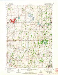
 1906 Madison1906 Print · USGSThe state capital and its Four Lakes are captured here in the early twentieth century. Genealogists and historians can trace the early development of Madison and the University of Wisconsin, along with rural hubs like Waunakee and Mc Farland.6 unique versions available
 - 1907 Map of Sun Prairie
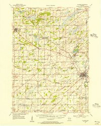
 1907 Sun Prairie1907 Print · USGSEastern Dane County at the turn of the century shows a landscape of rail-connected dairy towns and glacial wetlands. Genealogists and historians can trace family locations near York Center, Liberty Mound, and the old rail junction at London.8 unique versions available
 - 1955 Map of Columbus, 1956 Print
 1955 Columbus1956 Print · USGSColumbia County’s dairy and rail corridor is captured here in the mid-fifties, centered on the growing community of Columbus. Genealogists can trace family names at St Joseph Cem or locate the many country schools like McKinley Sch and Hampden Sch.2 unique versions available
 - 1957 Map of Madison, 1967 Print
 1957 Madison1967 Print · USGSSouth-central Wisconsin in the mid-fifties reveals a landscape of industrial hubs and glacial lakes linked by a dense rail and highway network. Genealogists and historians can trace the development of lakeside communities and find notable sites like Badger Ordnance Works and the Horicon National Wildlife Refuge.3 unique versions available
 - 1959 Map of De Forest, 1960 Print
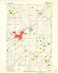
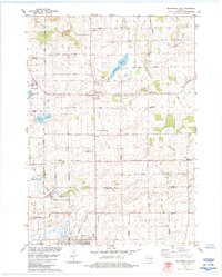
 1959 De Forest1960 Print · USGSUpper Dane County shows its transition from a farming heartland to a suburban corridor in the late fifties. Genealogists and historians can trace numerous rural schoolhouses and family cemeteries including Pumpkin Hollow Sch and Hoepker Cem.3 unique versions available
 - 1959 Map of Madison, 1961 Print
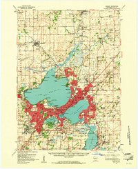 1959 Madison1961 Print · USGSMadison and the surrounding Dane County countryside appear here in the late fifties, showing the city's growth between its iconic lakes. Genealogists and local historians can trace family roots through numerous country schools like Wangness Sch and historic cemeteries such as Norway Grove Cem.3 unique versions available
 - 1960 Map of Madison
 1960 Madison1960 Print · USGSCentral and Southern Wisconsin are captured in the late fifties, showing the region as its rail-and-river network matured. Trace the paths of the Soo Line RR or locate family roots near Lake Mendota and Horicon National Wildlife Refuge.2 unique versions available
 - 1962 Map of Sun Prairie, 1964 Print
 1962 Sun Prairie1964 Print · USGSDane County farmland surrounds the growing village of Sun Prairie in the early sixties as it develops along the Milwaukee Road railroad. Genealogists and local historians can trace family locations near Pierceville, Bristol Ch, and Brazee Lake.5 unique versions available
 - 1962 Map of Poynette, 1964 Print
 1962 Poynette1964 Print · USGSIn the early sixties, the farming communities of Columbia and Dane Counties were evolving alongside the new interstate highway. Genealogists can locate family sites and rural landmarks like Hillside Cem, Leeds Center, and the Arlington Prairie Ch.2 unique versions available
 - 1962 Map of Sun Prairie, 1964 Print
 1962 Sun Prairie1964 Print · USGSEastern Dane County thrives as a rail-connected agricultural region in the early sixties, centered on the growing community of Sun Prairie. Researchers can trace old family roots through numerous landmarks like the Prairie Queen Sch, York Center Ch, and the Liberty Prairie Cem.2 unique versions available
 - 1980 Map of North Bristol
 1980 North Bristol1980 Print · USGSThe agricultural heartland of Columbia and Dane Counties is captured here in the late 1970s. Local researchers can trace family lands and rural landmarks like Hampden Cemetery, the Hampden School, and the winding Crawfish River.
 - 1983 Map of De Forest, 1984 Print
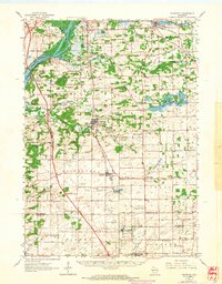
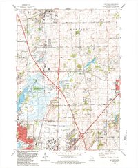 1983 De Forest1984 Print · USGSThe northern suburbs of Madison are captured here in the early eighties as they expanded toward Windsor and De Forest. Genealogists and local historians can trace family locations near the Hoepker Cem, Norway Grove Ch, and the Pumpkin Hollow Sch.
 - 1984 Map of Morrisonville
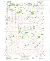
 1984 Morrisonville1984 Print · USGSColumbia and Dane counties come into focus in the mid-1980s, showcasing a landscape of established rail lines and agricultural hamlets. Genealogists can trace family roots at North Windsor Church or locate ancestral plots at Greenwood Cemetery and Zion Cemetery.
 - 1991 Map of Madison
 1991 Madison1991 Print · USGSMadison and its iconic glacial lakes are captured here during a time of steady urban expansion and regional growth. Researchers can trace the mid-century development of the University of Wisconsin, locate family sites near Forest Hill Cem, or explore the footprint of the Badger Army Ammunition Plant.
End of results
Showing maps 1-17 of 17
Top cities near Windsor
- Madison historical maps
- Sun Prairie historical maps
- Fitchburg historical maps
- Middleton historical maps
- Waunakee historical maps
- DeForest historical maps
See more
Top neighborhoods of Windsor
- Morrisonville historical maps
- Lake Windsor historical maps
- Windsor Ridge historical maps
- Savannah Hill historical maps
- Oak Springs historical maps
- Bear Tree Farms historical maps
See more
Frequently asked questions
- What are the different types of historical maps available for Windsor?
- What is the oldest map of Windsor?
- Where can I purchase historical maps of Windsor for my home or office?
- Where can I download high-res historical maps of Windsor?
- Are there historical topographic maps available for Windsor?
- Is there historical aerial imagery available for Windsor?
- Where are historical maps of Windsor sourced from?