1900s (20th Century) Maps of Leroy, Wisconsin
Explore 12 historic maps of Leroy from the 1900s (20th Century). These maps offer a rare glimpse into what life looked like during the 1900s — showing old roads, neighborhoods, homes, and landmarks that have changed or disappeared over time.
Whether you're researching your family's past, planning a metal detecting trip, or studying how Leroy's landscape evolved across the 1900s, these high-resolution maps are a powerful tool for exploring the history of this region.
- Focus on a specific era: All maps on this page are from the 1900s, giving you a focused view of this time period.
- See what’s changed: Compare century-old streets, trails, and buildings to today's modern landscape using overlays and satellite layers.
- Research with precision: Use these maps for genealogy, historical research, land use analysis, or educational projects.
- View, download, or print: Maps are fully viewable online in high resolution, and can be downloaded or printed for your own records.
Start exploring Leroy's history through authentic maps from the 1900s. This is your window into the past.
Leroy, WI maps
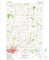
(12)- 1955 Map of Waupun, 1957 Print
 1955 Waupun1957 Print · USGSIn the mid-1950s, the Dodge and Fond du Lac county border was defined by the massive wetland expanse of the Horicon Marsh. Genealogists and local historians can trace rural school locations like Cattaraugus Sch and the institutional grounds of the State Prison in Waupun.2 unique versions available
 - 1957 Map of Madison, 1967 Print
 1957 Madison1967 Print · USGSSouth-central Wisconsin in the mid-fifties reveals a landscape of industrial hubs and glacial lakes linked by a dense rail and highway network. Genealogists and historians can trace the development of lakeside communities and find notable sites like Badger Ordnance Works and the Horicon National Wildlife Refuge.3 unique versions available
 - 1960 Map of Madison
 1960 Madison1960 Print · USGSCentral and Southern Wisconsin are captured in the late fifties, showing the region as its rail-and-river network matured. Trace the paths of the Soo Line RR or locate family roots near Lake Mendota and Horicon National Wildlife Refuge.2 unique versions available
 - 1975 Map of Waupun NW, 1977 Print
 1975 Waupun NW1977 Print · USGSThe northern outskirts of Waupun and the surrounding dairy lands are captured here in the mid-seventies. Researchers can examine the detailed rural landscape around the settlement of Ladoga and the marshy fringes of the Horicon National Wildlife Refuge.
 - 1975 Map of Waupun NE, 1977 Print
 1975 Waupun NE1977 Print · USGSFond du Lac County agriculture and small-town life are preserved in this mid-seventies aerial survey. Researchers can trace the layout of Oakfield, Lamartine, and the northern reaches of the Horicon National Wildlife Refuge.
 - 1975 Map of Waupun SE, 1977 Print
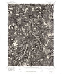
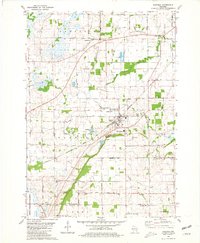
 1975 Waupun SE1977 Print · USGSDodge County agricultural lands and the eastern edge of the marsh are captured here in the mid-seventies. Researchers can trace the layout of Mayville and rural hamlets like Leroy and Kekoskee against the Horicon Marsh.
 - 1975 Map of Waupun SW, 1977 Print
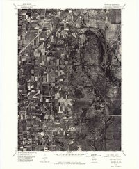 1975 Waupun SW1977 Print · USGSThe Dodge County wetlands and agricultural frontier are captured in this mid-seventies aerial survey. Researchers can trace the boundaries of the Horicon National Wildlife Refuge and the southern edge of Waupun.
 - 1980 Map of Fond Du Lac
 1980 Fond Du Lac1980 Print · USGSThe Fox River Valley and Horicon Marsh meet here during the late twentieth century, showing a transition from lakeside industry to glacial conservation. Genealogists can locate family sites at Estabrook Cem or trace the rail lines through Ripon and Waupun.
 - 1980 Map of Waupun North, 1981 Print
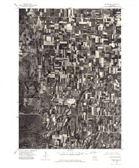
 1980 Waupun North1981 Print · USGSThe city of Waupun and its surrounding townships are shown here in the early eighties, just as the local rail and prison systems remained central to the town's identity. Researchers can trace family roots through numerous sites like Cattaraugus Cem, Amity Sch, and the State Prison Farm.
 - 1980 Map of Oakfield, 1981 Print
 1980 Oakfield1981 Print · USGSCentral Fond du Lac County is shown in the late seventies as a busy rail and quarrying hub. Researchers can locate family sites near Oak Center, the Belle Reynolds Sch, and the Soo Line tracks.
 - 1980 Map of Waupun South, 1981 Print
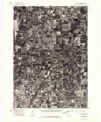
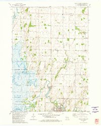
 1980 Waupun South1981 Print · USGSDodge County's expansive wetlands and rural townships are frozen in time during the early eighties. Genealogists and historians can trace the foundations of Atwater, Burnett, and Chester, alongside landmarks like Burnett Union Cem and the Chester Sch.
 - 1981 Map of Mayville North
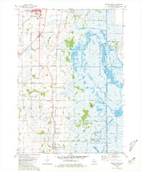
 1981 Mayville North1981 Print · USGSDodge County in the early eighties shows a landscape shaped by the sprawling Horicon Marsh and the industry of its small towns. Genealogists can trace family roots at St Paul Cem or Tidyman Cem, while mapping the rail lines through Nasbro and Knowles.
End of results
Showing maps 1-12 of 12
Top cities near Leroy
- Fond du Lac historical maps
- Beaver Dam historical maps
- Mayville historical maps
- North Fond du Lac historical maps
- Taycheedah historical maps
- Horicon historical maps
See more
Top neighborhoods of Leroy
Frequently asked questions
- What are the different types of historical maps available for Leroy?
- What is the oldest map of Leroy?
- Where can I purchase historical maps of Leroy for my home or office?
- Where can I download high-res historical maps of Leroy?
- Are there historical topographic maps available for Leroy?
- Is there historical aerial imagery available for Leroy?
- Where are historical maps of Leroy sourced from?