1960s Maps of Hawthorne, Wisconsin
Explore 5 historic maps of Hawthorne from the 1960s. These maps offer a rare glimpse into what life looked like during the 1960s — showing old roads, neighborhoods, homes, and landmarks that have changed or disappeared over time.
Whether you're researching your family's past, planning a metal detecting trip, or studying how Hawthorne's landscape evolved across the 1960s, these high-resolution maps are a powerful tool for exploring the history of this region.
- Focus on a specific era: All maps on this page are from the 1960s, giving you a focused view of this time period.
- See what’s changed: Compare century-old streets, trails, and buildings to today's modern landscape using overlays and satellite layers.
- Research with precision: Use these maps for genealogy, historical research, land use analysis, or educational projects.
- View, download, or print: Maps are fully viewable online in high resolution, and can be downloaded or printed for your own records.
Start exploring Hawthorne's history through authentic maps from the 1960s. This is your window into the past.
Hawthorne, WI maps
(5)- 1961 Map of Lyman Lake, 1962 Print
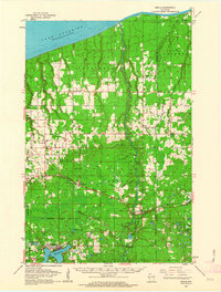
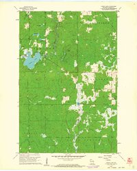 1961 Lyman Lake1962 Print · USGSDouglas County’s wilderness in the early sixties is a landscape of glacial lakes and river forks waiting to be explored. Trace the drainage of the Amnicon River or locate remote landmarks like the Bennett Lookout Tower and Three Bucks Lakes.2 unique versions available
 - 1961 Map of Lake Nebagamon, 1962 Print
 1961 Lake Nebagamon1962 Print · USGSWisconsin's northern timber and rail country is captured here during the early sixties, centered on the village of Lake Nebagamon. Genealogists and historians can trace local landmarks like Finnish Ch, the Blueberry Cem, and the Northern Pacific rail line.2 unique versions available
 - 1961 Map of Solon Springs, 1963 Print
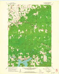
 1961 Solon Springs1963 Print · USGSNorthern Wisconsin lake country is captured in the early sixties, centered on the community of Solon Springs and the headwaters of the St. Croix. Genealogists can locate Evergreen Cem and Bennett Cem while tracing the Chicago and North Western rail line.2 unique versions available
 - 1961 Map of Ellison Lake, 1963 Print
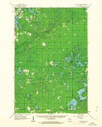 1961 Ellison Lake1963 Print · USGSNorthern Wisconsin's lake country is captured in the early sixties as a center for conservation and recreation. Researchers can trace family history at the Barnes Cem or explore the wilderness around the Bois Brule River and Lake Nebagamon.2 unique versions available
 - 1961 Map of Brule, 1963 Print
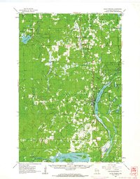
 1961 Brule1963 Print · USGSNorthern Wisconsin's lake country and timberlands are captured here in the early sixties, showing the transition from the Brule River valley to the big lake. Researchers can trace family roots at Rest Haven Cem, locate the State Fish Hatchery, and follow the Northern Pacific Railroad through Blueberry.2 unique versions available
End of results
Showing maps 1-5 of 5
Top cities near Hawthorne
- Duluth historical maps
- Superior historical maps
- Parkland historical maps
- Lake Nebagamon historical maps
- Gordon historical maps
- Maple historical maps
See more
Top neighborhoods of Hawthorne
Frequently asked questions
- What are the different types of historical maps available for Hawthorne?
- What is the oldest map of Hawthorne?
- Where can I purchase historical maps of Hawthorne for my home or office?
- Where can I download high-res historical maps of Hawthorne?
- Are there historical topographic maps available for Hawthorne?
- Is there historical aerial imagery available for Hawthorne?
- Where are historical maps of Hawthorne sourced from?