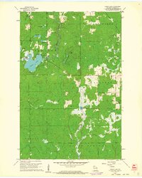
1961 Map of Lyman Lake
USGS Topo · Published 1962About this map
The Amnicon River and its varied tributaries define this section of the Douglas County landscape in the early 1960s. The map illustrates a complex network of glacial water bodies, from the prominent Lyman Lake and Moose Lake to smaller basins like Three Bucks Lakes and Scout Lake. This interior wilderness, divided among the townships of Hawthorne, Oakland, Bennett, Gordon, and Solon Springs, shows a region primarily shaped by natural drainage and fire observation, evidenced by the Bennett Lookout Tower standing watch over the wooded terrain.
Find a feature on this map
20 named features on this map. Tap any name to fly to it.
Don’t see what you’re looking for? This feature index may not catch every label — zoom into the map to look around manually.
Map Details
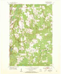
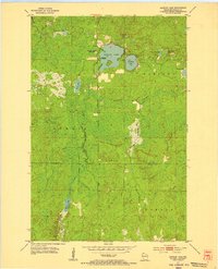
Editions of this 1961 Lyman Lake Map
2 editions found

Other maps of this area

1915 · Superior
USGS Topo · 1:48,000

1917 · Superior
USGS Topo · 1:62,500

1945 · Solon Springs
USGS Topo · 1:48,000

1949 · Solon Springs
USGS Topo · 1:48,000

1949 · Patzau
USGS Topo · 1:48,000

1949 · Poplar
USGS Topo · 1:48,000

1953 · Ashland
USGS Topo · 1:250,000

1953 · Duluth
USGS Topo · 1:250,000
1954 · Sunnyside
USGS Topo · 1:24,000
1954 · Amnicon Lake
USGS Topo · 1:24,000