
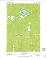
1954 Map of Amnicon Lake
USGS Topo · Published 1955About this map
Amnicon Lake serves as the central focal point of this mid-century survey of the northern Wisconsin wilderness, situated at the crossroads of the townships of Oakland, Summit, and Gordon. The landscape is defined by an intricate network of glacial lakes and waterways, including Dowling Lake, Reichuster Lake, and the winding Amnicon River. Evidence of former human activity and changing infrastructure is visible in the presence of the Amnicon Lake Sch, which is marked as abandoned by the early 1950s. The northern reaches show a Gravel Pit near Scout Lake, indicating localized resource extraction. Running through the heart of the wetlands and forested terrain is an Old Railroad Grade, a clear indication of a vanished timber or transport line that once linked these remote outposts. Small water bodies like One Buck Lake and Mud Lake dot the green expanse, illustrating the saturated, low-lying character of this Douglas County region.
Find a feature on this map
16 named features on this map. Tap any name to fly to it.
Don’t see what you’re looking for? This feature index may not catch every label — zoom into the map to look around manually.
Map Details
Editions of this 1954 Amnicon Lake Map
2 editions found
Other maps of this area

1915 · Superior
USGS Topo · 1:48,000

1917 · Superior
USGS Topo · 1:62,500

1945 · Solon Springs
USGS Topo · 1:48,000

1949 · Solon Springs
USGS Topo · 1:48,000

1949 · Patzau
USGS Topo · 1:48,000

1949 · Poplar
USGS Topo · 1:48,000

1953 · Ashland
USGS Topo · 1:250,000

1953 · Duluth
USGS Topo · 1:250,000

1954 · Borea
USGS Topo · 1:24,000

1954 · Sunnyside
USGS Topo · 1:24,000