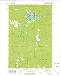
1954 Map of Amnicon Lake
USGS Topo · Published 1976About this map
Amnicon Lake and its neighboring waters dominate this northern Wisconsin landscape as it appeared in the mid-1950s. The terrain is defined by a dense network of glacial lakes and wetlands, including Dowling Lake, Reichuster Lake, and the small One Buck Lake. An Old Railroad Grade cuts through the northwest and central portions of the sheet, tracing a path through the townships of Summit and Gordon. This former rail corridor signifies the area's transition from early timber extraction toward a landscape more focused on water resources and conservation. The hydrologic connectivity is visible through the Amnicon River and Ericson Creek, which drain the numerous basins. This survey preserves the exact location of family-named features like Lake Newman and Scout Lake before later decades of shoreline development shifted the local character.
Find a feature on this map
15 named features on this map. Tap any name to fly to it.
Don’t see what you’re looking for? This feature index may not catch every label — zoom into the map to look around manually.
Map Details
Editions of this 1954 Amnicon Lake Map
2 editions found

Other maps of this area

1915 · Superior
USGS Topo · 1:48,000

1917 · Superior
USGS Topo · 1:62,500

1945 · Solon Springs
USGS Topo · 1:48,000

1949 · Solon Springs
USGS Topo · 1:48,000

1949 · Patzau
USGS Topo · 1:48,000

1949 · Poplar
USGS Topo · 1:48,000

1953 · Ashland
USGS Topo · 1:250,000

1953 · Duluth
USGS Topo · 1:250,000

1954 · Borea
USGS Topo · 1:24,000

1954 · Sunnyside
USGS Topo · 1:24,000