2000s (21st Century) Maps of Sherman, Wisconsin
Explore 4 historic maps of Sherman from the 2000s (21st Century). These maps offer a rare glimpse into what life looked like during the 2000s — showing old roads, neighborhoods, homes, and landmarks that have changed or disappeared over time.
Whether you're researching your family's past, planning a metal detecting trip, or studying how Sherman's landscape evolved across the 2000s, these high-resolution maps are a powerful tool for exploring the history of this region.
- Focus on a specific era: All maps on this page are from the 2000s, giving you a focused view of this time period.
- See what’s changed: Compare century-old streets, trails, and buildings to today's modern landscape using overlays and satellite layers.
- Research with precision: Use these maps for genealogy, historical research, land use analysis, or educational projects.
- View, download, or print: Maps are fully viewable online in high resolution, and can be downloaded or printed for your own records.
Start exploring Sherman's history through authentic maps from the 2000s. This is your window into the past.
Sherman, WI maps
(4)- 2022 Map of Wheeler, 2022 Print
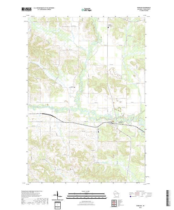 2022 Wheeler2022 Print · USGSThe village of Wheeler and the surrounding Dunn County countryside are mapped here in the early twenty-first century. Genealogists can locate family sites near Hay River Lutheran Church Cem, Our Saviors Cem, and the winding Hay River.
 - 2022 Map of Boyceville, 2022 Print
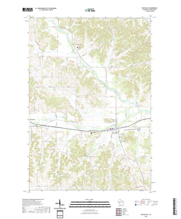 2022 Boyceville2022 Print · USGSThe Boyceville and Downing corridor of Dunn County is documented here during the early twenty-first century. Genealogists can locate family sites near Mound Cem, Tiffany Cem, and the landmark Chimney Rock.
 - 2022 Map of Knapp, 2022 Print
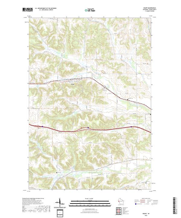 2022 Knapp2022 Print · USGSThe village of Knapp is the focal point of this recent Dunn County survey, illustrating the area's rural character and complex drainage basins. Genealogists can locate several family burial sites like Forest Hill Cem and Teegarden Cem.
 - 2022 Map of Menomonie North, 2022 Print
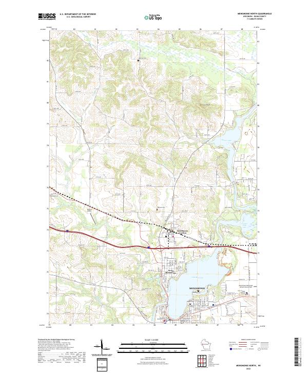 2022 Menomonie North2022 Print · USGSDunn County in the twenty-first century reveals a landscape where the Red Cedar River and Lake Menomin shape the growth of Menomonie. Researchers can trace local heritage through numerous sites like Menomonie Junction, Evergreen Cem, and the University of Wisconsin - Stout.
End of results
Showing maps 1-4 of 4
Top cities near Sherman
- Menomonie historical maps
- Town of Tainter historical maps
- Tainter historical maps
- Town of Red Cedar historical maps
- Red Cedar historical maps
- Glenwood City historical maps
See more
Top neighborhoods of Sherman
Frequently asked questions
- What are the different types of historical maps available for Sherman?
- What is the oldest map of Sherman?
- Where can I purchase historical maps of Sherman for my home or office?
- Where can I download high-res historical maps of Sherman?
- Are there historical topographic maps available for Sherman?
- Is there historical aerial imagery available for Sherman?
- Where are historical maps of Sherman sourced from?