1940s Maps of Sherman, Wisconsin
Explore 6 historic maps of Sherman from the 1940s. These maps offer a rare glimpse into what life looked like during the 1940s — showing old roads, neighborhoods, homes, and landmarks that have changed or disappeared over time.
Whether you're researching your family's past, planning a metal detecting trip, or studying how Sherman's landscape evolved across the 1940s, these high-resolution maps are a powerful tool for exploring the history of this region.
- Focus on a specific era: All maps on this page are from the 1940s, giving you a focused view of this time period.
- See what’s changed: Compare century-old streets, trails, and buildings to today's modern landscape using overlays and satellite layers.
- Research with precision: Use these maps for genealogy, historical research, land use analysis, or educational projects.
- View, download, or print: Maps are fully viewable online in high resolution, and can be downloaded or printed for your own records.
Start exploring Sherman's history through authentic maps from the 1940s. This is your window into the past.
Sherman, WI maps
(6)- 1940 Map of Menomonie, 1965 Print
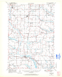
 1940 Menomonie1965 Print · USGSDunn County in the early 1940s is a landscape of established river towns and a dense network of country schoolhouses. Genealogists can trace family roots through sites like Beyer Settlement Sch, Ideal Cem, and the County Asylum.2 unique versions available
 - 1942 Map of Menomonie
 1942 Menomonie1942 Print · USGSDunn County at the start of the 1940s reveals a region of thriving river towns and closely knit rural school districts. Genealogists can trace family roots through numerous country schools like Knapp Settlement School and local burial grounds such as Sherman Cem.
 - 1946 Map of Knapp, 1967 Print
 1946 Knapp1967 Print · USGSThe borderlands of St. Croix, Pierce, and Dunn Counties come to life in this mid-century survey of the Wisconsin dairy country. Genealogists can locate dozens of country schools like Broadview Sch and Denver Sch, as well as the Dunkard Ch and Teegarden Cem.
 - 1948 Map of Downing, 1970 Print
 1948 Downing1970 Print · USGSWestern Wisconsin's agricultural and rail heartland is captured here in the late 1940s, centered on the villages of the Tiffany Creek valley. Genealogists can trace family roots through dozens of rural landmarks like Beaver Valley Sch, Graytown, and Immanuel Ch.
 - 1949 Map of Knapp
 1949 Knapp1949 Print · USGSDunn, St. Croix, and Pierce counties come together in the late 1940s, showing a landscape defined by small-scale farming and the rail corridor. Genealogists can locate dozens of country schools and churches like Wilson Ch, East Hill Sch, and Hatchville Ch.
 - 1949 Map of Ridgeland, 1970 Print
 1949 Ridgeland1970 Print · USGSThe rural borderlands of Barron and Dunn counties are captured here in the late 1940s, when small-town rail hubs and country schoolhouses still dotted the landscape. Researchers can trace family roots through numerous sites like Evergreen Cem, Vanceburg, and Parkman Sch.
End of results
Showing maps 1-6 of 6
Top cities near Sherman
- Menomonie historical maps
- Town of Tainter historical maps
- Tainter historical maps
- Town of Red Cedar historical maps
- Red Cedar historical maps
- Glenwood City historical maps
See more
Top neighborhoods of Sherman
Frequently asked questions
- What are the different types of historical maps available for Sherman?
- What is the oldest map of Sherman?
- Where can I purchase historical maps of Sherman for my home or office?
- Where can I download high-res historical maps of Sherman?
- Are there historical topographic maps available for Sherman?
- Is there historical aerial imagery available for Sherman?
- Where are historical maps of Sherman sourced from?