Old Maps of Florence County, Wisconsin for Academic Research
Study the evolution of Florence County with 157 high-resolution historic maps. Whether you're teaching, researching, or modeling changes in land use, these maps provide essential visual documentation of urban, environmental, and geographic change.
- Analyze long-term change: Track patterns in development, transportation, and natural features.
- Ideal for environmental or urban studies: Support academic projects with primary historical map data.
- Use in the classroom or lab: Educators and researchers rely on these maps to bring historical context to life.
These maps are a powerful tool for teaching, research, and visualizing how Florence County has changed over the decades.
Florence County, WI maps
(157)- 1898 Map of Iron River, 1899 Print
 1898 Iron River1899 Print · USGSUpper Peninsula mining and timber frontiers emerge in the 1890s as railroads begin connecting remote outposts. Researchers can trace early rail lines through Iron River and Stambaugh or locate former stations and camps at Hazle, Atkinson, and Saunders.2 unique versions available
 - 1899 Map of Crystal Falls
 1899 Crystal Falls1899 Print · USGSIron County mining and timber operations are at their peak at the close of the century. Genealogists and industrial historians can trace early rail spurs to the Mastodon Mine, Shafer Mine, and the developing town of Crystal Falls.2 unique versions available
 - 1939 Map of Dunbar, 1955 Print
 1939 Dunbar1955 Print · USGSThe town of Dunbar and surrounding Marinette County lands are shown here in the late 1930s, caught between the era of heavy rail and emerging forest roads. You can trace early schoolhouses like McKinley Sch, find landmarks like the Dunbar Fire Tower, and locate the crossing at Carney Rapids.2 unique versions available
 - 1939 Map of Goodman, 1956 Print
 1939 Goodman1956 Print · USGSMarinette and Forest counties are shown just before the war when the timber economy and the railroad were the lifeblood of the Northwoods. Genealogists and local historians can trace early settlements at Goodman and Fence, alongside rural landmarks like Engleking Sch and Pine Hill Cem.
 - 1939 Map of Laona, 1956 Print
 1939 Laona1956 Print · USGSForest County during the late 1930s was a landscape defined by the timber industry and the intersection of major railroads. Trace the rail-and-river network through lumber hubs like Laona and Blackwell, or locate the CCC Camp and Laona Fire Tower.2 unique versions available
 - 1939 Map of Long Lake, 1957 Print
 1939 Long Lake1957 Print · USGSNortheastern Wisconsin’s timber country comes alive in this pre-war survey of Florence and Forest counties. Researchers can trace the logging spurs of the Chicago and Northwestern, the Long Lake CCC Camp, and local landmarks like Wild Rose Sch.2 unique versions available
 - 1939 Map of Iron Mountain, 1963 Print
 1939 Iron Mountain1963 Print · USGSThe Menominee River borderlands at the end of the 1930s show a landscape of hydroelectric power and deep-woods settlements. Genealogists and historians can trace rural school districts like Golden Rule Sch and early industrial sites such as the Henry Ford Dam.
 - 1941 Map of Florence
 1941 Florence1941 Print · USGSFlorence and the surrounding lake country appear in this early 1940s survey just as modern highways began to bypass the old rail corridors. Local researchers can trace rural schoolhouse locations like Fern Sch and landmarks like the Rainbow Firetower.
 - 1941 Map of Dunbar
 1941 Dunbar1941 Print · USGSMarinette and Florence Counties are shown here just before the war, when rail lines and rural schools still defined northern Wisconsin life. Genealogists and historians can trace families near Dunbar or locate local landmarks like the Dunbar Fire Tower and Merriman Sch.
 - 1941 Map of Iron Mountain
 1941 Iron Mountain1941 Print · USGSThe Menominee River borderlands thrive with hydroelectric power and iron mining during the late thirties. Genealogists can trace family footprints at Woodlawn Cem or find early rural schoolhouses like Golden Rule Sch and Hauserman Sch.
 - 1944 Map of Iron River, 1956 Print
 1944 Iron River1956 Print · USGSIron River and the Menominee Range are shown in the 1940s during a peak era of Michigan mining activity. Researchers can trace the extensive rail-and-mine network connecting sites like James Mine, Wauseca Mine, and the Virgil Location worker settlement.2 unique versions available
 - 1944 Map of Gaastra, 1956 Print
 1944 Gaastra1956 Print · USGSIron County thrived during the mid-forties as a critical mining hub where rail lines and company towns shaped the landscape. Genealogists and industrial historians can locate worker housing at Bates Location and trace the paths of the Bates Mine and Bengal Mine.2 unique versions available
 - 1944 Map of Fortune Lakes, 1958 Print
 1944 Fortune Lakes1958 Print · USGSIron County, Michigan, was a landscape of remote timber and rail-bound mining settlements during the mid-1940s. Genealogists and historians can trace the residents of Alpha and Pentoga or locate the specialized mining outposts at Dunn Location and New Bridge Location.2 unique versions available
 - 1946 Map of Laona
 1946 Laona1946 Print · USGSForest and Florence counties are shown here in the 1940s during a pivotal era of rail-driven forestry and conservation. Researchers can trace the junction of the Soo Line and Chicago and Northwestern railroads or locate the CCC Camp and Newald Fire Tower.
 - 1946 Map of Iron River
 1946 Iron River1946 Print · USGSIron County’s mining heartland is captured here during the mid-1940s, showing the dense industrial corridor from Stambaugh to Caspian. Trace the iron ore legacy through the Hiawatha No 1 Mine and the many worker-housing sites like Homer Location.2 unique versions available
 - 1946 Map of Gaastra
 1946 Gaastra1946 Print · USGSIron County’s mining heartland is captured here in the mid-1940s, showing the height of local industrial and community life. Genealogists can locate specific homesteads and family sites near Bates Location, Bates Sch, and the Bengal Mine.
 - 1946 Map of Fortune Lakes
 1946 Fortune Lakes1946 Print · USGSIron County's lake country is captured here just after the war, showing the intersection of industrial mining life and growing public recreation. Researchers can trace old rail lines and worker settlements like New Bristol Location and Dunn Location near Bewabic Park.2 unique versions available
 - 1946 Map of Goodman
 1946 Goodman1946 Print · USGSMarinette and Florence counties were still deeply tied to the timber industry and rail transit just before the 1940s. Genealogists and historians can trace local family roots at Pine Hill Cem or locate rural landmarks like Engleking Sch and the Goodman Fire Tower.
 - 1947 Map of Naults
 1947 Naults1947 Print · USGSThe Brule River borderland was a remote frontier of rail and timber in the late 1940s. Genealogists and historians can trace the settlement at Naults and the route of the Chicago and Northwestern railroad through the Mastodon area.
 - 1947 Map of Dunbar
 1947 Dunbar1947 Print · USGSNortheastern Wisconsin’s logging and rail history is on full display here in the late 1940s, centered on the junction at Dunbar. Local historians can trace the paths of two major railroads and locate vanished community landmarks like the Dunbar Fire Tower and Pike Ridge Sch.
 - 1947 Map of Iron Mountain
 1947 Iron Mountain1947 Print · USGSAs the post-war industrial era took hold, this borderland map reveals a landscape of hydroelectric dams and iron-town settlements along the Menominee River. Genealogists and local historians can locate several rural schoolhouses, including Golden Rule Sch and Roach Sch, and trace the path of the Chicago and Northwestern Railroad.
 - 1947 Map of Stager
 1947 Stager1947 Print · USGSThe Brule River forms the state boundary in the late 1940s, marking a landscape of wild waterways and essential rail lines. Trace the local rail history at Stager or explore the rugged river bends of the Brule River and the Horse Race Rapids.
 - 1948 Map of Long Lake
 1948 Long Lake1948 Print · USGSThe timber country of Florence and Forest counties is shown here at the tail end of the New Deal era. You can locate the Long Lake CCC Camp, active logging spurs like Lindels Spur, and several rural schoolhouses including Wild Rose Sch.
 - 1949 Map of Commonwealth
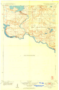 1949 Commonwealth1949 Print · USGSThe riverine border between Wisconsin and Michigan is captured here just after the war, showing a landscape of hydroelectric power and state forestry. Researchers can trace the Brule Island Dam and locate the rural South Mastodon Sch near Peavy Pond.
 - 1954 Map of Iron Mountain, 1964 Print
 1954 Iron Mountain1964 Print · USGSUpper Michigan and Northeastern Wisconsin are shown in detail during the mid-fifties, when the logging and mining economies still moved by rail. Trace the rail lines of the Soo Line to remote stops like Koepenick Station or explore the Iron Range near Iron Mountain.2 unique versions available
Showing maps 1-25 of 157
Top cities of Florence County
- Aurora historical maps
- Florence historical maps
- Commonwealth historical maps
- Fence historical maps
- Tipler historical maps
- Fern historical maps
See more
Frequently asked questions
- What are the different types of historical maps available for Florence County?
- What is the oldest map of Florence County?
- Where can I purchase historical maps of Florence County for my home or office?
- Where can I download high-res historical maps of Florence County?
- Are there historical topographic maps available for Florence County?
- Is there historical aerial imagery available for Florence County?
- Where are historical maps of Florence County sourced from?