Old Maps of Mercer, Wisconsin for Genealogy
Trace your family roots with 35 historic maps of Mercer. These high-res maps reveal old neighborhoods, homesites, landmarks, and streets — helping you uncover where your ancestors lived and how the area evolved over time.
- Explore historic neighborhoods: Identify where your relatives may have lived in the 1800s or 1900s.
- Compare maps over time: Trace the changes in streets, buildings, and landmarks for multi-generational research.
- Perfect for genealogy & ancestry research: Used by family historians and researchers to map out lineage and migration.
These maps are an incredible resource for exploring your personal connection to Mercer's past.
Mercer, WI maps
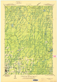
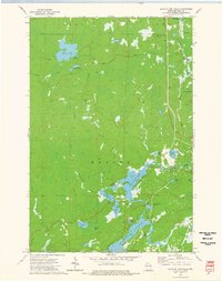
(35)- 1939 Map of Winchester
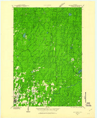
 1939 Winchester1939 Print · USGSWisconsin's lake-strewn Northwoods are documented here in the late thirties as the region transitioned into a destination for conservation and recreation. Researchers can locate Depression-era infrastructure like the CCC Camp or trace family roots near Winchester, Spider Lake Sch, and Powell.2 unique versions available
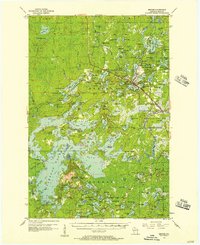
 - 1940 Map of Mercer, 1953 Print
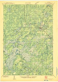
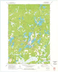
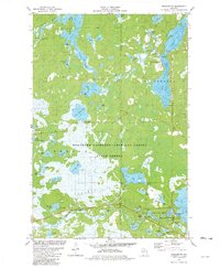
 1940 Mercer1953 Print · USGSIron County’s lake-rich landscape is captured in the early 1940s, showing the early growth of Northwoods tourism and timber management. Researchers can trace the rail corridor of the Chicago and Northwestern, find the rural Springstead Sch, and locate the historic Mercer Fire Tower.
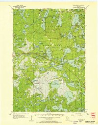
 - 1940 Map of Butternut, 1961 Print
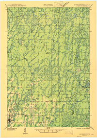
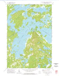
 1940 Butternut1961 Print · USGSAshland and Iron Counties come alive in this wartime-era survey of the Northwoods timber and rail country. Genealogists and historians can trace rural schoolhouses like Otto Sch, the local government at Agenda Town Hall, and the old rail paths of the Soo Line.
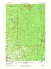
 - 1945 Map of Mercer
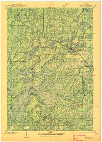
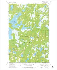
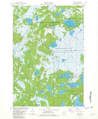
 1945 Mercer1945 Print · USGSIron County in the mid-1940s is defined by its massive flowage systems and transition from rail to highway travel. Genealogists and researchers can trace the rural infrastructure of Mercer via the Springstead Sch, Mercer Fire Tower, and the Chicago and Northwestern tracks.
 - 1946 Map of Winchester
 1946 Winchester1946 Print · USGSNorthern Wisconsin's lake country was a landscape of remote settlements and timber management during the mid-forties. Genealogists and local historians can trace the footprint of early communities at Winchester and Presque Isle, or locate the Winegar Church and the regional CCC Camp.
 - 1947 Map of Butternut
 1947 Butternut1947 Print · USGSThe village of Butternut and the surrounding timberlands are captured here in the late 1940s. Genealogists and local historians can trace rural schoolhouse locations like Tank Sch and Smart Sch alongside early industry at Teeter Camp.
 - 1947 Map of Mercer
 1947 Mercer1947 Print · USGSIron County’s lake country is captured here during the post-war years as the regional transport network evolved. Researchers can trace family roots through settlements like Mercer and Springstead, or locate landmarks such as the Springstead Sch and the Mercer Fire Tower.
 - 1950 Map of Butternut
 1950 Butternut1950 Print · USGSWisconsin's Northwoods were still defined by logging camps and rural school districts in the mid-twentieth century. Genealogists and local historians can trace the foundations of Butternut and the surrounding townships, locating sites like Agenda Town Hall, Old Camp, and Tank Sch.
 - 1953 Map of Ashland, 1964 Print
 1953 Ashland1964 Print · USGSNorthern Wisconsin's lakefront and timberlands are seen here in the mid-1950s, showing the intersection of industrial rail lines and vast wilderness. Genealogists and historians can trace the Soo Line through rail towns like Mellen or locate family roots in the Apostle Islands and Bad River Indian Reservation.3 unique versions available
 - 1955 Map of Mercer, 1957 Print
 1955 Mercer1957 Print · USGSIron County in the mid-1950s is a landscape of expansive forests and interconnected waterways. Researchers can trace the path of the CHICAGO AND NORTHWESTERN railroad or locate local landmarks like Springstead Sch and Murrays Landing.4 unique versions available
 - 1955 Map of Winchester, 1957 Print
 1955 Winchester1957 Print · USGSVilas County's lake country is captured here during the mid-fifties, showing the intersection of state forest lands and tribal geography. Trace the old rail lines of the Chicago and Northwestern or locate landmarks like Birch Lake Sch and the Cranberry Bogs.4 unique versions available
 - 1958 Map of Ashland
 1958 Ashland1958 Print · USGSCoastal Wisconsin and the Michigan borderlands meet here in the late fifties, dominated by the timbered expanses and iron-rich ranges. Genealogists can trace family footprints in settlements like Odanah and Montreal, or locate landmarks such as the Coast Guard Station and Agricultural Experiment Station.
 - 1958 Map of Iron River, 1968 Print
 1958 Iron River1968 Print · USGSThe Upper Peninsula in the late fifties is captured here as a landscape of timber, iron, and rail. Genealogists and historians can trace rail stops like Mass Station or explore the coastlines of Lake Gogebic and Keweenaw Bay.3 unique versions available
 - 1960 Map of Iron River
 1960 Iron River1960 Print · USGSThe Upper Peninsula’s western reaches are shown in the late fifties, featuring the industrial infrastructure of the Copper Country and the vast Ottawa National Forest. Researchers can trace the rail lines of the Milwaukee Road through settlements like Bruce Crossing and the White Pine Mine.
 - 1961 Map of Iron River
 1961 Iron River1961 Print · USGSThe Upper Peninsula and northern Wisconsin are shown here in the early 1960s, a landscape defined by the iron range and vast timberlands. Researchers can trace the legacy of mining and rail transport through Caspian, the Lac Du Flambeau Indian Reservation, and the Milwaukee Road.
 - 1967 Map of Iron River, 1968 Print
 1967 Iron River1968 Print · USGSThe Upper Peninsula and northern Wisconsin borderlands are shown here in the late sixties, a landscape of deep woods and iron-country rail lines. Genealogists and historians can trace the lakeside settlements of L'Anse and Ontonagon or follow the Soo Line through towns like Michigamme and Nestoria.
 - 1968 Map of Butternut, 1971 Print
 1968 Butternut1971 Print · USGSWisconsin's Northwoods come into focus in the late 1960s as a landscape defined by timber, rail, and water. Researchers can trace the Soo Line through Butternut, find the Union Cem, and locate river landmarks like Stubbs Rapids and Petes Landing.
 - 1973 Map of Lake of The Falls, 1976 Print
 1973 Lake of The Falls1976 Print · USGSIron County's lake country in the early seventies shows a landscape shaped by water and the timber-era rail network. Researchers can trace the Chicago and North Western line through Carter or locate the Winter Trail near Moose Lake.
 - 1973 Map of Mercer, 1976 Print
 1973 Mercer1976 Print · USGSNorthern Wisconsin's lake country is captured here during the 1970s, centered on the rail-side settlement of Mercer. Genealogists and local historians can trace the Chicago and North Western line, Mercer Cem, and the Lookout Tower near the Turtle River.2 unique versions available
 - 1973 Map of Turtle-Flambeau Flowage, 1976 Print
 1973 Turtle-Flambeau Flowage1976 Print · USGSIron County's Northwoods landscape is captured here in the early 1970s, defined by the expansion of the Turtle-Flambeau Flowage. Genealogists and local historians can locate the Springstead settlement, the Townhall, and landmarks like the Springstead Lookout Tower.2 unique versions available
 - 1973 Map of Wilson Lake, 1976 Print
 1973 Wilson Lake1976 Print · USGSIron County’s Northwoods are captured in the early seventies, a landscape dominated by the confluence of three major rivers and extensive protected wetlands. Researchers can locate remote landmarks like Murrays Landing, Bonies Mound, and Leach Lake.2 unique versions available
 - 1980 Map of Ironwood
 1980 Ironwood1980 Print · USGSThe Michigan-Wisconsin borderlands appear in the late twentieth century as a landscape defined by iron mining and deep forests. Researchers can trace the rail-and-river economy through the Soo Line and Chicago and North Western tracks connecting Mellen, Glidden, and Hurley.
 - 1981 Map of Winchester, 1982 Print
 1981 Winchester1982 Print · USGSWinchester and the surrounding Northwoods lakes are captured here in the early eighties as the region balanced local industry with growing public recreation. Genealogists and local historians can trace family-named sites and landmarks like Wayside Park Shay Dam, the Old Grade Drive, and Fox Island.
 - 1981 Map of Powell, 1982 Print
 1981 Powell1982 Print · USGSIron and Vilas counties are seen here in the early 1980s, where the Northwoods landscape is shaped by the Chicago and North Western railroad. Trace the small settlements of Powell and Powell No 2 alongside the sprawling Powell Marsh State Public Hunting Grounds.
 - 1984 Map of Hay Creek Flowage
 1984 Hay Creek Flowage1984 Print · USGSThe northern Wisconsin wilderness comes into focus in the 1980s, centered on the complex river systems of the Ashland and Iron County line. You can trace the rocky navigation of the Flambeau River past Bear Skull Rock, Stubbs Rapids, and Petes Landing.
Showing maps 1-25 of 35
Top cities near Mercer
- Lac du Flambeau historical maps
- Fifield historical maps
- Manitowish Waters historical maps
- Winchester historical maps
Top neighborhoods of Mercer
Frequently asked questions
- What are the different types of historical maps available for Mercer?
- What is the oldest map of Mercer?
- Where can I purchase historical maps of Mercer for my home or office?
- Where can I download high-res historical maps of Mercer?
- Are there historical topographic maps available for Mercer?
- Is there historical aerial imagery available for Mercer?
- Where are historical maps of Mercer sourced from?