Old Maps of Jefferson County, Wisconsin for Hiking & Exploration
Hike through history with 75 historic maps of Jefferson County. Explore old trails, ghost towns, and forgotten backroads — perfect for outdoor adventurers and local explorers.
- Rediscover forgotten places: Map out old mining camps, roads, and footpaths that no longer exist on modern maps.
- Layer with modern tools: Combine with LiDAR or satellite views to plan hikes through historical terrain.
- Made for exploration: Popular among hikers, overlanders, and local history lovers.
Use these maps to find adventure and explore the hidden past of Jefferson County.
Jefferson County, WI maps
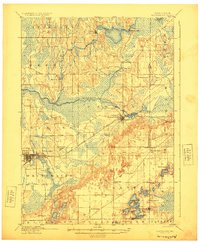
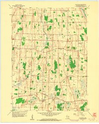
(75)- 1890 Map of Sun Prairie
 1890 Sun Prairie1890 Print · USGSEastern Dane County was a landscape of budding rail towns and glacial ridges in the late nineteenth century. Genealogists and local historians can trace the early footprints of Sun Prairie, Deerfield, and Marshall along the active corridors of the Chicago and Northwestern Railroad.2 unique versions available
 - 1890 Map of Stoughton
 1890 Stoughton1890 Print · USGSSouthern Wisconsin during the 1890s shows a landscape of thriving river towns and expanding rail networks. Researchers can trace early family homesteads near Stebbinsville, Cooksville, and Fulton Center while following the historic route of the Chicago Milwaukee and St Paul Railroad.6 unique versions available
 - 1891 Map of Waterloo
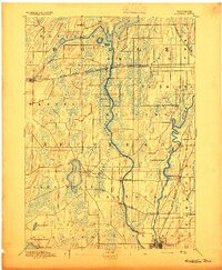
 1891 Waterloo1891 Print · USGSJefferson County was an agricultural and rail landscape during the 1890s, defined by its winding river systems and glacial lakes. Genealogists can trace property locations near Lake Mills, Aztalan, and the Crawfish River during this period of early growth.
 - 1891 Map of Koshkonong
 1891 Koshkonong1891 Print · USGSJefferson County was an evolving hub of river power and rail transit in the 1890s. Researchers can trace the early footprints of Jefferson and Fort Atkinson or locate rural landmarks like Busseyville and Cold Spring.
 - 1892 Map of Watertown
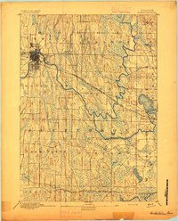
 1892 Watertown1892 Print · USGSJefferson and Dodge counties at the close of the nineteenth century are defined by their winding river valleys and newly established rail corridors. Genealogists can trace family roots in early settlements like Watertown, Ixonia, and Sullivan, or follow the Rock River to its junction with the Oconomowoc River.
 - 1892 Map of Whitewater
 1892 Whitewater1892 Print · USGSSoutheastern Wisconsin's glaciated landscape is revealed in the late nineteenth century as the rail network began to shape local growth. Trace the path of the Chicago Milwaukee And St. Paul Railroad through Whitewater, Palmyra, and the marshes of the Bark River.
 - 1893 Map of Whitewater
 1893 Whitewater1893 Print · USGSThe dairy lands and glacial lake districts of southeastern Wisconsin are captured here in the late nineteenth century. Trace the early village footprints of Whitewater and Palmyra, or follow the iron path of the Prairie Du Chien Division Railroad past Lauderdale Lakes.7 unique versions available
 - 1894 Map of Waterloo
 1894 Waterloo1894 Print · USGSJefferson County was an expanding hub of rail and river commerce in the 1890s as several major lines connected new settlements. You can trace early township boundaries and find the footprints of Lake Mills and Waterloo alongside the Rock River.2 unique versions available
 - 1894 Map of Watertown
 1894 Watertown1894 Print · USGSSouthern Wisconsin at the close of the nineteenth century reveals a landscape shaped by glacial ridges and the iron horse. Genealogists can trace family footprints in settlements like Watertown, Ixonia, and Sullivan, or follow the rail lines that connected Lac La Belle to the wider region.5 unique versions available
 - 1894 Map of Koshkonong
 1894 Koshkonong1894 Print · USGSSouthern Wisconsin at the end of the nineteenth century is defined by its glacial lakes and expanding rail networks. Genealogists can trace family footprints in Fort Atkinson and Milton Junction, or locate small settlements like Busseyville and Cold Spring.2 unique versions available
 - 1896 Map of Sun Prairie
 1896 Sun Prairie1896 Print · USGSEastern Dane County in the 1880s is captured here as a landscape of glacial ridges and emerging rail towns. Genealogists and local historians can trace early homesteads and rail stops like Deansville, Cottage Grove, and London.2 unique versions available
 - 1903 Map of Whitewater
 1903 Whitewater1903 Print · USGSSoutheastern Wisconsin at the turn of the century reveals a landscape of thriving rail towns and glacial lake systems. Trace the early routes of the Chicago Milwaukee and St Paul railroad between Whitewater and Palmyra, or locate old lakeside settlements like Heart Prairie.5 unique versions available
 - 1905 Map of Sun Prairie, 1959 Print
 1905 Sun Prairie1959 Print · USGSIn the early twentieth century, this part of Dane County was a thriving network of rail-stop towns and dairy farms. Genealogists and historians can trace the original rail paths of the Milwaukee Road through settlements like Sun Prairie, Deerfield, and Marshall.
 - 1906 Map of Koshkonong
 1906 Koshkonong1906 Print · USGSSouthern Wisconsin at the turn of the century was a landscape of expanding rail junctions and river towns. Trace the early footprints of Fort Atkinson and Jefferson, or follow the rail lines connecting Milton Junction and Lima Center.3 unique versions available
 - 1907 Map of Sun Prairie
 1907 Sun Prairie1907 Print · USGSEastern Dane County at the turn of the century shows a landscape of rail-connected dairy towns and glacial wetlands. Genealogists and historians can trace family locations near York Center, Liberty Mound, and the old rail junction at London.8 unique versions available
 - 1910 Map of Waterloo
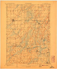
 1910 Waterloo1910 Print · USGSJefferson County’s river valleys and rail hubs are preserved here during the Edwardian era. Genealogists and historians can trace the rail-and-river economy through landmarks like Jefferson Junction, Hoopers Mill, and the early shoreline of Rock Lake.2 unique versions available
 - 1924 Map of Whitewater
 1924 Whitewater1924 Print · USGSSoutheastern Wisconsin at the turn of the century shows a landscape of glacial lakes and thriving rail-side towns. Genealogists and historians can trace old homesteads near Heaths Mills, the station at Palmyra, and the early township centers of Rome and Lagrange.4 unique versions available
 - 1954 Map of Rockford
 1954 Rockford1954 Print · USGSThe Rock River valley and the Illinois-Wisconsin borderlands are captured here in the mid-1950s during a period of robust industrial and agricultural activity. Genealogists and historians can trace rail-era corridors like the Illinois Central RR and locate landmarks from Big Foot Prairie to Lake Geneva.
 - 1955 Map of Rockford
 1955 Rockford1955 Print · USGSThe Rock River valley and southern Wisconsin dairy country are shown here in the mid-fifties as the region's manufacturing centers grew. Genealogists and historians can trace the paths of the Chicago and North Western RR and Illinois Central RR through hubs like Rockford and Beloit.
 - 1957 Map of Madison, 1967 Print
 1957 Madison1967 Print · USGSSouth-central Wisconsin in the mid-fifties reveals a landscape of industrial hubs and glacial lakes linked by a dense rail and highway network. Genealogists and historians can trace the development of lakeside communities and find notable sites like Badger Ordnance Works and the Horicon National Wildlife Refuge.3 unique versions available
 - 1958 Map of Rockford, 1974 Print
 1958 Rockford1974 Print · USGSNorthern Illinois and southern Wisconsin are shown here in the mid-twentieth century as rail-dependent industrial towns began to interface with growing lakefront communities. Genealogists can trace family roots through settlements like Saylesville and Tess Corners or locate historical landmarks like the Rockford Ordnance Depot.4 unique versions available
 - 1959 Map of Richwood, 1960 Print
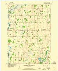 1959 Richwood1960 Print · USGSDodge and Jefferson Counties come alive in the late fifties, showcasing a rural landscape defined by river confluences and the railroad. Researchers can locate many local landmarks, including Mamre Ch Cem, St Marks Sch, and the rail siding at Richwood.2 unique versions available
 - 1959 Map of Waterloo, 1960 Print
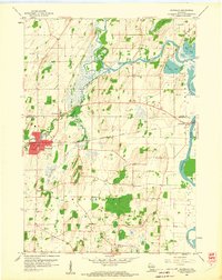 1959 Waterloo1960 Print · USGSWaterloo and its river-carved surroundings are captured here in the late fifties, showing a landscape shaped by glacial deposits and rail travel. Researchers can trace rural lineages through local landmarks like St Wenceslaus Ch, Oak Hill Cem, and the small river community of Hubbleton.3 unique versions available
 - 1959 Map of Lake Mills, 1961 Print
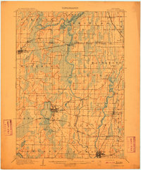
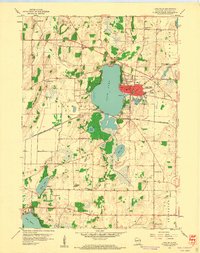 1959 Lake Mills1961 Print · USGSJefferson County in the late fifties showcases a landscape of glacial lakes and dairy-era rural schoolhouses centered on Rock Lake. Genealogists can locate family-named landmarks and institutions like Hoopers Mill, Faville Grove, and the Brick Street Sch.3 unique versions available
 - 1959 Map of Helenville, 1961 Print
 1959 Helenville1961 Print · USGSJefferson County agricultural life is captured here in the late fifties, showing a landscape defined by the Chicago and North Western rail line. Genealogists can locate numerous rural landmarks like Sunshine Sch, Immanuel Ch, and Pioneer Cem.2 unique versions available
Showing maps 1-25 of 75
Top cities of Jefferson County
- Fort Atkinson historical maps
- Jefferson historical maps
- Lake Mills historical maps
- Ixonia historical maps
- Oakland historical maps
- Waterloo historical maps
See more
Frequently asked questions
- What are the different types of historical maps available for Jefferson County?
- What is the oldest map of Jefferson County?
- Where can I purchase historical maps of Jefferson County for my home or office?
- Where can I download high-res historical maps of Jefferson County?
- Are there historical topographic maps available for Jefferson County?
- Is there historical aerial imagery available for Jefferson County?
- Where are historical maps of Jefferson County sourced from?