2020s Maps of Jefferson County, Wisconsin
Explore 20 historic maps of Jefferson County from the 2020s. These maps offer a rare glimpse into what life looked like during the 2020s — showing old roads, neighborhoods, homes, and landmarks that have changed or disappeared over time.
Whether you're researching your family's past, planning a metal detecting trip, or studying how Jefferson County's landscape evolved across the 2020s, these high-resolution maps are a powerful tool for exploring the history of this region.
- Focus on a specific era: All maps on this page are from the 2020s, giving you a focused view of this time period.
- See what’s changed: Compare century-old streets, trails, and buildings to today's modern landscape using overlays and satellite layers.
- Research with precision: Use these maps for genealogy, historical research, land use analysis, or educational projects.
- View, download, or print: Maps are fully viewable online in high resolution, and can be downloaded or printed for your own records.
Start exploring Jefferson County's history through authentic maps from the 2020s. This is your window into the past.
Jefferson County, WI maps
(20)- 2022 Map of Little Prairie, 2022 Print
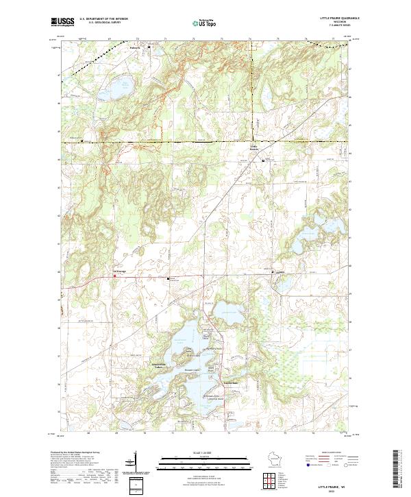 2022 Little Prairie2022 Print · USGSThe rolling glacial terrain of Walworth County appears here in the early twenty-first century. Genealogists can trace rural family plots at Little Prairie Cem and Adams Cem or locate homes near Lauderdale Lakes.
 - 2022 Map of Rome, 2022 Print
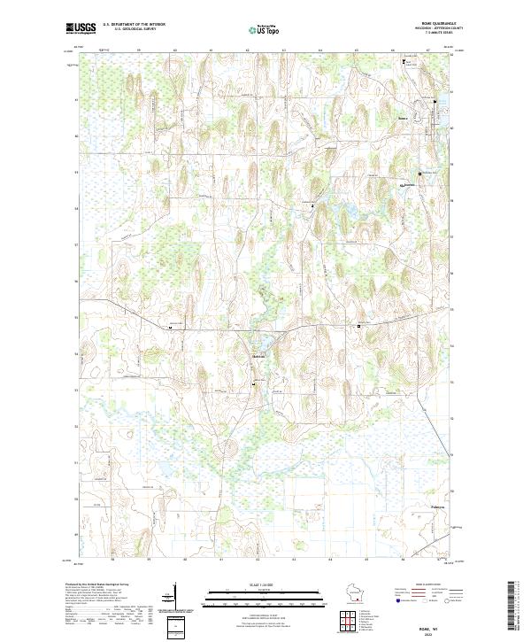 2022 Rome2022 Print · USGSJefferson County's rural landscape is captured here in the early twenty-first century, showing a network of river-fed wetlands and historic hamlets. Genealogists can locate family sites at Crowder Cem, Riverview Cem, or the old settlement of Slabtown along the Bark River.
 - 2022 Map of Oconomowoc West, 2022 Print
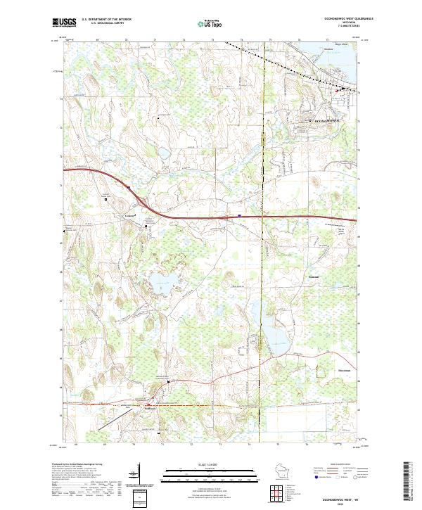 2022 Oconomowoc West2022 Print · USGSJefferson and Waukesha counties appear here in the early 2020s, showing a landscape defined by glacial lakes and river systems. Genealogists can trace several local burial sites, including Saint Jerome Cem and the Webster - Holcomb Cem.
 - 2022 Map of Lake Mills, 2022 Print
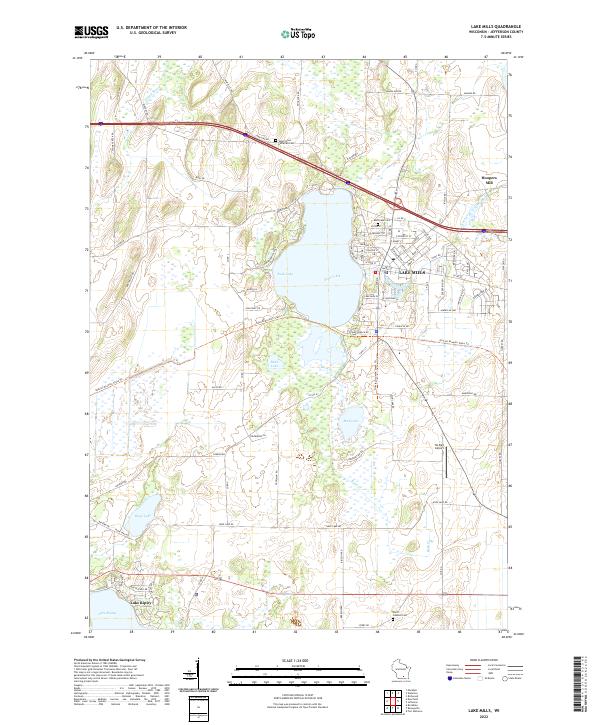 2022 Lake Mills2022 Print · USGSLake Mills and the surrounding glacial lake country are captured in this recent survey of Jefferson County. Genealogists and local historians can trace family plots at Rock Lake Cem or explore the waterfront history of Lake Mills and Hoopers Mill.
 - 2022 Map of Helenville, 2022 Print
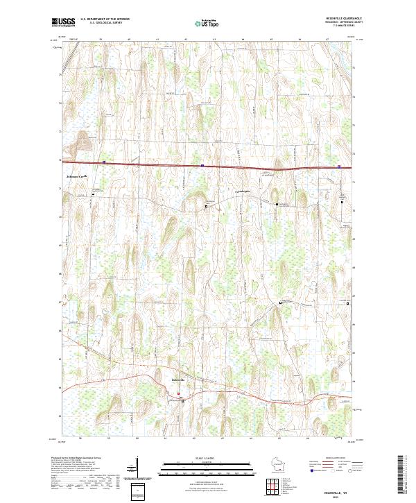 2022 Helenville2022 Print · USGSJefferson County in the early 2020s shows a landscape of persistent agricultural roots and quiet rural hamlets. Family historians can trace ancestral sites at Farmington Cem, Saint Stephens Cem, and along the Glacial Drumlin State Trail.
 - 2022 Map of Lima Center, 2022 Print
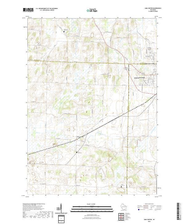 2022 Lima Center2022 Print · USGSWisconsin's southern dairy country is captured here in the early twenty-first century, showing the rural landscapes of Rock and Jefferson counties. Genealogists and historians can trace family land via Lima Center, Utters Corners Cem, and the Ice Age National Scenic Trl.
 - 2022 Map of Richwood, 2022 Print
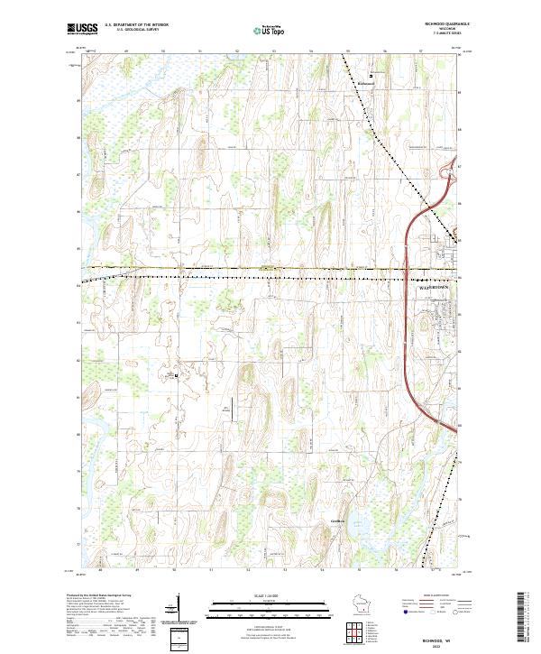 2022 Richwood2022 Print · USGSJefferson and Dodge Counties are captured here in the early 2020s, showing the rural corridor north of the city. Genealogists and local historians can locate the Mamre Moravian Cem, the small community of Richwood, and the banks of the Crawfish River.
 - 2022 Map of Watertown, 2022 Print
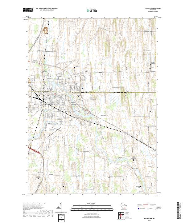 2022 Watertown2022 Print · USGSWatertown and the Rock River valley are shown in contemporary detail just as they appeared in the early 2020s. Researchers can locate family sites at Saint Paul's Lutheran Cem or trace the rural character of Ebenezer and Old Lebanon.
 - 2022 Map of Waterloo, 2022 Print
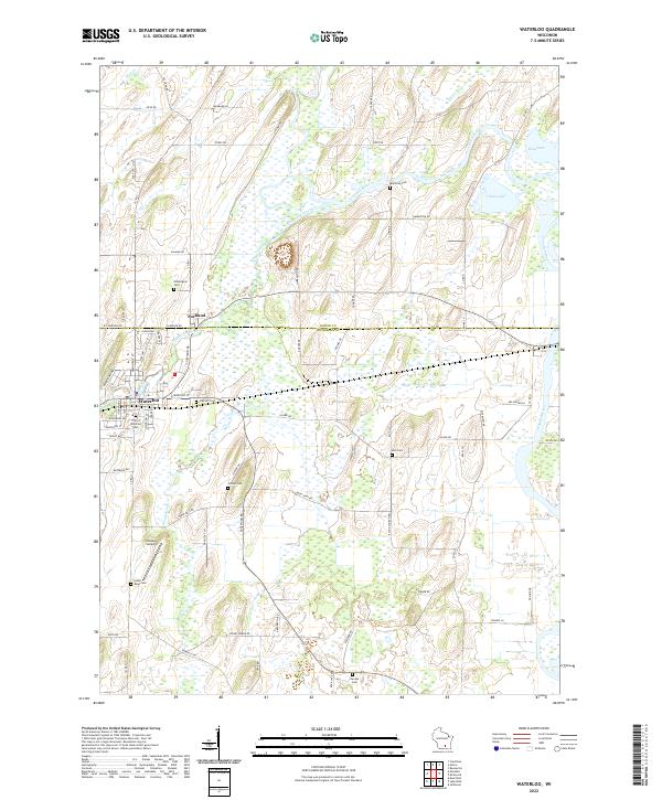 2022 Waterloo2022 Print · USGSWaterloo and Portland sit at the intersection of Dodge and Jefferson Counties during the early twenty-first century. Local historians can trace the positions of several historic burial sites, including Washington Cem, Oak Hill Cem, and the Jordan Cem.
 - 2022 Map of Jefferson, 2022 Print
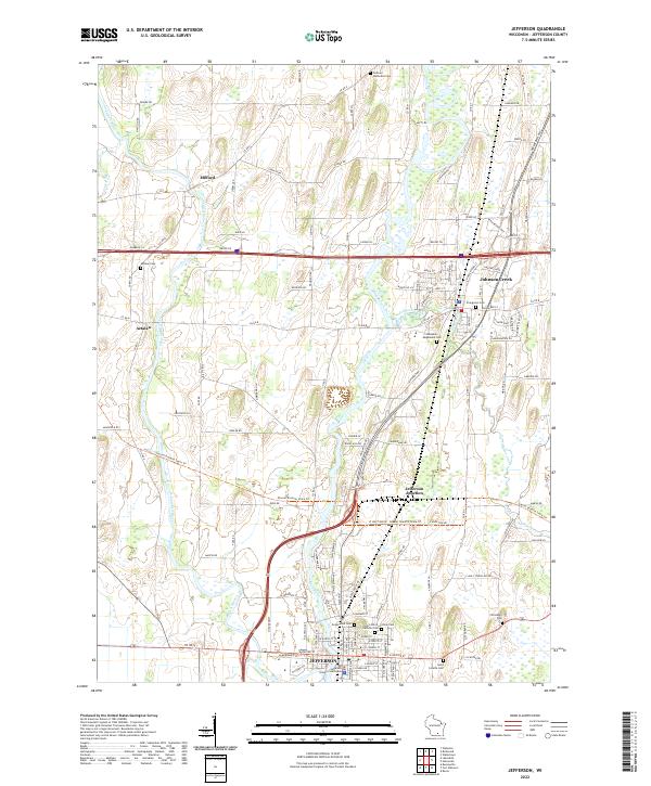 2022 Jefferson2022 Print · USGSJefferson and the surrounding river valleys are captured here in the early 2020s, showcasing a landscape defined by the Crawfish River and Rock River. Local historians can trace the development of Aztalan and Johnson Creek or locate ancestral sites like Greenwood Cem and the Jefferson County Courthouse.
 - 2022 Map of Marshall, 2022 Print
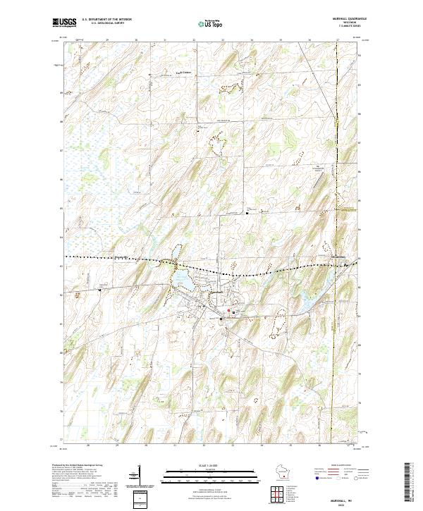 2022 Marshall2022 Print · USGSNortheast Dane County and the borders of Dodge and Jefferson counties are captured here in the early 2020s. Researchers can locate numerous local burial grounds like York Medina Cem and trace the Maunesha River through Deansville and Marshall.
 - 2022 Map of Milton, 2022 Print
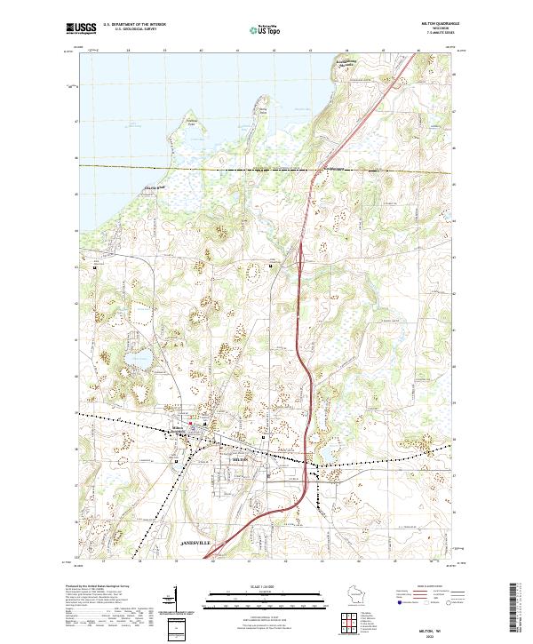 2022 Milton2022 Print · USGSMilton and the shores of Lake Koshkonong are captured here during a period of modern growth and landscape preservation. Researchers can trace local heritage through several cemeteries like Rock River Cem or explore prominent terrain features like Koshkonong Mounds and Charlie Bluff.
 - 2022 Map of Busseyville, 2022 Print
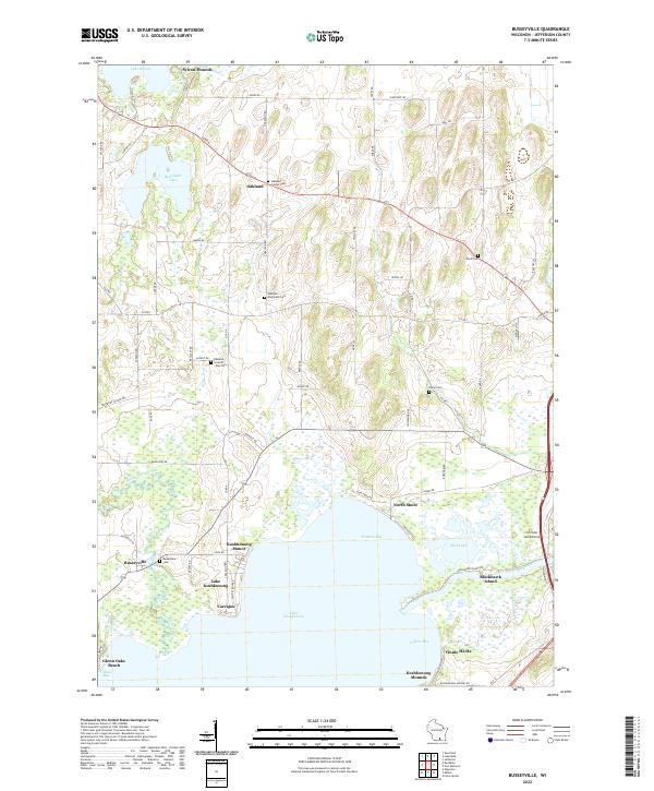 2022 Busseyville2022 Print · USGSJefferson County shorelines and rural townships are captured here in the early twenty-first century. Researchers can trace ancestral sites at Oakland Seventh Day Cem, explore the layout of Busseyville, or locate landmarks like Sylvan Mounds and Blackhawk Island.
 - 2022 Map of Edgerton, 2022 Print
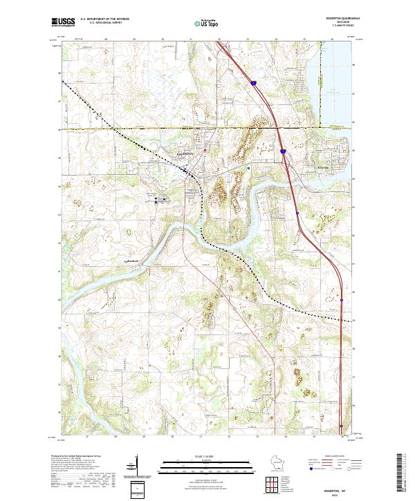 2022 Edgerton2022 Print · USGSSouthern Wisconsin at the turn of the decade shows the meeting of river and road as Edgerton expands toward the Jefferson County line. Trace local heritage and family sites at Saint Joseph Parish Cem or follow the Rock River down to Indianford.
 - 2022 Map of Whitewater, 2022 Print
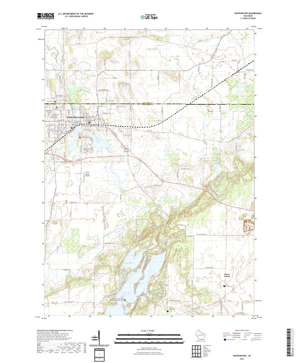 2022 Whitewater2022 Print · USGSWhitewater and the glaciated Kettle Moraine landscape are captured in this recent survey, featuring the expansive University campus and surrounding lake systems. Researchers can trace local heritage at Heart Prairie Cem or Oak Grove Cem.
 - 2022 Map of Fort Atkinson, 2022 Print
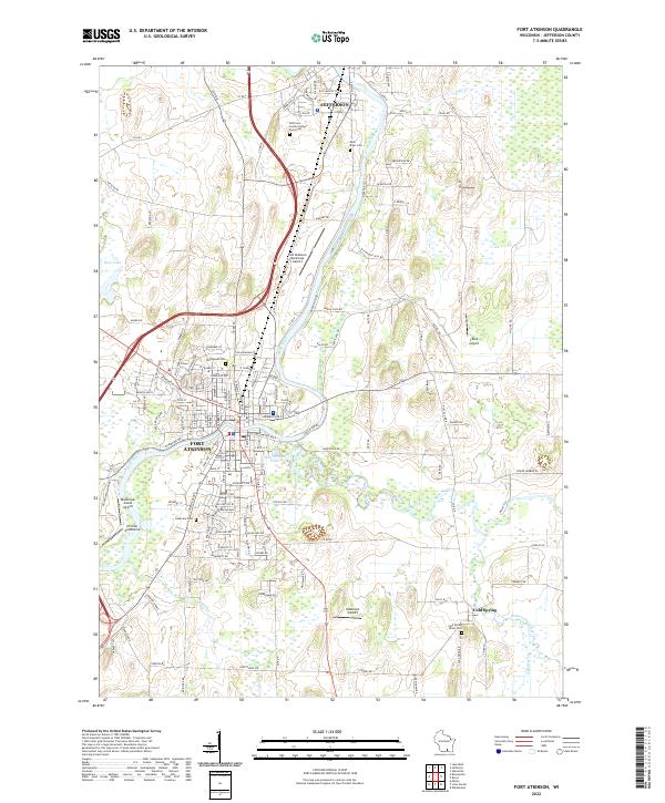 2022 Fort Atkinson2022 Print · USGSJefferson County at the start of the 2020s shows a landscape shaped by the Rock River and aviation. Trace local history at the Potter's Field Cem or explore the river confluence near Blackhawk Island.
 - 2022 Map of Rockdale, 2022 Print
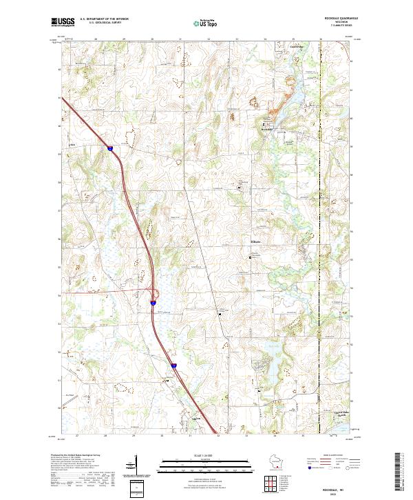 2022 Rockdale2022 Print · USGSThe rolling terrain between Cambridge and Albion comes alive in this 2022 survey, showcasing a landscape defined by deep-rooted heritage and glacial waters. Genealogists can trace family landmarks at Rockdale Lutheran Church Cem and Pioneer Norwegian Cem.
 - 2022 Map of Ixonia, 2022 Print
 2022 Ixonia2022 Print · USGSSoutheastern Wisconsin at the confluence of the Rock River and Ashippun River reveals a landscape defined by water and early settlement. Researchers can trace family history through sites like Old Ashippun, Monterey, and the Bethel Cem.
 - 2022 Map of Deerfield, 2022 Print
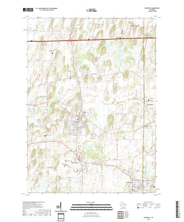 2022 Deerfield2022 Print · USGSThe crossroads and hamlets on the border of Dane and Jefferson Counties come into focus in the early 2020s. Genealogists can trace early settler heritage at the Pioneer Norwegian Cemetery and explore old rail corridors like the Glacial Drumlin State Trail.
 - 2022 Map of Palmyra, 2022 Print
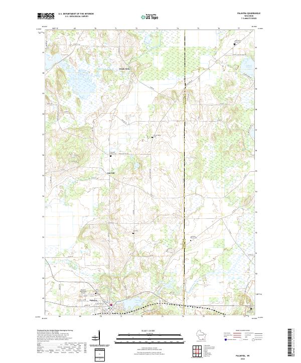 2022 Palmyra2022 Print · USGSJefferson County settlement and wetland patterns are documented here in the early 2020s. Researchers can locate numerous local burial grounds including Zion Cem and Saint Bruno Parish Cem, alongside landmarks like Heath Mills and Rome Pond.
End of results
Showing maps 1-20 of 20
Top cities of Jefferson County
- Fort Atkinson historical maps
- Jefferson historical maps
- Lake Mills historical maps
- Ixonia historical maps
- Oakland historical maps
- Waterloo historical maps
See more
Frequently asked questions
- What are the different types of historical maps available for Jefferson County?
- What is the oldest map of Jefferson County?
- Where can I purchase historical maps of Jefferson County for my home or office?
- Where can I download high-res historical maps of Jefferson County?
- Are there historical topographic maps available for Jefferson County?
- Is there historical aerial imagery available for Jefferson County?
- Where are historical maps of Jefferson County sourced from?