2022 Map of Palmyra
USGS Topo · Published 2022About this map
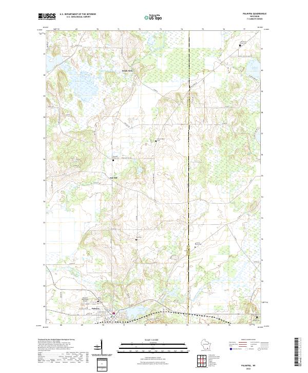
Palmyra sits at the southern edge of this landscape, where the Scuppernong River flows near the Palmyra Municipal Airport. The area is characterized by a high density of rural burial sites, including Saint Marys Cem, Melendys Prairie Cem, and Hardscrabble Cem, which provide significant points of reference for genealogical research in this part of Jefferson County. Water features dominate the northern and central sections, most notably the sprawling Rome Pond and the winding course of the Bark River near Heath Mills. The settlement pattern follows a grid of local roads like Hardscrabble Rd and Rome Oak Hill Rd, connecting established community centers like Oak Hill with the surrounding agricultural and wetland terrain. This era shows the developed recreation and conservation landscape of southeastern Wisconsin, evidenced by the Ice Age National Scenic Trl passing through the wetlands near Spring Lake 38.
Find a feature on this map
68 named features on this map. Tap any name to fly to it.
Don’t see what you’re looking for? This feature index may not catch every label — zoom into the map to look around manually.
Map Details
Editions of this 2022 Palmyra Map
This is the sole edition of this map. No revisions or reprints were ever made.
Historical Maps of Jefferson County Through Time
3 maps found