1980s Maps of Germantown, Wisconsin
Explore 6 historic maps of Germantown from the 1980s. These maps offer a rare glimpse into what life looked like during the 1980s — showing old roads, neighborhoods, homes, and landmarks that have changed or disappeared over time.
Whether you're researching your family's past, planning a metal detecting trip, or studying how Germantown's landscape evolved across the 1980s, these high-resolution maps are a powerful tool for exploring the history of this region.
- Focus on a specific era: All maps on this page are from the 1980s, giving you a focused view of this time period.
- See what’s changed: Compare century-old streets, trails, and buildings to today's modern landscape using overlays and satellite layers.
- Research with precision: Use these maps for genealogy, historical research, land use analysis, or educational projects.
- View, download, or print: Maps are fully viewable online in high resolution, and can be downloaded or printed for your own records.
Start exploring Germantown's history through authentic maps from the 1980s. This is your window into the past.
Germantown, WI maps
(6)- 1983 Map of Round Bluff, 1984 Print
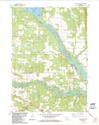 1983 Round Bluff1984 Print · USGSThe river systems of Juneau and Adams counties are shown in high detail during the early 1980s. Local researchers can trace old property lines and landmarks like St Michaels Cem, the Woodside Ranch, and the rail corridor near Round Bluff.
 - 1983 Map of Mauston, 1984 Print
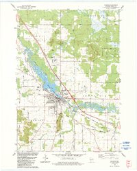 1983 Mauston1984 Print · USGSJuneau County was characterized by a blend of river-valley agriculture and growing civic centers in the early eighties. You can trace family plots at St Patricks Cem or locate landmarks like the Hess Memorial Hospital and the Milwaukee Road rail line.
 - 1983 Map of Dellwood, 1984 Print
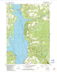 1983 Dellwood1984 Print · USGSThe Wisconsin River valley in the early 1980s reveals a landscape of recreational growth and quiet lakeside settlements. You can trace the development of Dellwood and locate landmarks like the Quincy Cem, Quincy Bluff, and Our Lady of the Lake.
 - 1983 Map of Kelly, 1984 Print
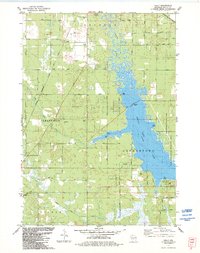 1983 Kelly1984 Print · USGSJuneau County's eastern lakefront and rail corridors are captured in the early eighties as Castle Rock Lake borders rising parklands. Genealogists and local historians can trace the Danish Cem, locate the Townhall, or follow the path of the Chicago and North Western railroad.
 - 1985 Map of Wisconsin Dells
 1985 Wisconsin Dells1985 Print · USGSCentral Wisconsin in the mid-eighties was a landscape of intricate river bends, rail junctions, and sprawling marshlands. Researchers can trace historic routes along the Soo Line or locate family landmarks near Lyndon Station, Buffalo Lake, and Puckaway Lake.
 - 1985 Map of Sparta
 1985 Sparta1985 Print · USGSWestern Wisconsin in the 1980s shows the unique ridge-and-valley terrain of the Driftless Area during a period of transition for its rails and rural hubs. Trace the historic rail tunnels of the Elroy-Sparta State Trail and find local landmarks like St Marys Ch and Castle Rock Lake.2 unique versions available
End of results
Showing maps 1-6 of 6
Top cities near Germantown
- Mauston historical maps
- New Lisbon historical maps
- Adams historical maps
- Lemonweir historical maps
- Dell Prairie historical maps
- Easton historical maps
See more
Top neighborhoods of Germantown
Frequently asked questions
- What are the different types of historical maps available for Germantown?
- What is the oldest map of Germantown?
- Where can I purchase historical maps of Germantown for my home or office?
- Where can I download high-res historical maps of Germantown?
- Are there historical topographic maps available for Germantown?
- Is there historical aerial imagery available for Germantown?
- Where are historical maps of Germantown sourced from?