1980s Maps of Kenosha County, Wisconsin
Explore 4 historic maps of Kenosha County from the 1980s. These maps offer a rare glimpse into what life looked like during the 1980s — showing old roads, neighborhoods, homes, and landmarks that have changed or disappeared over time.
Whether you're researching your family's past, planning a metal detecting trip, or studying how Kenosha County's landscape evolved across the 1980s, these high-resolution maps are a powerful tool for exploring the history of this region.
- Focus on a specific era: All maps on this page are from the 1980s, giving you a focused view of this time period.
- See what’s changed: Compare century-old streets, trails, and buildings to today's modern landscape using overlays and satellite layers.
- Research with precision: Use these maps for genealogy, historical research, land use analysis, or educational projects.
- View, download, or print: Maps are fully viewable online in high resolution, and can be downloaded or printed for your own records.
Start exploring Kenosha County's history through authentic maps from the 1980s. This is your window into the past.
Kenosha County, WI maps
(4)- 1980 Map of Waukegan
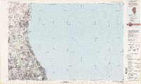 1980 Waukegan1980 Print · USGSThe Illinois North Shore and Lake Michigan coastline appear at a point of high development in the early eighties. Trace the expansive grounds of the Great Lakes Naval Training Center, Fort Sheridan, and historic Northwestern University.
 - 1980 Map of Lake Geneva, 1981 Print
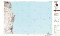
 1980 Lake Geneva1981 Print · USGSSoutheastern Wisconsin at the start of the eighties reveals a landscape of glacial moraines and established lakefront resorts. Researchers can trace historic rail lines like the Chicago and North Western RR or locate landmarks such as Yerkes Observatory and East Lawn Cem.
 - 1980 Map of Racine, 1981 Print
 1980 Racine1981 Print · USGSThe Lake Michigan shoreline at the start of the 1980s reveals a bustling industrial corridor from Milwaukee to Kenosha. Genealogists and local historians can trace family roots through numerous sites like Forest Home Cem or locate former rail stops along the C & N W and C M St P & P lines.
 - 1981 Map of Elgin
 1981 Elgin1981 Print · USGSNorthern Illinois and southern Wisconsin are shown in the early eighties as suburban growth meets glacial terrain. Trace the paths of the Milwaukee Road through Harvard or explore the wetlands of Volo Bog State Natural Area.
End of results
Showing maps 1-4 of 4
Top cities of Kenosha County
- Kenosha historical maps
- Pleasant Prairie historical maps
- Salem Lakes historical maps
- Somers historical maps
- Twin Lakes historical maps
- Bristol historical maps
See more
Frequently asked questions
- What are the different types of historical maps available for Kenosha County?
- What is the oldest map of Kenosha County?
- Where can I purchase historical maps of Kenosha County for my home or office?
- Where can I download high-res historical maps of Kenosha County?
- Are there historical topographic maps available for Kenosha County?
- Is there historical aerial imagery available for Kenosha County?
- Where are historical maps of Kenosha County sourced from?