1990s Maps of Kenosha County, Wisconsin
Explore 5 historic maps of Kenosha County from the 1990s. These maps offer a rare glimpse into what life looked like during the 1990s — showing old roads, neighborhoods, homes, and landmarks that have changed or disappeared over time.
Whether you're researching your family's past, planning a metal detecting trip, or studying how Kenosha County's landscape evolved across the 1990s, these high-resolution maps are a powerful tool for exploring the history of this region.
- Focus on a specific era: All maps on this page are from the 1990s, giving you a focused view of this time period.
- See what’s changed: Compare century-old streets, trails, and buildings to today's modern landscape using overlays and satellite layers.
- Research with precision: Use these maps for genealogy, historical research, land use analysis, or educational projects.
- View, download, or print: Maps are fully viewable online in high resolution, and can be downloaded or printed for your own records.
Start exploring Kenosha County's history through authentic maps from the 1990s. This is your window into the past.
Kenosha County, WI maps
(5)- 1992 Map of Richmond
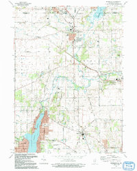 1992 Richmond1992 Print · USGSThe Illinois-Wisconsin borderlands come alive in the early nineties, showing the transition from rural crossroads to growing communities. Genealogists and historians can trace family sites like Washington Cem and schools in Richmond or Ringwood.
 - 1993 Map of Wadsworth
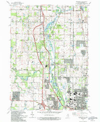 1993 Wadsworth1993 Print · USGSLake County settlements and the Des Plaines riverfront are captured here in the early nineties as suburban expansion met rural township history. Researchers can trace family roots through St Patricks Cem, identify old school sites like Howe Sch, or locate vanished crossroads at Rosecrans and Fossland.2 unique versions available
 - 1993 Map of Fox Lake
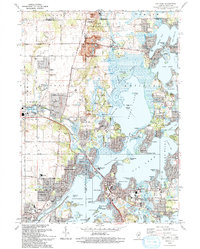 1993 Fox Lake1993 Print · USGSThe Illinois-Wisconsin border country comes alive in this survey of the Chain O' Lakes during the early nineties. Genealogists and local historians can trace family-named sites like Wray-Imeson Cem or explore the transit history of the Chicago and North Western railroad.
 - 1993 Map of Zion
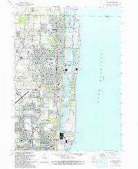 1993 Zion1993 Print · USGSThe Lake Michigan shoreline at the Wisconsin border is shown here in the early nineties, featuring the transition from industrial Waukegan to the protected dunes of Illinois Beach State Park. Researchers can trace local landmarks like Mount Olivet Memorial Park Cem and the Winthrop Harbor Station.
 - 1993 Map of Antioch
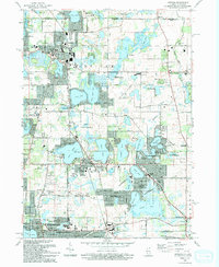 1993 Antioch1993 Print · USGSThe Chain O'Lakes region in the early nineties shows a dense network of suburban growth and glacial water bodies along the Illinois-Wisconsin line. Genealogists and local historians can trace old community markers like Hickory Union Cem, Wedges Corner, and the Petty Sch.
End of results
Showing maps 1-5 of 5
Top cities of Kenosha County
- Kenosha historical maps
- Pleasant Prairie historical maps
- Salem Lakes historical maps
- Somers historical maps
- Twin Lakes historical maps
- Bristol historical maps
See more
Frequently asked questions
- What are the different types of historical maps available for Kenosha County?
- What is the oldest map of Kenosha County?
- Where can I purchase historical maps of Kenosha County for my home or office?
- Where can I download high-res historical maps of Kenosha County?
- Are there historical topographic maps available for Kenosha County?
- Is there historical aerial imagery available for Kenosha County?
- Where are historical maps of Kenosha County sourced from?