1950s Maps of Kenosha County, Wisconsin
Explore 10 historic maps of Kenosha County from the 1950s. These maps offer a rare glimpse into what life looked like during the 1950s — showing old roads, neighborhoods, homes, and landmarks that have changed or disappeared over time.
Whether you're researching your family's past, planning a metal detecting trip, or studying how Kenosha County's landscape evolved across the 1950s, these high-resolution maps are a powerful tool for exploring the history of this region.
- Focus on a specific era: All maps on this page are from the 1950s, giving you a focused view of this time period.
- See what’s changed: Compare century-old streets, trails, and buildings to today's modern landscape using overlays and satellite layers.
- Research with precision: Use these maps for genealogy, historical research, land use analysis, or educational projects.
- View, download, or print: Maps are fully viewable online in high resolution, and can be downloaded or printed for your own records.
Start exploring Kenosha County's history through authentic maps from the 1950s. This is your window into the past.
Kenosha County, WI maps
(10)- 1954 Map of Rockford
 1954 Rockford1954 Print · USGSThe Rock River valley and the Illinois-Wisconsin borderlands are captured here in the mid-1950s during a period of robust industrial and agricultural activity. Genealogists and historians can trace rail-era corridors like the Illinois Central RR and locate landmarks from Big Foot Prairie to Lake Geneva.
 - 1955 Map of Rockford
 1955 Rockford1955 Print · USGSThe Rock River valley and southern Wisconsin dairy country are shown here in the mid-fifties as the region's manufacturing centers grew. Genealogists and historians can trace the paths of the Chicago and North Western RR and Illinois Central RR through hubs like Rockford and Beloit.
 - 1958 Map of Kenosha, 1960 Print
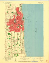 1958 Kenosha1960 Print · USGSThe Lake Michigan shoreline at Kenosha is shown here in the late 1950s during a period of significant urban expansion. Researchers can trace the three major rail lines, including the Chicago North Shore and Milwaukee, and locate local landmarks like St Josephs Sch and St Casimirs Cem.4 unique versions available
 - 1958 Map of Racine South, 1960 Print
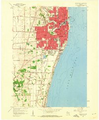 1958 Racine South1960 Print · USGSRacine and its southern lakefront suburbs are caught at a mid-century peak of rail activity and community expansion. Researchers can trace family sites at Mound Cemetery or locate the old Chicago North Shore and Milwaukee line.3 unique versions available
 - 1958 Map of Pleasant Prairie, 1960 Print
 1958 Pleasant Prairie1960 Print · USGSPleasant Prairie and the Des Plaines River valley are captured in the late fifties as rural life and aviation infrastructure intersected. Genealogists can locate family landmarks like Wesley Ch, Star Harmony Sch, and the North Bristol Cem.2 unique versions available
 - 1958 Map of Racine, 1971 Print
 1958 Racine1971 Print · USGSThe Lake Michigan shoreline in the late fifties was a study in contrasts between the industrial bustle of Kenosha and the quiet woods of the Allegan State Forest. Genealogists and historians can trace the urban footprint of Evanston or locate strategic sites like Fort Sheridan and the Wind Point Light.3 unique versions available
 - 1958 Map of Rockford, 1974 Print
 1958 Rockford1974 Print · USGSNorthern Illinois and southern Wisconsin are shown here in the mid-twentieth century as rail-dependent industrial towns began to interface with growing lakefront communities. Genealogists can trace family roots through settlements like Saylesville and Tess Corners or locate historical landmarks like the Rockford Ordnance Depot.4 unique versions available
 - 1959 Map of Racine, 1960 Print
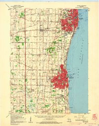 1959 Racine1960 Print · USGSThe Lake Michigan shoreline between Racine and Kenosha in the late fifties was a bustling corridor of rail lines and rural schools. Genealogists can locate family landmarks like Mound Cemetery or trace the early days of aviation at Sylvania Airport and the Kenosha Airport.2 unique versions available
 - 1959 Map of Sturtevant, 1960 Print
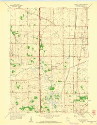
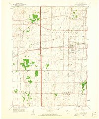 1959 Sturtevant1960 Print · USGSMid-century southeastern Wisconsin comes into focus here at a major railroad junction between the townships of Yorkville and Mount Pleasant. Genealogists and local historians can locate several country schools and cemeteries, including Paris Cem, Tucker Sch, and the grounds of St Bonaventure Sch.4 unique versions available
 - 1959 Map of Paddock Lake, 1961 Print
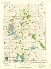 1959 Paddock Lake1961 Print · USGSSoutheast Wisconsin in the late fifties shows a landscape of glacial lakes and growing lakeside communities. Genealogists can trace family roots at Union Cem or Hosmer Cem, and locate landmarks like the Holy Family Convent and Paddock Lake Sch.3 unique versions available
End of results
Showing maps 1-10 of 10
Top cities of Kenosha County
- Kenosha historical maps
- Pleasant Prairie historical maps
- Salem Lakes historical maps
- Somers historical maps
- Twin Lakes historical maps
- Bristol historical maps
See more
Frequently asked questions
- What are the different types of historical maps available for Kenosha County?
- What is the oldest map of Kenosha County?
- Where can I purchase historical maps of Kenosha County for my home or office?
- Where can I download high-res historical maps of Kenosha County?
- Are there historical topographic maps available for Kenosha County?
- Is there historical aerial imagery available for Kenosha County?
- Where are historical maps of Kenosha County sourced from?