2020s Maps of Farmington, Wisconsin
Explore 6 historic maps of Farmington from the 2020s. These maps offer a rare glimpse into what life looked like during the 2020s — showing old roads, neighborhoods, homes, and landmarks that have changed or disappeared over time.
Whether you're researching your family's past, planning a metal detecting trip, or studying how Farmington's landscape evolved across the 2020s, these high-resolution maps are a powerful tool for exploring the history of this region.
- Focus on a specific era: All maps on this page are from the 2020s, giving you a focused view of this time period.
- See what’s changed: Compare century-old streets, trails, and buildings to today's modern landscape using overlays and satellite layers.
- Research with precision: Use these maps for genealogy, historical research, land use analysis, or educational projects.
- View, download, or print: Maps are fully viewable online in high resolution, and can be downloaded or printed for your own records.
Start exploring Farmington's history through authentic maps from the 2020s. This is your window into the past.
Farmington, WI maps
(6)- 2022 Map of West Salem, 2022 Print
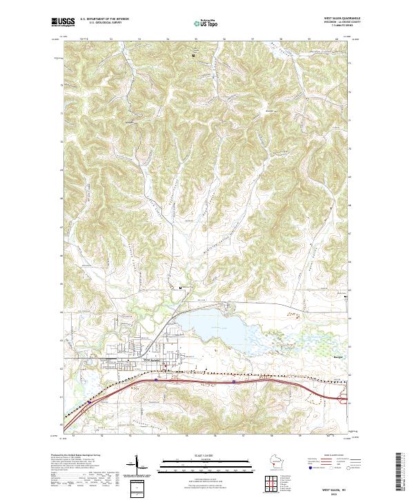 2022 West Salem2022 Print · USGSThe La Crosse River valley near West Salem is captured here in the early twenty-first century, showing the enduring pattern of coulees and river-fed settlements. You can trace family plots at Neshonoc Cem or explore the geography of Mindoro Cut and Neshonoc Lake.
 - 2022 Map of Onalaska, 2022 Print
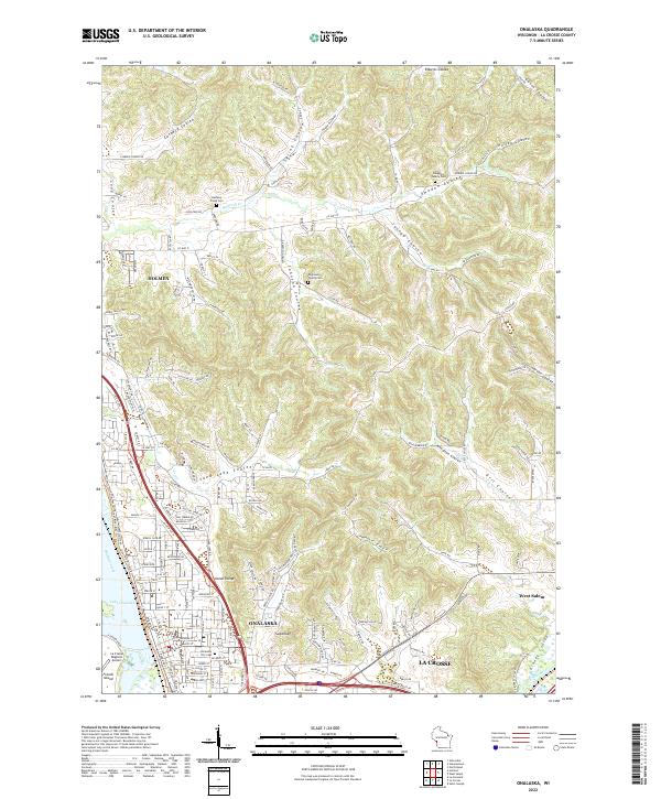 2022 Onalaska2022 Print · USGSLa Crosse County enters the 2020s with a mix of growing river towns and deep-valley farming coulees. Researchers can pinpoint early pioneer burials at Engelson Family Cem or trace the routes of the Great River State Trl and Halfway Creek.
 - 2022 Map of Four Corners, 2022 Print
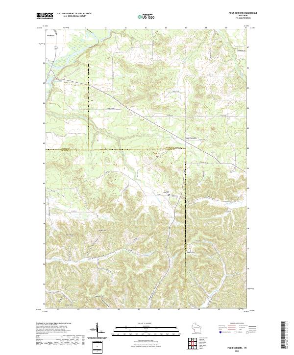 2022 Four Corners2022 Print · USGSThe tri-county borders of Monroe, Jackson, and La Crosse counties meet here among the ridges and coulees of the early 2020s. Local researchers can trace family lands near Four Corners and Sand Creek Cemetery or locate landmarks like Twin Peaks and Raffelson Coulee.
 - 2022 Map of Stevenstown, 2022 Print
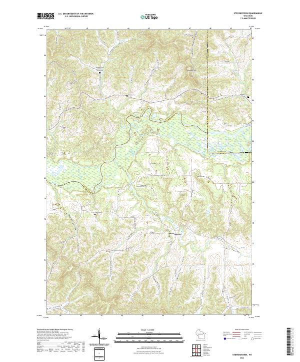 2022 Stevenstown2022 Print · USGSLa Crosse and Trempealeau Counties appear here in the early twenty-first century, showing a landscape shaped by the Black River and deep coulees. Genealogists can locate family sites like Hardies Creek Lutheran Church Cem and Glasgow Cem.
 - 2022 Map of North Bend, 2022 Print
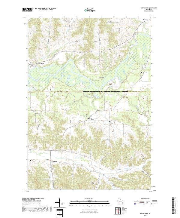 2022 North Bend2022 Print · USGSLa Crosse and Jackson Counties are captured here in the early 2020s, showing a landscape defined by coulees and the Black River corridor. Researchers can trace rural lineages through local landmarks like Mindoro, North Bend, and the Burr Oak Methodist Cem.
 - 2022 Map of Bangor, 2022 Print
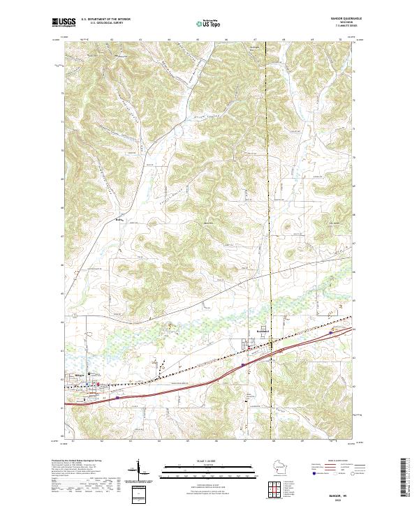 2022 Bangor2022 Print · USGSThe La Crosse River valley and its intricate coulee systems are captured here in the early twenty-first century. Genealogists can trace family names and landmarks from Bangor to Rockland, including the Welsh Calvanistic Cem and Norwegian Coulee.
End of results
Showing maps 1-6 of 6
Top cities near Farmington
- La Crosse historical maps
- Onalaska historical maps
- Holmen historical maps
- Sparta historical maps
- Sparta historical maps
- West Salem historical maps
See more
Top neighborhoods of Farmington
Frequently asked questions
- What are the different types of historical maps available for Farmington?
- What is the oldest map of Farmington?
- Where can I purchase historical maps of Farmington for my home or office?
- Where can I download high-res historical maps of Farmington?
- Are there historical topographic maps available for Farmington?
- Is there historical aerial imagery available for Farmington?
- Where are historical maps of Farmington sourced from?