1970s Maps of Pine River, Wisconsin
Explore 2 historic maps of Pine River from the 1970s. These maps offer a rare glimpse into what life looked like during the 1970s — showing old roads, neighborhoods, homes, and landmarks that have changed or disappeared over time.
Whether you're researching your family's past, planning a metal detecting trip, or studying how Pine River's landscape evolved across the 1970s, these high-resolution maps are a powerful tool for exploring the history of this region.
- Focus on a specific era: All maps on this page are from the 1970s, giving you a focused view of this time period.
- See what’s changed: Compare century-old streets, trails, and buildings to today's modern landscape using overlays and satellite layers.
- Research with precision: Use these maps for genealogy, historical research, land use analysis, or educational projects.
- View, download, or print: Maps are fully viewable online in high resolution, and can be downloaded or printed for your own records.
Start exploring Pine River's history through authentic maps from the 1970s. This is your window into the past.
Pine River, WI maps
(2)- 1973 Map of Kalinke, 1976 Print
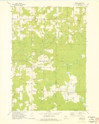
 1973 Kalinke1976 Print · USGSIn the early 1970s, the rural crossroads of Marathon County supported a quiet network of family farms and river-fed wetlands. Genealogists and local historians can locate early institutions like Zion Ch, Trinity Cem, and the Hewitt Texas Sch.
 - 1973 Map of Doering, 1976 Print
 1973 Doering1976 Print · USGSThe northern woods of Lincoln County come to life in this mid-seventies survey of the area around Doering. Genealogists and historians can trace the Old Railroad Grade past Wildwood Ch and find family names at Forest View Cem.
End of results
Showing maps 1-2 of 2
Top cities near Pine River
- Wausau historical maps
- Merrill historical maps
- Rib Mountain historical maps
- Bradley historical maps
- Maine historical maps
- Ringle historical maps
See more
Frequently asked questions
- What are the different types of historical maps available for Pine River?
- What is the oldest map of Pine River?
- Where can I purchase historical maps of Pine River for my home or office?
- Where can I download high-res historical maps of Pine River?
- Are there historical topographic maps available for Pine River?
- Is there historical aerial imagery available for Pine River?
- Where are historical maps of Pine River sourced from?