1980s Maps of Grover, Wisconsin
Explore 6 historic maps of Grover from the 1980s. These maps offer a rare glimpse into what life looked like during the 1980s — showing old roads, neighborhoods, homes, and landmarks that have changed or disappeared over time.
Whether you're researching your family's past, planning a metal detecting trip, or studying how Grover's landscape evolved across the 1980s, these high-resolution maps are a powerful tool for exploring the history of this region.
- Focus on a specific era: All maps on this page are from the 1980s, giving you a focused view of this time period.
- See what’s changed: Compare century-old streets, trails, and buildings to today's modern landscape using overlays and satellite layers.
- Research with precision: Use these maps for genealogy, historical research, land use analysis, or educational projects.
- View, download, or print: Maps are fully viewable online in high resolution, and can be downloaded or printed for your own records.
Start exploring Grover's history through authentic maps from the 1980s. This is your window into the past.
Grover, WI maps
(6)- 1981 Map of Marinette, 1982 Print
 1981 Marinette1982 Print · USGSThe Menominee River valley and Door County peninsula are captured here in the early 1980s, showcasing the region's timber and maritime foundations. Researchers can trace historic shorelines from Fish Creek to Deathdoor Bluff or locate inland landmarks like Lake Noquebay and Kangaroo Lake.
 - 1982 Map of Harmony, 1983 Print
 1982 Harmony1983 Print · USGSMarinette County in the early eighties shows a landscape of river-driven industry and quiet rural crossroads. Genealogists and local historians can trace family-named routes like Schonfeldt Lane while locating the St Johns Sch Church and Harmony Cem.
 - 1982 Map of Loomis, 1983 Print
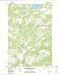 1982 Loomis1983 Print · USGSMarinette County in the early eighties shows a landscape shaped by the Peshtigo River and the legacy of the timber rail lines. Genealogists and local researchers can trace family landmarks like the St Paul Cem and the small settlement of Loomis.
 - 1982 Map of Porterfield SW, 1983 Print
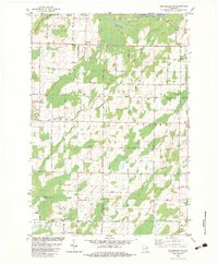 1982 Porterfield SW1983 Print · USGSNortheastern Wisconsin farmland and river valleys are captured here in the early eighties. Genealogists and local historians can trace family-named routes like Seefeldt Ln and Behnke Road or locate the St Matthews Ch and Equity Park.
 - 1982 Map of Porterfield, 1983 Print
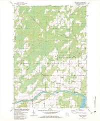 1982 Porterfield1983 Print · USGSMarinette County in the early eighties was a landscape of river-fed lowlands and busy rail corridors. Genealogists and local historians can trace family locations near Porterfield, the St Joseph Cem near Walsh, and the rails at Bagley Junction.
 - 1984 Map of Sturgeon Bay, 1985 Print
 1984 Sturgeon Bay1985 Print · USGSDoor Peninsula and the Kewaunee coast are documented here in the mid-eighties, showing the deep-water harbor at Sturgeon Bay and the rural agricultural interior. Genealogists can trace family roots through crossroads towns like Kolberg, Duvall, and Sugar Bush.2 unique versions available
End of results
Showing maps 1-6 of 6
Top cities near Grover
- Marinette historical maps
- Menominee historical maps
- Oconto historical maps
- Peshtigo historical maps
- Peshtigo historical maps
- Porterfield historical maps
See more
Top neighborhoods of Grover
Frequently asked questions
- What are the different types of historical maps available for Grover?
- What is the oldest map of Grover?
- Where can I purchase historical maps of Grover for my home or office?
- Where can I download high-res historical maps of Grover?
- Are there historical topographic maps available for Grover?
- Is there historical aerial imagery available for Grover?
- Where are historical maps of Grover sourced from?