Old Maps of Jefferson, Wisconsin for Genealogy
Trace your family roots with 39 historic maps of Jefferson. These high-res maps reveal old neighborhoods, homesites, landmarks, and streets — helping you uncover where your ancestors lived and how the area evolved over time.
- Explore historic neighborhoods: Identify where your relatives may have lived in the 1800s or 1900s.
- Compare maps over time: Trace the changes in streets, buildings, and landmarks for multi-generational research.
- Perfect for genealogy & ancestry research: Used by family historians and researchers to map out lineage and migration.
These maps are an incredible resource for exploring your personal connection to Jefferson's past.
Jefferson, WI maps
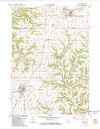
(39)- 1909 Map of Sparta
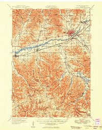
 1909 Sparta1909 Print · USGSMonroe and La Crosse Counties are shown here during the height of the steam-rail era, centered on the growing hub of Sparta. Genealogists can trace family holdings across the dissected ridges of Middle Ridge and Portland or along the rail stops at Rockland and Bangor.3 unique versions available
 - 1916 Map of Tomah
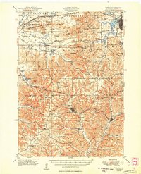
 1916 Tomah1916 Print · USGSMonroe County is defined by its strategic rail junctions and military training grounds in the years before the Great War. Genealogists can trace rural life through sites like St Marys, Hopville School, and the Sparta Target Range.2 unique versions available
 - 1923 Map of Viroqua, 1960 Print
 1923 Viroqua1960 Print · USGSViroqua and the rural townships of Vernon and Monroe counties are shown in the early 1920s as a thriving network of ridge-top farms and valley schools. Genealogists can locate family landmarks like Wang Church, the Vernon County Asylum, and the Clockmaker School.
 - 1926 Map of Viroqua
 1926 Viroqua1926 Print · USGSThe ridge-and-valley country of Vernon County is captured in the mid-1920s, showing a landscape of small farms connected by a vast network of rural schools. Genealogists can trace hundreds of family sites near Clockmaker School, Moen Church, and the Vernon County Asylum.2 unique versions available
 - 1926 Map of La Farge
 1926 La Farge1926 Print · USGSThe Kickapoo River valley in the mid-1920s reveals a landscape of ridge-top farms and isolated coulee settlements. Genealogists can trace family footprints across dozens of local school sites like Johnniecake School and through the rail corridor of the Chicago Milwaukee and St Paul River.3 unique versions available
 - 1947 Map of Sparta, 1972 Print
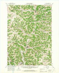
 1947 Sparta1972 Print · USGSMid-century Monroe County comes alive through a dense network of valley farms and small-town rail hubs just after the war. Researchers can trace dozens of rural school sites like East Beaver Sch and Lincoln Sch alongside the flight paths of the Sparta Landing Field.
 - 1949 Map of Sparta
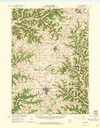
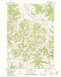
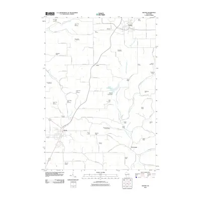
 1949 Sparta1949 Print · USGSMonroe and La Crosse Counties in the late 1940s are defined by the rail-carved valleys of the La Crosse River. Genealogists can trace rural life through landmarks like Hylandale Academy, SS Peter & Paul Sch, and the border of Camp McCoy Military Reservation.
 - 1949 Map of Tomah
 1949 Tomah1949 Print · USGSMonroe County in the late forties shows a landscape defined by the heavy rail corridors of the Chicago and North Western and the expanding Camp Mc Coy Military Reservation. Researchers can locate dozens of rural landmarks, from Tunnel Joint Sch and St Marys Ch to the old rail stop at Scotts Junction.
 - 1958 Map of La Crosse, 1979 Print
 1958 La Crosse1979 Print · USGSThe Driftless Area of Wisconsin and Iowa is captured here during the late seventies, showing the intricate river valleys and ridge-top settlements. Genealogists and historians can trace the rail corridors of the Soo Line or locate landmarks like Grandad Bluff and Effigy Mounds National Monument.2 unique versions available
 - 1961 Map of La Crosse
 1961 La Crosse1961 Print · USGSThe Driftless Area at the start of the 1960s reveals a complex network of river towns and rail lines along the Mississippi River. Genealogists and historians can trace old settlements like New Amsterdam and Wyattville or locate major landmarks like Camp McCoy Military Reservation and Effigy Mounds National Monument.
 - 1965 Map of La Crosse
 1965 La Crosse1965 Print · USGSThe Driftless Area and the Upper Mississippi valley are captured here during a period of steady mid-century growth. Researchers can trace the rail lines of the Chicago and North Western or locate riverfront sites like Effigy Mounds National Monument and the Camp McCoy Military Reservation.
 - 1965 Map of La Farge, 1967 Print
 1965 La Farge1967 Print · USGSThe Kickapoo River valley and the ridges of Vernon County are captured here in the mid-sixties, showing a landscape defined by small-scale farming and winding valley roads. Researchers can trace rural lineages through numerous hilltop landmarks like Oak Ridge Ch, Potts Corners, and the Billings Creek Cem.
 - 1965 Map of Viroqua, 1967 Print
 1965 Viroqua1967 Print · USGSVernon County ridge country is captured in the mid-1960s, showing the agricultural heart of the Driftless Area. Genealogists and historians can locate family landmarks like Bethel Ch Cem, rural schools such as Smith Sch, and the winding Kickapoo River valley.2 unique versions available
 - 1976 Map of La Crosse
 1976 La Crosse1976 Print · USGSThe Driftless Area and Mississippi River valley are captured here in the mid-seventies, showing a landscape of deep coulees and river commerce. Genealogists can trace family footprints from La Crosse to smaller hamlets like Newburg Corners and Witoka.
 - 1983 Map of Westby
 1983 Westby1983 Print · USGSThe ridge-and-valley country of Vernon and Monroe counties is captured here in the early eighties. Genealogists can trace family lines at Coon Prairie Ch and Pleasant View Cem, or locate landmarks like the Ski Jumps and Living Waters Camp.2 unique versions available
 - 1983 Map of St. Marys, 1984 Print
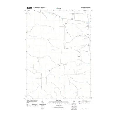
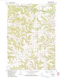 1983 St. Marys1984 Print · USGSMonroe County was a landscape of ridgeline cemeteries and deep valley farms in the early 1980s. You can trace family roots at Summit Ridge Cem and St Jacobs Cem, or follow the historic rail corridor now designated as the Elroy Sparta State Trail.
 - 1983 Map of Dell, 1984 Print
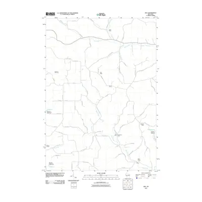
 1983 Dell1984 Print · USGSVernon County and the Driftless Area topography are captured here in the early eighties. Genealogists can locate family-named landmarks like Potts Corners or trace rural community centers including Sugar Grove Ch and the Bad Axe Cem.
 - 1983 Map of Melvina, 1984 Print
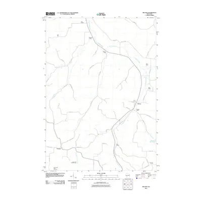
 1983 Melvina1984 Print · USGSThe Driftless Area of Monroe County is shown in the early 1980s, shaped by the Little La Crosse River and the winding rail lines of the era. Genealogists and historians can locate the Union Cem, the settlement of Portland, and the old Chicago and North Western railroad grade.
 - 1985 Map of Sparta
 1985 Sparta1985 Print · USGSWestern Wisconsin in the 1980s shows the unique ridge-and-valley terrain of the Driftless Area during a period of transition for its rails and rural hubs. Trace the historic rail tunnels of the Elroy-Sparta State Trail and find local landmarks like St Marys Ch and Castle Rock Lake.2 unique versions available
 - 2010 Map of Melvina, 2010 Print
 2010 Melvina2010 Print · USGSCovers Jefferson, including Cashton, Leon, and other nearby areas
 - 2010 Map of Saint Marys, 2010 Print
 2010 Saint Marys2010 Print · USGSCovers Jefferson, including Norwalk, Sheldon, and other nearby areas
 - 2010 Map of Westby, 2010 Print
 2010 Westby2010 Print · USGSCovers Jefferson, including Westby, Cashton, and other nearby areas
 - 2010 Map of Dell, 2010 Print
 2010 Dell2010 Print · USGSCovers Jefferson, including Sheldon, Webster, and other nearby areas
 - 2013 Map of Melvina, 2013 Print
 2013 Melvina2013 Print · USGSCovers Jefferson, including Cashton, Leon, and other nearby areas
 - 2013 Map of Westby, 2013 Print
 2013 Westby2013 Print · USGSCovers Jefferson, including Westby, Cashton, and other nearby areas
Showing maps 1-25 of 39
Top cities near Jefferson
- Sparta historical maps
- Sparta historical maps
- Tomah historical maps
- Viroqua historical maps
- Westby historical maps
- Angelo historical maps
See more
Top neighborhoods of Jefferson
Frequently asked questions
- What are the different types of historical maps available for Jefferson?
- What is the oldest map of Jefferson?
- Where can I purchase historical maps of Jefferson for my home or office?
- Where can I download high-res historical maps of Jefferson?
- Are there historical topographic maps available for Jefferson?
- Is there historical aerial imagery available for Jefferson?
- Where are historical maps of Jefferson sourced from?