1970s Maps of Oconto County, Wisconsin
Explore 34 historic maps of Oconto County from the 1970s. These maps offer a rare glimpse into what life looked like during the 1970s — showing old roads, neighborhoods, homes, and landmarks that have changed or disappeared over time.
Whether you're researching your family's past, planning a metal detecting trip, or studying how Oconto County's landscape evolved across the 1970s, these high-resolution maps are a powerful tool for exploring the history of this region.
- Focus on a specific era: All maps on this page are from the 1970s, giving you a focused view of this time period.
- See what’s changed: Compare century-old streets, trails, and buildings to today's modern landscape using overlays and satellite layers.
- Research with precision: Use these maps for genealogy, historical research, land use analysis, or educational projects.
- View, download, or print: Maps are fully viewable online in high resolution, and can be downloaded or printed for your own records.
Start exploring Oconto County's history through authentic maps from the 1970s. This is your window into the past.
Oconto County, WI maps
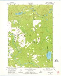
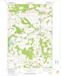
(34)- 1972 Map of Wheeler Lake, 1975 Print
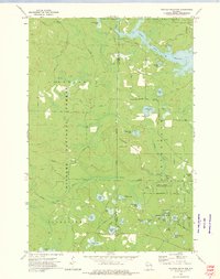
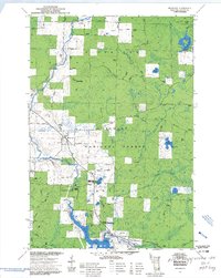
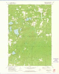 1972 Wheeler Lake1975 Print · USGSOconto County's lake-rich landscape is captured in the early 1970s, showcasing the intricate water systems within the Nicolet National Forest. You can trace an old railroad grade, locate the Lakewood State Fish Hatchery, or find family-named landmarks like Bucks Ranch.
 - 1972 Map of Mc Caslin Mountain, 1975 Print
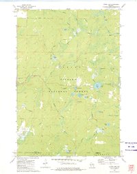
 1972 Mc Caslin Mountain1975 Print · USGSThe borderlands of Forest and Marinette County in the early seventies reveal a landscape of managed timber and remote glacial lakes. You can trace the Rat River rapids, locate the McCaslin Lookout Tower, and find small landmarks like the Cem or the Deer Lake Flowage.2 unique versions available
 - 1972 Map of Roaring Rapids, 1975 Print
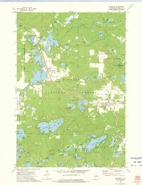
 1972 Roaring Rapids1975 Print · USGSMarinette County was a hub of river activity and forestry in the early seventies, centered on the wild stretches of the Peshtigo River. Researchers can locate St Mary of the Cliff Ch and trace the many rapids and chutes like Jerry Chute and Roaring Rapids.2 unique versions available
 - 1972 Map of Wabeno, 1975 Print
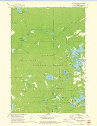
 1972 Wabeno1975 Print · USGSForest County in the early 1970s is characterized by the timber-belt communities of Wabeno and Soperton within the Nicolet National Forest. Genealogists and historians can trace rail-side developments, numerous lakefronts, and several local cemeteries like St Ambrose Cem and Roseland Cem.
 - 1972 Map of Thunder Mountain, 1975 Print
 1972 Thunder Mountain1975 Print · USGSThe Marinette and Oconto county line runs through this forested landscape during the 1970s, dominated by the waters of the Peshtigo River. Researchers can trace old forest routes and local landmarks like the Thunder River State Rearing Station and Camp Bird State Youth Recreational Center.2 unique versions available
 - 1972 Map of Otter Lake, 1975 Print
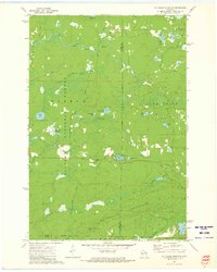
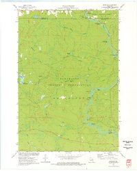
 1972 Otter Lake1975 Print · USGSThe deep Northwoods of Forest County are captured in the early seventies, dominated by the sprawling Nicolet National Forest. Researchers can trace old timber access routes like Kufner Road and locate remote water features such as Johnson Spring and Otter Lake.
 - 1972 Map of Townsend, 1975 Print
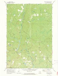
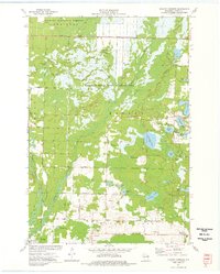
 1972 Townsend1975 Print · USGSOconto County's timber and lake country is captured in the early seventies, when the Chicago and North Western railroad still served the northern woods. Trace family history at Forest Home Cem or locate the Archibald Lookout Tower near Townsend and Lakewood.2 unique versions available
 - 1972 Map of Reservoir Pond, 1975 Print
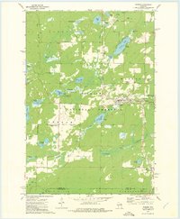
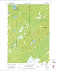
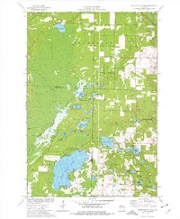
 1972 Reservoir Pond1975 Print · USGSWisconsin's north woods in the early 1970s appear as a dense network of glacial lakes and springs along the Oconto River. Outdoorsmen and historians can trace the Railroad Grade or locate the Ada Lake Lookout Tower and the Jones Spring Impoundment.2 unique versions available
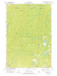
 - 1973 Map of Mountain
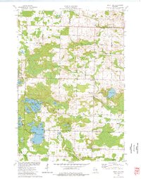
 1973 Mountain1973 Print · USGSMountain and the surrounding Oconto River valley are shown in the early seventies as a hub for timber and recreation. Trace the development of Chute Pond, locate the St Michael Chapel, and explore landmarks like Bowman Airport.3 unique versions available
 - 1973 Map of Kelly Lake, 1977 Print
 1973 Kelly Lake1977 Print · USGSThe glacial lake country of Oconto County is captured here in the early seventies, showing a landscape defined by water and woods. Genealogists can locate family landmarks like Section Eight Church, St Wenceslaus Cem, and the old Klondike settlement.
 - 1973 Map of Hickory Corners, 1977 Print
 1973 Hickory Corners1977 Print · USGSOconto County in the early seventies reveals a landscape of dense wetlands and forest edge settlements. Genealogists and historians can trace family locations near Hickory Corners, Frostville, and the Hickory Cem, or locate landmarks like the Bagley Lookout Tower.
 - 1973 Map of Shay Lake, 1977 Print
 1973 Shay Lake1977 Print · USGSThe Northwoods of Oconto County are shown here in the 1970s, revealing a landscape defined by timber, glacial lakes, and the Nicolet National Forest. Researchers can trace old logging routes and rural landmarks like Butler Rock, St Marys of the Lake Ch, and the remote Landing Strip.
 - 1973 Map of Langlade, 1977 Print
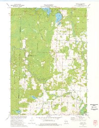
 1973 Langlade1977 Print · USGSThe Wolf River and Nicolet National Forest define this Wisconsin landscape in the early 1970s. Genealogists and historians can trace the community around Langlade, including the St Stanislaus Ch and the winding Soo Line railroad.2 unique versions available
 - 1973 Map of Fredenberg Lake, 1977 Print
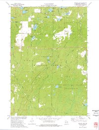
 1973 Fredenberg Lake1977 Print · USGSThe Menominee Indian Reservation and Nicolet National Forest meet in this early 1970s survey of Wisconsin's lake country. Researchers can trace the paths of Pecore Creek and the South Branch Oconto River or locate St Joseph Ch and the La Belle Lookout Tower.
 - 1973 Map of Breed, 1977 Print
 1973 Breed1977 Print · USGSThe Oconto County woodlands were a landscape of managed forests and river wildlife areas in the early 1970s. Local researchers can trace family landmarks and rural infrastructure from the Menominee Indian Reservation to the Union Cem and Piso Landing Strip.
 - 1973 Map of Shadow Lake, 1977 Print
 1973 Shadow Lake1977 Print · USGSOconto County's lake country is captured here in the early seventies, spanning the wooded borders of Doty and Riverview. Researchers can trace old routes like Old Grave Rd and locate landmarks ranging from the Townhall to the shores of Deadman Lake.
 - 1973 Map of Coleman, 1977 Print
 1973 Coleman1977 Print · USGSThe villages of Pound and Coleman are shown during the 1970s as vital hubs along the Chicago Milwaukee St Paul and Pacific railroad. Genealogists and local historians can trace family sites at St Leos Cem, Town Cem, and the rural Section Eight Sch.
 - 1973 Map of White Potato Lake, 1977 Print
 1973 White Potato Lake1977 Print · USGSThe Marinette County lake country is captured here in the early seventies, just as modern conservation efforts were shaping the land. Genealogists and historians can locate Brazeau Cem, the Patz Landing Field, and the many family-named waters like Heisel Lake.
 - 1973 Map of Markton, 1977 Print
 1973 Markton1977 Print · USGSThe Wolf River corridor in the early 1970s reveals a wilderness landscape managed by the Menominee Indian Reservation. Researchers can trace numerous river landmarks including Big Smoky Falls, The Dalles, and the small settlement of Markton.
 - 1974 Map of Oconto East, 1977 Print
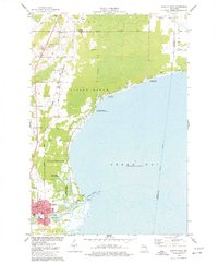 1974 Oconto East1977 Print · USGSThe Lake Michigan shoreline at Oconto is captured in the mid-seventies, showing the transition from city streets to protected marshlands. Researchers can find old family sites at Garden of Hope Cem and trace the Chicago and North Western rail line.
 - 1974 Map of Cecil, 1977 Print
 1974 Cecil1977 Print · USGSShawano Lake and the village of Cecil are captured here during the mid-seventies, showing the intersection of resort life and rural farming. Genealogists and local historians can trace the Chicago and North Western rail line and locate family sites like St Martins Cem and Tracy Corners.
 - 1974 Map of Abrams, 1977 Print
 1974 Abrams1977 Print · USGSOconto County in the mid-seventies shows a landscape defined by the Oconto and Pensaukee rivers. Local historians can trace the rail junction at Abrams or find family-named landmarks like Heider Road and the Stiles Lookout Tower.
 - 1974 Map of Lena, 1977 Print
 1974 Lena1977 Print · USGSOconto County rural life is preserved here during the mid-seventies, centered on the rail-fed village of Lena and the crossroads at Stiles Junction. Genealogists and local historians can trace family-named roads and landmarks like St Charles Cem, the Larson Studio Landing Strip, and the High Sch.
 - 1974 Map of Oconto Falls North, 1977 Print
 1974 Oconto Falls North1977 Print · USGSOconto County in the mid-1970s reveals a landscape of quiet dairy farms and emerging river towns before modern expansion. Genealogists can trace family footprints at Kelly Brook Cem, St Mark Ch, and along the tracks of the Chicago and North Western rail line.
 - 1974 Map of Gillett, 1977 Print
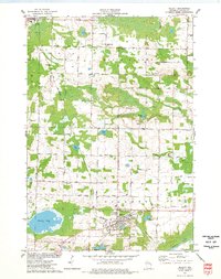 1974 Gillett1977 Print · USGSOconto County in the mid-1970s shows a landscape of rail-connected towns and rural townships centered on the village of Gillett. Genealogists can locate family-named sites like Wanderers Rest Cem, Spring Hill Sch, and Hickory Ch.
Showing maps 1-25 of 34
Top cities of Oconto County
- Oconto historical maps
- Little Suamico historical maps
- Chase historical maps
- Oconto Falls historical maps
- Abrams historical maps
- Stiles historical maps
See more
Frequently asked questions
- What are the different types of historical maps available for Oconto County?
- What is the oldest map of Oconto County?
- Where can I purchase historical maps of Oconto County for my home or office?
- Where can I download high-res historical maps of Oconto County?
- Are there historical topographic maps available for Oconto County?
- Is there historical aerial imagery available for Oconto County?
- Where are historical maps of Oconto County sourced from?