2020s Maps of Mountain, Wisconsin
Explore 6 historic maps of Mountain from the 2020s. These maps offer a rare glimpse into what life looked like during the 2020s — showing old roads, neighborhoods, homes, and landmarks that have changed or disappeared over time.
Whether you're researching your family's past, planning a metal detecting trip, or studying how Mountain's landscape evolved across the 2020s, these high-resolution maps are a powerful tool for exploring the history of this region.
- Focus on a specific era: All maps on this page are from the 2020s, giving you a focused view of this time period.
- See what’s changed: Compare century-old streets, trails, and buildings to today's modern landscape using overlays and satellite layers.
- Research with precision: Use these maps for genealogy, historical research, land use analysis, or educational projects.
- View, download, or print: Maps are fully viewable online in high resolution, and can be downloaded or printed for your own records.
Start exploring Mountain's history through authentic maps from the 2020s. This is your window into the past.
Mountain, WI maps
(6)- 2022 Map of Shay Lake, 2022 Print
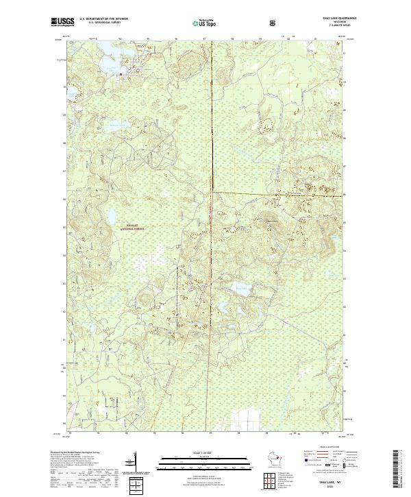 2022 Shay Lake2022 Print · USGSWisconsin's Northwoods are captured here in the early twenty-first century, showing the dense timber and glacial basins of the Nicolet National Forest. You can trace the rugged access roads and recreation trails surrounding Shay Lake, Butler Rock, and the remote banks of W Br Peshtigo Brook.
 - 2022 Map of Shadow Lake, 2022 Print
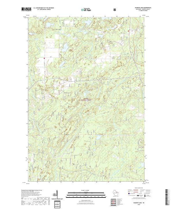 2022 Shadow Lake2022 Print · USGSOconto County's Northwoods are captured here in the early twenty-first century, showing a landscape of forest management and glacial lakes. You can trace historical rural routes like Old Shingle Mill Road and find secluded spots such as Hells Acre Springs and Shadow Lake.
 - 2022 Map of Fredenberg Lake, 2022 Print
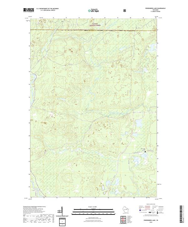 2022 Fredenberg Lake2022 Print · USGSMenominee County’s deep forest and river systems are shown here as they appeared in the early 2020s. Researchers can locate the Saint Joseph of the Lake Cem and trace the S Br Oconto River past the Chipmunk Rapids.
 - 2022 Map of Mountain, 2022 Print
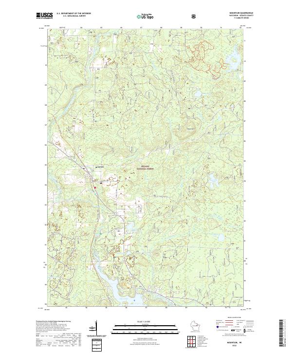 2022 Mountain2022 Print · USGSThe community of Mountain is depicted here deep within the Nicolet National Forest during the early 2020s. Genealogists and outdoor historians can trace local landmarks like the Mountain Cem and follow the route of the Nicolet State Trl past Chute Pond.
 - 2022 Map of Breed, 2022 Print
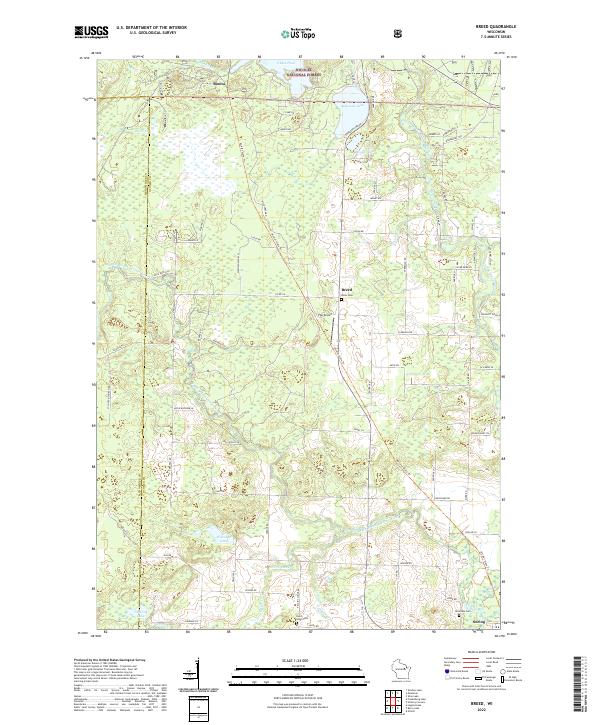 2022 Breed2022 Print · USGSUpper Oconto County and the southern fringes of the national forest appear in this contemporary survey of northern Wisconsin. Researchers can locate remote family sites near Breed, Bonita, and Suring, or trace local lineages at Union Cem and Saint Johns Cem.
 - 2023 Map of Hickory Corners, 2023 Print
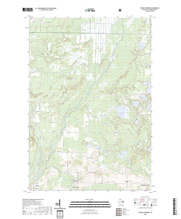 2023 Hickory Corners2023 Print · USGSThe Oconto County lake country and the northern reaches of the Oconto River are documented here in recent detail. Researchers can trace family roots at Hickory Cem and Frostville Cem or locate homesites near Impassable Lake and Frostville.
End of results
Showing maps 1-6 of 6
Top cities near Mountain
- Wabeno historical maps
- Townsend historical maps
- Spruce historical maps
- Lakewood historical maps
- Underhill historical maps
- Breed historical maps
See more
Top neighborhoods of Mountain
Frequently asked questions
- What are the different types of historical maps available for Mountain?
- What is the oldest map of Mountain?
- Where can I purchase historical maps of Mountain for my home or office?
- Where can I download high-res historical maps of Mountain?
- Are there historical topographic maps available for Mountain?
- Is there historical aerial imagery available for Mountain?
- Where are historical maps of Mountain sourced from?