Old Maps of Eureka, Wisconsin for Academic Research
Study the evolution of Eureka with 32 high-resolution historic maps. Whether you're teaching, researching, or modeling changes in land use, these maps provide essential visual documentation of urban, environmental, and geographic change.
- Analyze long-term change: Track patterns in development, transportation, and natural features.
- Ideal for environmental or urban studies: Support academic projects with primary historical map data.
- Use in the classroom or lab: Educators and researchers rely on these maps to bring historical context to life.
These maps are a powerful tool for teaching, research, and visualizing how Eureka has changed over the decades.
Eureka, WI maps
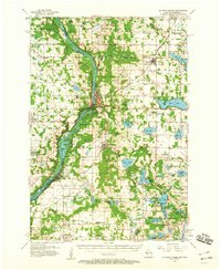
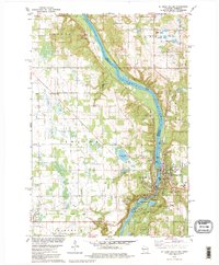
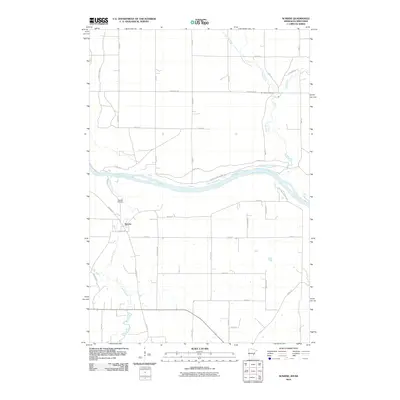
(32)- 1900 Map of St Croix Dalles
 1900 St Croix Dalles1900 Print · USGSThe river gorge at the Wisconsin-Minnesota border comes alive in this late nineteenth-century survey, showing the twin hubs of the Dalles before modern expansion. Genealogists can trace family roots in Dresser Junction, El Salem, and the scattered lakefront farms of Farmington.
 - 1901 Map of St Croix Dalles
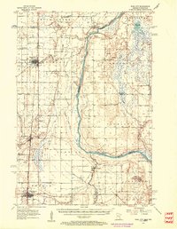
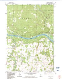
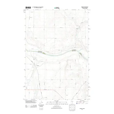
 1901 St Croix Dalles1901 Print · USGSThe river-border between Wisconsin and Minnesota was a hub of rail activity and river commerce at the start of the twentieth century. Genealogists and rail historians can trace the paths of the St. Paul and Duluth R. R. through Shafer and Taylors Falls, or locate old settlements like Franconia Station and Dresser Junction.6 unique versions available
 - 1950 Map of Rush City
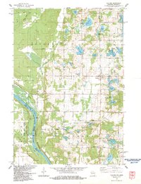
 1950 Rush City1950 Print · USGSThe St. Croix River valley in the late 1940s reveals a quiet borderland where timber and rail infrastructure meet rural crossroads. Genealogists and historians can trace the foundations of local life at Indian Cem, the Rush City Ferry, and the Logging RR.
 - 1951 Map of Milltown
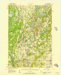
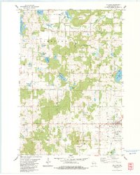
 1951 Milltown1951 Print · USGSPolk County at the close of the 1940s reveals a dense network of rural schoolhouses and lakeside settlements. Trace the history of small communities like West Denmark and Cushing, or locate ancestral sites like Bethany Ch and Union Cem.
 - 1953 Map of Stillwater, 1980 Print
 1953 Stillwater1980 Print · USGSThe Twin Cities and the St. Croix Valley are captured in this mid-century survey as the interstate era began to transform the Upper Midwest. Genealogists and historians can trace the rail-and-river geography of Stillwater, locate landmarks in Anoka, or explore the sprawling St Croix State Park.
 - 1955 Map of St. Croix Dalles
 1955 St. Croix Dalles1955 Print · USGSThe river valley along the Wisconsin and Minnesota border thrived in the mid-fifties as a hub of rail traffic and early Cold War defense. You can trace the Minneapolis St Paul and Sault Ste Marie rail lines and locate the Osceola Air Force Station or the abandoned Ubet Sch.4 unique versions available
 - 1955 Map of Rush City, 1957 Print
 1955 Rush City1957 Print · USGSThe St. Croix River valley in the mid-1950s reveals a landscape of railroad towns and riverside settlements. Genealogists can trace family landmarks like the Swedish Cem, Pleasant Prairie Ch, and the Indian Cem.5 unique versions available
 - 1955 Map of Milltown, 1957 Print
 1955 Milltown1957 Print · USGSNorthwestern Wisconsin’s lake country is captured here in the mid-fifties, showing a landscape defined by small-scale dairy farming and glacial geography. Genealogists can locate numerous rural schoolhouses and country churches like Bethany Ch, North Valley Ch, and Alabama Sch.4 unique versions available
 - 1955 Map of Stillwater, 1965 Print
 1955 Stillwater1965 Print · USGSThe Upper St. Croix Valley and the growing Twin Cities area are shown here during the mid-fifties, before the interstate era transformed the regional commute. You can trace the lines of the Northern Pacific RR through towns like Rush City or locate the Saint Croix Indian Reservation.
 - 1958 Map of Stillwater
 1958 Stillwater1958 Print · USGSThe Upper Mississippi and St. Croix River valleys appear in the mid-fifties as the Twin Cities expanded north. Genealogists can locate family landmarks like Oak Park Cem, Saint Michael Church, and the Soo Line RR rail corridors.2 unique versions available
 - 1965 Map of Stillwater
 1965 Stillwater1965 Print · USGSThe Twin Cities and the St. Croix Valley are mapped here during a period of significant post-war growth and industrial transit. Genealogists and historians can trace rail lines like the Northern Pacific RR through towns such as Rush City, Amery, and Balsam Lake.
 - 1974 Map of Milltown SE, 1976 Print
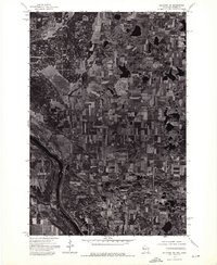
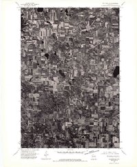 1974 Milltown SE1976 Print · USGSMid-1970s Polk County comes into sharp focus in this aerial study of the dairy and timber lands surrounding the village of Milltown. Genealogists and local historians can trace exact 1970s farmstead footprints and property lines across the rural landscape.
 - 1974 Map of Milltown SW, 1976 Print
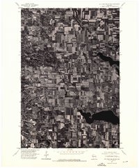
 1974 Milltown SW1976 Print · USGSWisconsin's rural dairy and timber lands are captured in photographic detail in the mid-1970s. Trace the winding St Croix River and locate the small rural center of Cushing amidst a landscape of glacial lakes and farmsteads.
 - 1974 Map of St. Croix Dalles NE, 1976 Print
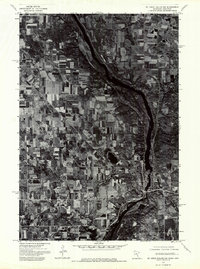
 1974 St. Croix Dalles NE1976 Print · USGSPolk County, Wisconsin, is captured in this mid-seventies aerial survey, showing a landscape of productive dairy farms and deep northern lakes. Local researchers can trace the detailed layout of Centuria and the surrounding township road network during this era.
 - 1974 Map of St Croix Dalles NW, 1976 Print
 1974 St Croix Dalles NW1976 Print · USGSThe river valley between Minnesota and Wisconsin is captured during the mid-1970s, showing a landscape defined by agriculture and woodland. Trace the early development of St Croix Falls and Taylors Falls along the banks of the St Croix River.
 - 1975 Map of Stillwater
 1975 Stillwater1975 Print · USGSThe Twin Cities and the St. Croix Valley are captured in the mid-seventies, showing the urban growth of Minneapolis and St Paul. Researchers can trace old rail corridors of the Northern Pacific RR and locate tribal lands at the Mille Lacs Indian Reservation.2 unique versions available
 - 1978 Map of Centuria, 1979 Print
 1978 Centuria1979 Print · USGSPolk County at the end of the 1970s shows a landscape of small rural settlements and scattered family burial grounds. Genealogists can trace local roots at Fristad Cem and St John Cem while exploring the rail corridor of the Soo Line.
 - 1978 Map of St. Croix Dalles, 1979 Print
 1978 St. Croix Dalles1979 Print · USGSThe river gorge at the Minnesota-Wisconsin border was well-established as a recreational and industrial hub by the late 1970s. Local researchers can trace family sites near Kahbakong Cem, find the Chisago Lakes Sch, or follow the Old Railroad Grade through Shafer.2 unique versions available
 - 1983 Map of Milltown
 1983 Milltown1983 Print · USGSNorthwest Wisconsin in the early eighties shows a landscape of glacial lakes and tight-knit rural townships. Trace family history at Pleasant Valley Cem, follow the Soo Line rail corridor through Milltown, or locate old landmarks like Trade and Laketown Ch.
 - 1983 Map of Cushing
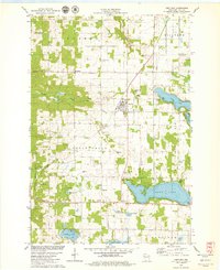
 1983 Cushing1983 Print · USGSPolk County at the start of the 1980s shows a landscape defined by the protected St. Croix riverfront and numerous glacial lakes. Genealogists and local historians can trace family-named sites and landmarks like Cushing, the Nevers Dam Site, and Eureka Center.
 - 1983 Map of Sunrise, 1984 Print
 1983 Sunrise1984 Print · USGSThe St. Croix Valley straddles the Minnesota-Wisconsin border in the early eighties, where the river remains the central artery of the landscape. Researchers can trace the Old Railroad Grade near Sunrise or locate the Old Settlers Cem tucked away near Cowan Creek.2 unique versions available
 - 1985 Map of Grantsburg
 1985 Grantsburg1985 Print · USGSThe river borderlands of Minnesota and Wisconsin come alive in the mid-1980s, showcasing the intricate water networks and forest preserves of Burnett and Pine counties. Trace the rail lines of the Soo Line or find rural landmarks like Trade Lake Ch and Hildas Corner.2 unique versions available
 - 1985 Map of Stillwater
 1985 Stillwater1985 Print · USGSThe St. Croix River valley in the mid-1980s reveals a borderland of river towns and conservation areas. Trace the rail lines of the Soo Line, locate the Minnesota State Prison, and explore the numerous wildlife areas like Cylon Marsh.2 unique versions available
 - 2010 Map of Sunrise, 2010 Print
 2010 Sunrise2010 Print · USGSCovers Eureka, including Sunrise, Sunrise Township, and other nearby areas
 - 2013 Map of Sunrise, 2013 Print
 2013 Sunrise2013 Print · USGSCovers Eureka, including Sunrise, Sunrise Township, and other nearby areas
Showing maps 1-25 of 32
Top cities near Eureka
- Chisago City historical maps
- Lindström historical maps
- Osceola historical maps
- Town of Osceola historical maps
- Sunrise historical maps
- Rock Creek historical maps
See more
Top neighborhoods of Eureka
Frequently asked questions
- What are the different types of historical maps available for Eureka?
- What is the oldest map of Eureka?
- Where can I purchase historical maps of Eureka for my home or office?
- Where can I download high-res historical maps of Eureka?
- Are there historical topographic maps available for Eureka?
- Is there historical aerial imagery available for Eureka?
- Where are historical maps of Eureka sourced from?