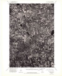
1974 Map of Milltown SE
USGS Topo · Published 1976About this map
Milltown sits at the southwestern edge of this 1974 orthophotograph, surrounded by a densely patterned grid of agricultural fields and woodlots in Polk County. This specialized imagery, prepared from high-altitude aerial photography, captures the precise land-use patterns of the mid-1970s, revealing the intricate boundaries between tilled acreage and the numerous small, dark glacial kettle ponds that dot the northern landscape. While traditional topographic maps use symbols, this view provides an unfiltered look at the actual farmsteads, access roads, and forest cover as they existed during this era of Wisconsin's rural development. The concentrated layout of Milltown contrasts sharply with the expansive, checkerboard layout of the surrounding dairy country and timber stands.
Find a feature on this map
1 named feature on this map. Tap any name to fly to it.
Don’t see what you’re looking for? This feature index may not catch every label — zoom into the map to look around manually.
Map Details
Editions of this 1974 Milltown SE Map
This is the sole edition of this map. No revisions or reprints were ever made.
Other maps of this area

1900 · St Croix Dalles
USGS Topo · 1:62,500

1901 · St Croix Dalles
USGS Topo · 1:62,500

1950 · Balsam Lake
USGS Topo · 1:62,500

1951 · Milltown
USGS Topo · 1:48,000

1951 · Frederic
USGS Topo · 1:48,000

1953 · Stillwater
USGS Topo · 1:250,000

1955 · St. Croix Dalles
USGS Topo · 1:62,500

1955 · Frederic
USGS Topo · 1:62,500

1955 · Milltown
USGS Topo · 1:62,500

1955 · Stillwater
USGS Topo · 1:250,000