1960s Maps of Portage County, Wisconsin
Explore 16 historic maps of Portage County from the 1960s. These maps offer a rare glimpse into what life looked like during the 1960s — showing old roads, neighborhoods, homes, and landmarks that have changed or disappeared over time.
Whether you're researching your family's past, planning a metal detecting trip, or studying how Portage County's landscape evolved across the 1960s, these high-resolution maps are a powerful tool for exploring the history of this region.
- Focus on a specific era: All maps on this page are from the 1960s, giving you a focused view of this time period.
- See what’s changed: Compare century-old streets, trails, and buildings to today's modern landscape using overlays and satellite layers.
- Research with precision: Use these maps for genealogy, historical research, land use analysis, or educational projects.
- View, download, or print: Maps are fully viewable online in high resolution, and can be downloaded or printed for your own records.
Start exploring Portage County's history through authentic maps from the 1960s. This is your window into the past.
Portage County, WI maps
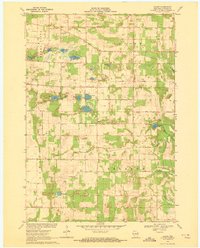
(16)- 1961 Map of Redgranite, 1963 Print
 1961 Redgranite1963 Print · USGSWaushara County’s kettle lake country is captured here in the early sixties, showing a landscape shaped by stone quarries and summer camps. Researchers can trace the Chicago and North Western rail line and find local landmarks like St Marks Cem and the Wild Rose State Fish Hatchery.2 unique versions available
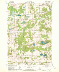
 - 1961 Map of Wild Rose, 1966 Print
 1961 Wild Rose1966 Print · USGSThe village of Wild Rose and its lake-strewn surroundings are captured here in the early sixties before modern development reshaped the landscape. Researchers can locate family landmarks such as Springwater Cem, the Wild Rose State Fish Hatchery, and numerous summer camps like Camp Windego.2 unique versions available
 - 1968 Map of Coloma NW, 1971 Print
 1968 Coloma NW1971 Print · USGSAdams County land and the Portage County line are shown here in the late sixties as the rural road grid matured. Genealogists and local historians can locate Holliday Cemetery, Coloma-Leola Cemetery, and landmarks like Owens Rock.2 unique versions available
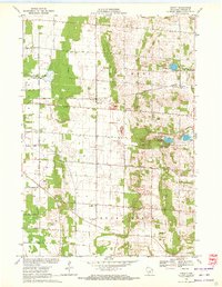
 - 1968 Map of Plainfield, 1971 Print
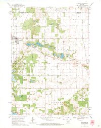 1968 Plainfield1971 Print · USGSWisconsin's glacial lake country comes into focus in the late sixties as the area around Plainfield developed its agricultural and recreational identity. Researchers can trace rural lineages through Hillside Cem and Lord Cem or explore the many shorelines of Lake Huron and Long Lake.2 unique versions available
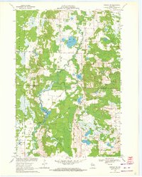
 - 1968 Map of Hancock, 1971 Print
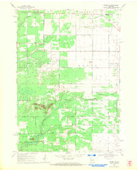
 1968 Hancock1971 Print · USGSCentral Wisconsin farmland at the close of the sixties reveals a detailed grid of rural life across the Adams and Waushara county line. Genealogists and local historians can trace the plots near Plainfield, locate the Plainfield Cemetery, and see the early layout of the Fish Hatchery.2 unique versions available
 - 1968 Map of Wautoma NE, 1971 Print
 1968 Wautoma NE1971 Print · USGSWaushara County during the late sixties shows a landscape of small farms and lakeside recreation centered around the Wild Rose village. Genealogists and local historians can trace rural family roots through sites like Bohemian Cem, West Holden Ch, and Union Cem.2 unique versions available
 - 1969 Map of Rosholt, 1972 Print
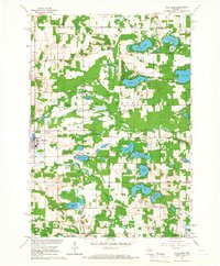
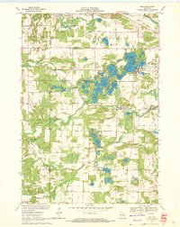
 1969 Rosholt1972 Print · USGSCentral Wisconsin's glaciated landscape is shown here in the late sixties, capturing the rural communities and lake-rich terrain of Portage County. Genealogists can trace family footprints near Rosholt, the Old Railroad Grade, and the small settlement of Galloway.2 unique versions available
 - 1969 Map of King, 1972 Print
 1969 King1972 Print · USGSWaupaca County lake country is captured here in the late sixties, showing the intricate chain of lakes around the community of King. Genealogists and local historians can trace rural roots through Badger Ch, Barton Sch, and the Pleasant Valley Cem.2 unique versions available
 - 1969 Map of Blaine, 1972 Print
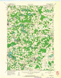
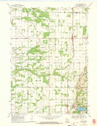
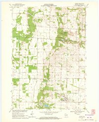
 1969 Blaine1972 Print · USGSPortage County at the close of the 1960s reveals a rural landscape defined by its glacial lakes and scattered farming communities. Genealogists and local historians can trace family locations near Blaine, St Patricks Ch, and the Hillside Cem.
 - 1969 Map of New Hope, 1972 Print
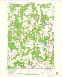
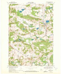
 1969 New Hope1972 Print · USGSPortage County at the end of the sixties is a landscape of glacial lakes and tight-knit rural communities. Genealogists and local historians can trace the foundations of the area through landmarks like North New Hope Ch, Nelsonville Cem, and the St Adalbert Sch.2 unique versions available
 - 1969 Map of Arnott, 1972 Print
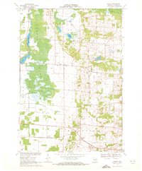
 1969 Arnott1972 Print · USGSPortage County at the end of the sixties reveals a transition between agricultural townships and growing recreational spaces. Researchers can find long-established landmarks like the St Mary of Mt Carmel Ch, the Townhall, and old family burial grounds like Morrill Cem.
 - 1969 Map of Rosholt NW, 1972 Print
 1969 Rosholt NW1972 Print · USGSThe Marathon and Portage county line bisects this rural Wisconsin landscape during the late sixties, a region defined by its glacial lakes and river bends. Trace local roots around Shantytown or explore the waterways of Big Bass Lake and Bentley Pond.2 unique versions available
 - 1969 Map of Almond, 1972 Print
 1969 Almond1972 Print · USGSPortage County’s agricultural and rail-dependent character is evident here during the late sixties. Researchers can trace family history through numerous rural sites like St Johns Cem, Spiritland Cem, and the tracks of the Chicago and North Western railroad.
 - 1969 Map of Scandinavia, 1972 Print
 1969 Scandinavia1972 Print · USGSScandinavia and its surrounding glacial lake country are captured in the late sixties as the village remained a rail-and-river hub. Genealogists can locate family-named sites like Bestul and Petersen alongside historical grounds at Salem Cem and Farmington Cem.2 unique versions available
 - 1969 Map of Polonia, 1972 Print
 1969 Polonia1972 Print · USGSPortage County’s rural character is on full display in this late 1960s survey, showing a landscape shaped by parish life and glacial terrain. You can trace the Soo Line through Custer, find small schools like Sacred Heart Sch, and explore the vast Jordan Swamp.2 unique versions available
 - 1969 Map of Amherst, 1972 Print
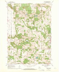
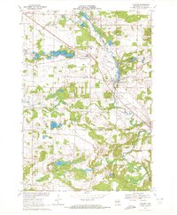 1969 Amherst1972 Print · USGSPortage County at the end of the sixties shows a landscape of glacial lakes and established rail towns like Amherst and Nelsonville. Genealogists and local historians can trace legacy sites such as St Mary of Mt Carmel Ch, the Amish Sch, and Lower Amherst Cem along the Tomorrow River.
End of results
Showing maps 1-16 of 16
Top cities of Portage County
- Stevens Point historical maps
- Plover historical maps
- Stockton historical maps
- Whiting historical maps
- Amherst historical maps
- Alban historical maps
See more
Frequently asked questions
- What are the different types of historical maps available for Portage County?
- What is the oldest map of Portage County?
- Where can I purchase historical maps of Portage County for my home or office?
- Where can I download high-res historical maps of Portage County?
- Are there historical topographic maps available for Portage County?
- Is there historical aerial imagery available for Portage County?
- Where are historical maps of Portage County sourced from?