2000s (21st Century) Maps of Price County, Wisconsin
Explore 163 historic maps of Price County from the 2000s (21st Century). These maps offer a rare glimpse into what life looked like during the 2000s — showing old roads, neighborhoods, homes, and landmarks that have changed or disappeared over time.
Whether you're researching your family's past, planning a metal detecting trip, or studying how Price County's landscape evolved across the 2000s, these high-resolution maps are a powerful tool for exploring the history of this region.
- Focus on a specific era: All maps on this page are from the 2000s, giving you a focused view of this time period.
- See what’s changed: Compare century-old streets, trails, and buildings to today's modern landscape using overlays and satellite layers.
- Research with precision: Use these maps for genealogy, historical research, land use analysis, or educational projects.
- View, download, or print: Maps are fully viewable online in high resolution, and can be downloaded or printed for your own records.
Start exploring Price County's history through authentic maps from the 2000s. This is your window into the past.
Price County, WI maps
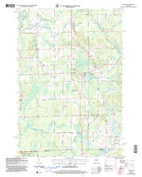
(163)- 2005 Map of Jump River Fire Tower NE, 2006 Print
 2005 Jump River Fire Tower NE2006 Print · USGSUpper Price County and Taylor County meet along the Jump River at the dawn of the millennium, showcasing a landscape of managed forests and waterways. Researchers can trace the river's path through Big Falls, find the Steve Greek Flowage, and locate several Gravel Pits along rural routes.
 - 2005 Map of Pike Lake, 2006 Print
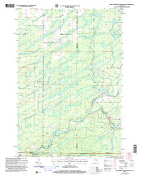
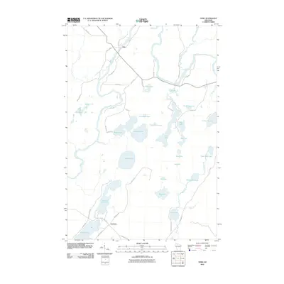
 2005 Pike Lake2006 Print · USGSThe Price County woods and waters are revealed here as they appeared at the start of the millennium, centered on the Chequamegon-Nicolet National Forest. You can trace the historic Chippewa Trail or locate isolated landmarks like Memorial Grove and Ferry Springs.
 - 2005 Map of Ogema NW, 2006 Print
 2005 Ogema NW2006 Print · USGSNorthern Wisconsin's timberlands and river forks are captured here at the dawn of the millennium. Trace the path of the North Fork Jump River through Ogema and find landmarks like Hallberg Hill and Silver Creek.
 - 2005 Map of Dover, 2006 Print
 2005 Dover2006 Print · USGSPrice County timberlands and river valleys are shown in detail during the early 2000s as the local road network expanded. Genealogists and local historians can locate the Emery Cem, the Dover Townhall, and small settlements like Uher.
 - 2005 Map of Pike Lake SW, 2006 Print
 2005 Pike Lake SW2006 Print · USGSPrice County’s northern woods and wetlands come alive in the mid-2000s, centered on the protected waters of the Chequamegon-Nicolet. Trace the boundaries of the Wilson Flowage Wildlife Management Area or explore the remote banks of Riley Lake and the Elk River.
 - 2005 Map of Thunder Creek, 2006 Print
 2005 Thunder Creek2006 Print · USGSNorthwoods timber and wetlands define this Price County landscape at the turn of the millennium. Researchers can trace the remote settlement of Dover and find old routes like Turcott Road near the banks of Willow Lake.
 - 2005 Map of Kennedy, 2006 Print
 2005 Kennedy2006 Print · USGSNorthern Wisconsin's deep woods and glacial lakes are mapped here in the early twenty-first century. Genealogists and researchers can trace the settlement of Kennedy and the remote forest roads near Lake Alice and Oxbo Lake.
 - 2005 Map of Ogema, 2006 Print
 2005 Ogema2006 Print · USGSThe settlement of Ogema and the surrounding Price County woods are captured here at the start of the twenty-first century. Genealogists and hikers can trace family-named routes like Hallstrand Road or find the Hillside Cem and Levitt Creek Cem.
 - 2005 Map of Gates Lake, 2006 Print
 2005 Gates Lake2006 Print · USGSPrice County’s forested wetlands and lake systems are captured in detail during the early 2000s. Researchers can locate specific conservation boundaries and recreational sites like Hicks Landing, Sailor Lake, and the Cranberry Bog.
 - 2005 Map of Pike Lake SE, 2006 Print
 2005 Pike Lake SE2006 Print · USGSNorthern Wisconsin's deep woods and wetlands are preserved here in the mid-2000s, where Price and Oneida counties meet. Researchers can trace forest management boundaries like the Medford-Park Falls Ranger District and find secluded water sources like Sieverson Spring and Lake Sixteen.
 - 2005 Map of Jump River Fire Tower NW, 2006 Print
 2005 Jump River Fire Tower NW2006 Print · USGSThe wooded borderlands of Rusk and Price counties are captured here in the early 2000s, showing a landscape shaped by the Jump River and its many forks. Genealogists and local historians can trace the rural road network including Big Falls Road and the timber-rich reaches of the Chequamegon-Nicolet National Forest.
 - 2005 Map of Blockhouse Lake, 2006 Print
 2005 Blockhouse Lake2006 Print · USGSWisconsin's Northwoods are captured here at the turn of the millennium, showing a landscape defined by managed wilderness and river drainage. You can trace the South Fork Flambeau River through its many rapids or locate quiet landings at Blockhouse Lake and Wintergreen Lake.
 - 2005 Map of Pike Lake NW, 2006 Print
 2005 Pike Lake NW2006 Print · USGSThe Northwoods of Price and Iron Counties are captured here in the early 2000s, showcasing a landscape of timber-era springs and river rapids. Trace local history at the Riley Creek Forest Work Camp or locate secluded landmarks like Newman Springs and Smith Rapids.
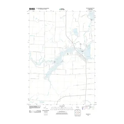
 - 2010 Map of Phillips, 2010 Print
 2010 Phillips2010 Print · USGSCovers Price County, including Phillips, Flambeau, and other nearby areas
 - 2010 Map of Lugerville, 2010 Print
 2010 Lugerville2010 Print · USGSCovers Price County, including Flambeau, Lake, and other nearby areas
 - 2010 Map of Pennington, 2010 Print
 2010 Pennington2010 Print · USGSCovers Price County, including Ogema, Prentice, and other nearby areas
 - 2010 Map of Prentice, 2010 Print
 2010 Prentice2010 Print · USGSCovers Price County, including Worcester, Ogema, and other nearby areas
 - 2010 Map of Lac Sault Dore, 2010 Print
 2010 Lac Sault Dore2010 Print · USGSCovers Price County, including Flambeau, Georgetown, and other nearby areas
 - 2010 Map of Brantwood, 2010 Print
 2010 Brantwood2010 Print · USGSCovers Price County, including Lynne, Clifford, and other nearby areas
 - 2010 Map of Spirit, 2010 Print
 2010 Spirit2010 Print · USGSCovers Price County, including Spirit, Corning, and other nearby areas
 - 2010 Map of Park Falls, 2010 Print
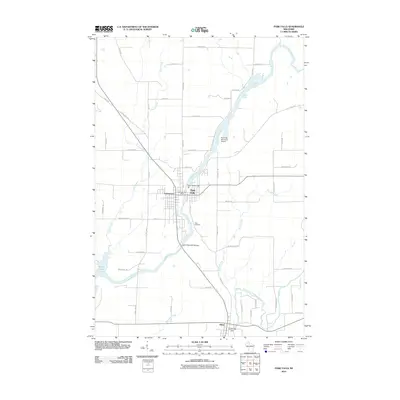 2010 Park Falls2010 Print · USGSCovers Price County, including Park Falls, Fifield, and other nearby areas
 - 2010 Map of Oxbo, 2010 Print
 2010 Oxbo2010 Print · USGSCovers Price County, including Draper, Oxbo, and other nearby areas
 - 2010 Map of Timms Hill, 2010 Print
 2010 Timms Hill2010 Print · USGSCovers Price County, including Westboro, Spirit, and other nearby areas
 - 2010 Map of Priest Lake, 2010 Print
 2010 Priest Lake2010 Print · USGSCovers Price County, including Fifield, Flambeau, and other nearby areas
 - 2010 Map of Big Briens Lake, 2010 Print
 2010 Big Briens Lake2010 Print · USGSCovers Price County, including Prentice, Hackett, and other nearby areas
Showing maps 1-25 of 163
Top cities of Price County
- Park Falls historical maps
- Phillips historical maps
- Fifield historical maps
- Ogema historical maps
- Prentice historical maps
- Spirit historical maps
See more
Frequently asked questions
- What are the different types of historical maps available for Price County?
- What is the oldest map of Price County?
- Where can I purchase historical maps of Price County for my home or office?
- Where can I download high-res historical maps of Price County?
- Are there historical topographic maps available for Price County?
- Is there historical aerial imagery available for Price County?
- Where are historical maps of Price County sourced from?