2020s Maps of Janesville, Wisconsin
Explore 4 historic maps of Janesville from the 2020s. These maps offer a rare glimpse into what life looked like during the 2020s — showing old roads, neighborhoods, homes, and landmarks that have changed or disappeared over time.
Whether you're researching your family's past, planning a metal detecting trip, or studying how Janesville's landscape evolved across the 2020s, these high-resolution maps are a powerful tool for exploring the history of this region.
- Focus on a specific era: All maps on this page are from the 2020s, giving you a focused view of this time period.
- See what’s changed: Compare century-old streets, trails, and buildings to today's modern landscape using overlays and satellite layers.
- Research with precision: Use these maps for genealogy, historical research, land use analysis, or educational projects.
- View, download, or print: Maps are fully viewable online in high resolution, and can be downloaded or printed for your own records.
Start exploring Janesville's history through authentic maps from the 2020s. This is your window into the past.
Janesville, WI maps
(4)- 2022 Map of Janesville West, 2022 Print
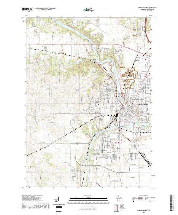 2022 Janesville West2022 Print · USGSJanesville and its western outskirts are shown during a period of steady civic development along the winding Rock River. Researchers can trace the grounds of the University of Wisconsin - Rock County and several historic sites like Oak Hill Cem and Big Rock.
 - 2022 Map of Edgerton, 2022 Print
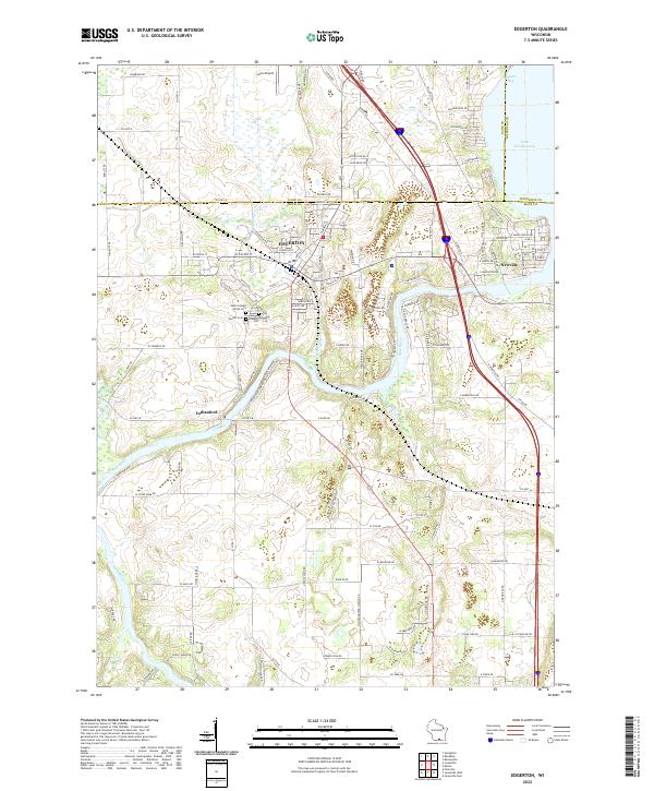 2022 Edgerton2022 Print · USGSSouthern Wisconsin at the turn of the decade shows the meeting of river and road as Edgerton expands toward the Jefferson County line. Trace local heritage and family sites at Saint Joseph Parish Cem or follow the Rock River down to Indianford.
 - 2022 Map of Cooksville, 2022 Print
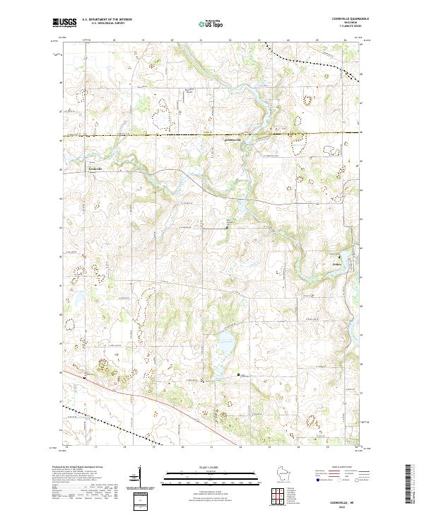 2022 Cooksville2022 Print · USGSThe rural borderlands of Dane and Rock County appear here in the early twenty-first century, centered on the river valleys and prairie farms. Genealogists can trace family names through burial sites like Fulton Cem and the waters of Gibbs Lake or the Yahara River.
 - 2022 Map of Footville, 2022 Print
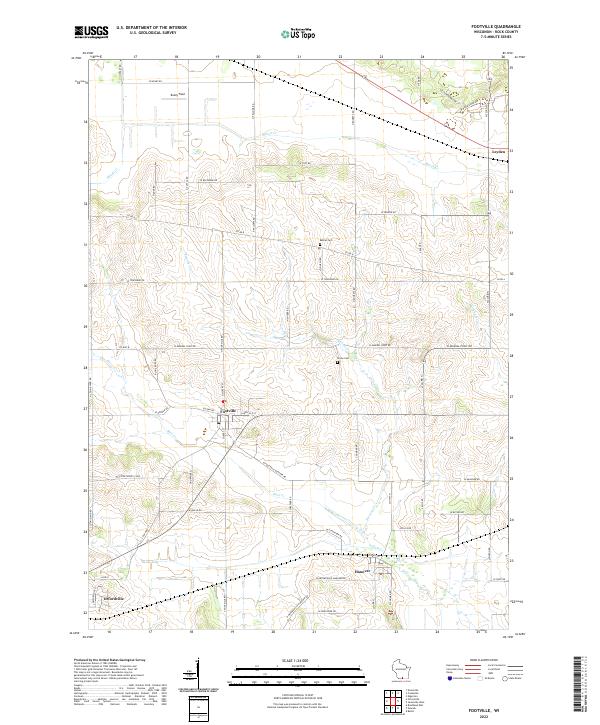 2022 Footville2022 Print · USGSSouthern Wisconsin farmland is mapped in detail during the early 2020s, showing the agricultural heart of Rock County. Local historians can trace family roots through sites like Bethel Cemetery or explore the settlements of Footville and Hanover.
End of results
Showing maps 1-4 of 4
Top cities near Janesville
- Janesville historical maps
- Beloit historical maps
- Stoughton historical maps
- Fort Atkinson historical maps
- Milton historical maps
- South Beloit historical maps
See more
Top neighborhoods of Janesville
Frequently asked questions
- What are the different types of historical maps available for Janesville?
- What is the oldest map of Janesville?
- Where can I purchase historical maps of Janesville for my home or office?
- Where can I download high-res historical maps of Janesville?
- Are there historical topographic maps available for Janesville?
- Is there historical aerial imagery available for Janesville?
- Where are historical maps of Janesville sourced from?