Old Maps of Atlanta, Wisconsin for Metal Detecting
Plan your next treasure hunt with 48 historic maps of Atlanta. Find old homesites, ghost towns, trails, and gathering spots that may be lost to time — perfect for identifying promising metal detecting locations.
- Locate forgotten sites: Uncover places like long-lost settlements, abandoned rail lines, or gathering spots.
- Plan better hunts: Use map overlays combined with LiDAR or satellite views to narrow in on historically rich areas.
- Made for detectorists: Thousands of hobbyists use these maps to discover relics, coins, and hidden history.
Use these historic maps to boost your research and find new opportunities beneath the surface of Atlanta.
Atlanta, WI maps
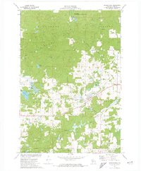
(48)- 1944 Map of Exeland, 1952 Print
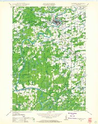
 1944 Exeland1952 Print · USGSNorthern Wisconsin's river country is captured in the mid-1940s as rural life centered on local schools and the rail line. Genealogists can trace family footprints near Exeland or at one of many country schoolhouses like Murry Sch and Laurel Hill Sch.2 unique versions available
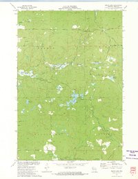
 - 1945 Map of Meteor, 1961 Print
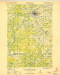
 1945 Meteor1961 Print · USGSNorthern Wisconsin's timber and lake country is captured here just after the war, showing the area as small settlements like Edgewater and Meteor grew. You can trace the Old RR Grade and find historic rural schools like Glendale Sch and Frontier Sch.2 unique versions available
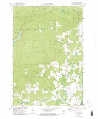
 - 1947 Map of Exeland
 1947 Exeland1947 Print · USGSNorthwest Wisconsin's river country comes into focus in the 1940s as rural school districts and small homesteads still defined the landscape. Genealogists can locate family-named landmarks like Reppert School or Murry School and trace the original course of the Chippewa River.
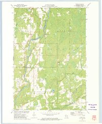
 - 1948 Map of Weyerhauser, 1964 Print
 1948 Weyerhauser1964 Print · USGSRusk County at mid-century is a landscape of glacial lakes and tight-knit rural districts organized around the Soo Line railroad. Genealogists can locate long-lost rural institutions including Pleasant Hill Sch, the Indian Cem, and the historic townsite of Apollonia.
 - 1948 Map of Ladysmith, 1967 Print
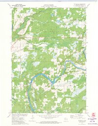
 1948 Ladysmith1967 Print · USGSRusk County and the Flambeau River are captured here in the late 1940s as a thriving hub of rail, timber, and water power. Researchers can locate numerous vanished country schools like Grant Center Sch and trace early river control at the Port Arthur Dam and Thornapple Dam.
 - 1949 Map of Meteor
 1949 Meteor1949 Print · USGSRusk and Sawyer Counties show a landscape of timber and early rail development in the late 1940s. Genealogists can locate family schoolhouses like Sentinel Ash Sch or Frontier Sch and trace the paths of the Old RR Grade and Edgewater shoreline.
 - 1950 Map of Weyerhauser
 1950 Weyerhauser1950 Print · USGSRusk County at the dawn of the 1950s reveals a transition from timber-driven rail towns to a landscape of lakeside communities. Genealogists and historians can trace local landmarks like Indian Cem, the Stan Lookout Tower, and numerous rural schoolhouses including Amacoy Sch.
 - 1950 Map of Ladysmith
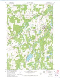
 1950 Ladysmith1950 Print · USGSMid-century Rusk County centers on the busy rail junction and riverfront of Ladysmith just as the regional flowages were being established. Researchers can locate dozens of rural schools and churches, including Meadow Brook Sch, St Francis Ch, and the Thornapple Dam.
 - 1953 Map of Rice Lake, 1967 Print
 1953 Rice Lake1967 Print · USGSNorthwest Wisconsin during the mid-fifties reveals a landscape defined by timber, rail, and water. Genealogists and historians can trace the development of river towns like Ladysmith and Rice Lake along the Soo Line and Chicago and North Western railroads.2 unique versions available
 - 1959 Map of Rice Lake
 1959 Rice Lake1959 Print · USGSNorthwest Wisconsin in the late fifties was a land of expanding road networks and deep-seated timber history. Genealogists and historians can trace rail lines like the Soo Line RR and Chicago St Paul Minneapolis and Omaha Ry as they link settlements from Spooner to Medford.
 - 1971 Map of Thornapple, 1973 Print
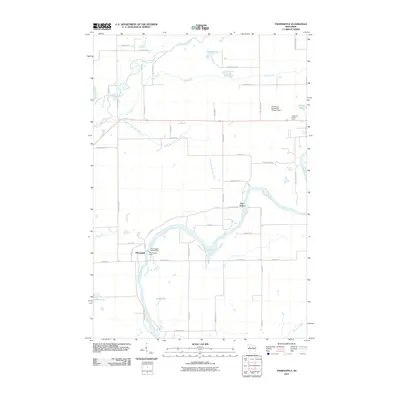
 1971 Thornapple1973 Print · USGSRusk County at the start of the seventies shows a landscape where industrial transit and river management converge. Researchers can trace the Old Railroad Grade and Soo Line tracks near the Thornapple Dam and Port Arthur.
 - 1972 Map of Bruce, 1974 Print
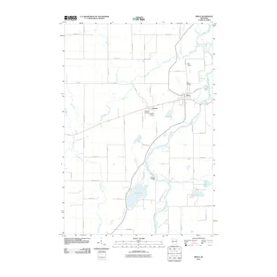
 1972 Bruce1974 Print · USGSRusk County at the start of the 1970s shows a landscape shaped by the Chippewa River and the steady presence of the Soo Line railroad. Local historians can trace family roots through sites like St Marys Cem or locate old community centers in Bruce and Apollonia.
 - 1972 Map of Weyerhauser, 1974 Print
 1972 Weyerhauser1974 Print · USGSRusk County at the start of the 1970s is a landscape of glacial hills and timbered wetlands centered on the railroad village of Weyerhauser. Genealogists and local historians can trace family roots at the Polish Cem or locate old homesteads along Norwegian Road and McDermott Rd.
 - 1972 Map of Bucks Lake, 1974 Print
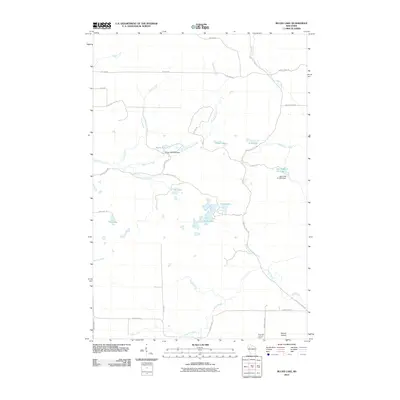
 1972 Bucks Lake1974 Print · USGSRusk County’s rugged northern timberlands are captured here in the early 1970s, showing a landscape of managed flowages and conservation areas. Researchers can locate the Blue Hills Lookout Tower, the local Townhall, and primitive tracks like Serley Camp Trail.
 - 1972 Map of Becky Creek, 1975 Print
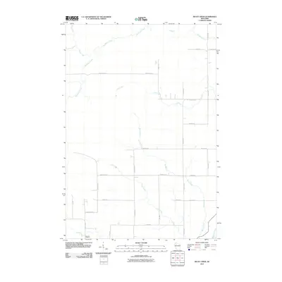
 1972 Becky Creek1975 Print · USGSRusk County's timberlands and drainage basins are captured here during the early seventies, showing a landscape defined by industrial logging remnants and small settlements. Researchers can trace the Old Railroad Grade, locate the Blue Hills Cem, and find the hamlet of Adams.2 unique versions available
 - 1972 Map of Crane, 1975 Print
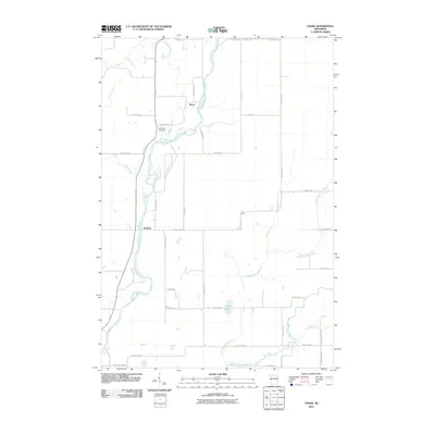
 1972 Crane1975 Print · USGSRusk County’s river valleys and rail corridors are captured in the early seventies as small communities and rural industries shaped the landscape. Genealogists and local historians can locate St Anns Ch, the Townhall, and old rail paths like the Old RR Grade.
 - 1980 Map of Spooner
 1980 Spooner1980 Print · USGSNorthwestern Wisconsin at the dawn of the eighties reveals a landscape of deep forests and transitioning rail corridors. Genealogists and historians can trace lakefront settlements like Spooner and Birchwood or follow the early Tuscobia-Park Falls State Trail.
 - 1980 Map of Bloomer
 1980 Bloomer1980 Print · USGSNorthwestern Wisconsin at the start of the eighties shows a landscape deeply connected to its rivers and rail lines. Genealogists and historians can trace the growth of Bloomer, Ladysmith, and Chetek or locate local landmarks like Brunet Island State Park and the Soo Line rail corridors.
 - 2010 Map of Bucks Lake, 2010 Print
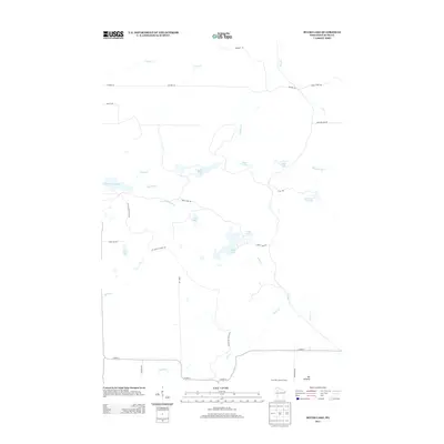
 2010 Bucks Lake2010 Print · USGSCovers Atlanta, including Murry, Wilson, and other nearby areas
 - 2010 Map of Bruce, 2010 Print
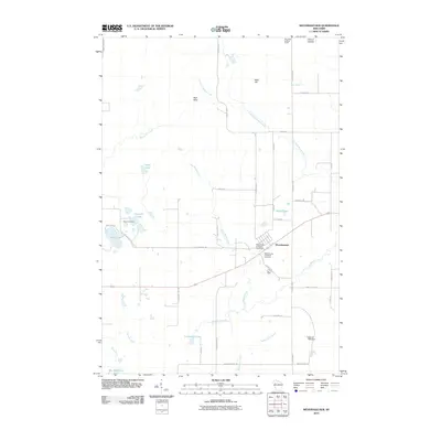
 2010 Bruce2010 Print · USGSCovers Atlanta, including Thornapple, Bruce, and other nearby areas
 - 2010 Map of Thornapple, 2010 Print
 2010 Thornapple2010 Print · USGSCovers Atlanta, including Ladysmith, Thornapple, and other nearby areas
 - 2010 Map of Crane, 2010 Print
 2010 Crane2010 Print · USGSCovers Atlanta, including Thornapple, Murry, and other nearby areas
 - 2010 Map of Becky Creek, 2010 Print
 2010 Becky Creek2010 Print · USGSCovers Atlanta, including Thornapple, Murry, and other nearby areas
 - 2010 Map of Weyerhaeuser, 2010 Print
 2010 Weyerhaeuser2010 Print · USGSCovers Atlanta, including Weyerhaeuser, Strickland, and other nearby areas
 - 2013 Map of Bucks Lake, 2013 Print
 2013 Bucks Lake2013 Print · USGSCovers Atlanta, including Murry, Wilson, and other nearby areas
Showing maps 1-25 of 48
Top cities near Atlanta
- Ladysmith historical maps
- Thornapple historical maps
- Bruce historical maps
- Sumner historical maps
- Edgewater historical maps
- Birchwood historical maps
See more
Frequently asked questions
- What are the different types of historical maps available for Atlanta?
- What is the oldest map of Atlanta?
- Where can I purchase historical maps of Atlanta for my home or office?
- Where can I download high-res historical maps of Atlanta?
- Are there historical topographic maps available for Atlanta?
- Is there historical aerial imagery available for Atlanta?
- Where are historical maps of Atlanta sourced from?