1940s Maps of Dewey, Wisconsin
Explore 7 historic maps of Dewey from the 1940s. These maps offer a rare glimpse into what life looked like during the 1940s — showing old roads, neighborhoods, homes, and landmarks that have changed or disappeared over time.
Whether you're researching your family's past, planning a metal detecting trip, or studying how Dewey's landscape evolved across the 1940s, these high-resolution maps are a powerful tool for exploring the history of this region.
- Focus on a specific era: All maps on this page are from the 1940s, giving you a focused view of this time period.
- See what’s changed: Compare century-old streets, trails, and buildings to today's modern landscape using overlays and satellite layers.
- Research with precision: Use these maps for genealogy, historical research, land use analysis, or educational projects.
- View, download, or print: Maps are fully viewable online in high resolution, and can be downloaded or printed for your own records.
Start exploring Dewey's history through authentic maps from the 1940s. This is your window into the past.
Dewey, WI maps
(7)- 1944 Map of Exeland, 1952 Print
 1944 Exeland1952 Print · USGSNorthern Wisconsin's river country is captured in the mid-1940s as rural life centered on local schools and the rail line. Genealogists can trace family footprints near Exeland or at one of many country schoolhouses like Murry Sch and Laurel Hill Sch.2 unique versions available
 - 1945 Map of Ingram, 1967 Print
 1945 Ingram1967 Print · USGSThe Flambeau River basin comes into sharp focus in the mid-1940s, revealing a landscape of remote camps and early state forestry. Researchers can trace the rail corridor through Ingram or locate vanished sites like the CCC Rusk Camp (Abandoned) and Pioneer Sch.
 - 1947 Map of Exeland
 1947 Exeland1947 Print · USGSNorthwest Wisconsin's river country comes into focus in the 1940s as rural school districts and small homesteads still defined the landscape. Genealogists can locate family-named landmarks like Reppert School or Murry School and trace the original course of the Chippewa River.
 - 1947 Map of Ingram
 1947 Ingram1947 Print · USGSIn the Wisconsin Northwoods after the war, the Flambeau River basin was a landscape of timber management and hydroelectric power. Researchers can locate the CCC Rusk Camp, the Big Falls Dam, and rural landmarks like the Swedish Lutheran Cem.
 - 1947 Map of Sheldon, 1967 Print
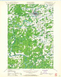
 1947 Sheldon1967 Print · USGSRusk and Taylor counties come into focus in the late 1940s, showing a landscape of river-valley settlements and timber management. Genealogists and historians can locate dozens of country schools and churches, from Sheldon to the Mt Nebo Cem and Hannibal.
 - 1948 Map of Ladysmith, 1967 Print
 1948 Ladysmith1967 Print · USGSRusk County and the Flambeau River are captured here in the late 1940s as a thriving hub of rail, timber, and water power. Researchers can locate numerous vanished country schools like Grant Center Sch and trace early river control at the Port Arthur Dam and Thornapple Dam.
 - 1949 Map of Sheldon
 1949 Sheldon1949 Print · USGSRusk and Taylor counties come into focus during the late 1940s, showing a landscape defined by small rail towns and scattered district schools. You can locate family-named landmarks like Baughman School or trace the early paths of the Jump River and Main Creek.
End of results
Showing maps 1-7 of 7
Top cities near Dewey
- Ladysmith historical maps
- Thornapple historical maps
- Ruby historical maps
- Weirgor historical maps
- Jump River historical maps
- Murry historical maps
See more
Frequently asked questions
- What are the different types of historical maps available for Dewey?
- What is the oldest map of Dewey?
- Where can I purchase historical maps of Dewey for my home or office?
- Where can I download high-res historical maps of Dewey?
- Are there historical topographic maps available for Dewey?
- Is there historical aerial imagery available for Dewey?
- Where are historical maps of Dewey sourced from?