1900s (20th Century) Maps of Sauk County, Wisconsin
Explore 65 historic maps of Sauk County from the 1900s (20th Century). These maps offer a rare glimpse into what life looked like during the 1900s — showing old roads, neighborhoods, homes, and landmarks that have changed or disappeared over time.
Whether you're researching your family's past, planning a metal detecting trip, or studying how Sauk County's landscape evolved across the 1900s, these high-resolution maps are a powerful tool for exploring the history of this region.
- Focus on a specific era: All maps on this page are from the 1900s, giving you a focused view of this time period.
- See what’s changed: Compare century-old streets, trails, and buildings to today's modern landscape using overlays and satellite layers.
- Research with precision: Use these maps for genealogy, historical research, land use analysis, or educational projects.
- View, download, or print: Maps are fully viewable online in high resolution, and can be downloaded or printed for your own records.
Start exploring Sauk County's history through authentic maps from the 1900s. This is your window into the past.
Sauk County, WI maps
(65)- 1901 Map of Denzer
 1901 Denzer1901 Print · USGSSauk County at the turn of the century shows a landscape of narrow valleys and early rail corridors along the Baraboo River. Researchers can trace old crossroads like Pains Corners and Lodi Mill or find landmarks like Pewits Nest.7 unique versions available
 - 1901 Map of The Dells
 1901 The Dells1901 Print · USGSSauk County and the Wisconsin River Dells were already becoming a destination at the turn of the century. Trace the early rail lines and river landmarks like Mirror Lake, Kilbourn, and the distinctive Elephants Back.6 unique versions available
 - 1902 Map of Briggsville
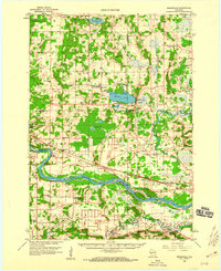
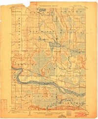 1902 Briggsville1902 Print · USGSThe Wisconsin River valley at the turn of the century shows a landscape of river-and-rail industry. Trace the early township developments of Lewiston and Douglas, or locate original landmarks like the Levee and Big Spring.4 unique versions available
 - 1905 Map of Richland Center
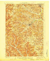
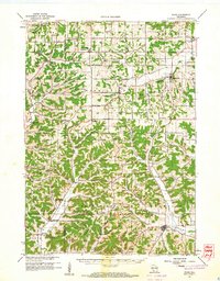
 1905 Richland Center1905 Print · USGSRichland and Sauk Counties at the turn of the century show a landscape defined by the winding Wisconsin River and early rail expansion. Genealogists and historians can trace the foundations of local commerce through early post offices like Beach P.O. and rail hubs at Lone Rock and Richland Center.2 unique versions available
 - 1907 Map of Cross Plains, 1960 Print
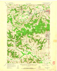
 1907 Cross Plains1960 Print · USGSWestern Dane County comes to life in this early 1900s survey, showing the transition from the rolling prairie to the driftless hills. Genealogists can trace family roots through historic junctions and rural centers like Marxville, Pine Bluff, and Ashton Church.
 - 1908 Map of Baraboo
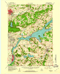
 1908 Baraboo1908 Print · USGSSauk and Columbia counties at the close of the nineteenth century reveal a landscape shaped by the Wisconsin River and early rail expansion. Trace the rail lines through Baraboo and Lodi, or locate old river landings near Merrimac and Sauk.
 - 1909 Map of Cross Plains
 1909 Cross Plains1909 Print · USGSDane County at the turn of the century shows a bustling corridor of rail-side towns and rural townships. Trace the early development of Mt Horeb, Cross Plains, and Middleton Junction alongside landmarks like Ashton Church and Richardson Cave.4 unique versions available
 - 1920 Map of Blue Mounds, 1959 Print
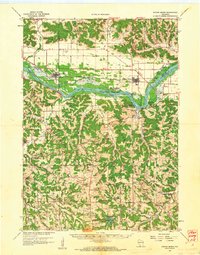
 1920 Blue Mounds1959 Print · USGSThe Driftless Area of Dane and Iowa counties comes to life in the years following the Great War, showing a landscape of ridge-top towns and river-valley rails. Genealogists can locate dozens of rural landmarks, from the Hyde Church to schools like Seitz School and Larsonville School.
 - 1922 Map of Blue Mounds
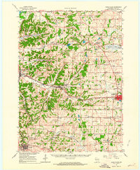
 1922 Blue Mounds1922 Print · USGSThe Wisconsin River valley and the Driftless Area uplands meet here in the early nineteen-twenties, showing a landscape defined by rail corridors and rural school districts. Researchers can pinpoint historic family landmarks like Hyde Church, the Coon Rock Mill, and Fairview School.3 unique versions available
 - 1927 Map of Hillsboro
 1927 Hillsboro1927 Print · USGSThe Driftless Area landscape near the Vernon and Sauk county lines is captured here in the mid-1920s. Genealogists can locate dozens of country schoolhouses like Whiteoak Grove School and tracing the route of the Chicago and Northeastern RR.2 unique versions available
 - 1956 Map of Reedsburg, 1958 Print
 1956 Reedsburg1958 Print · USGSThe Baraboo River valley at the peak of the mid-century era shows a landscape of rail-connected towns and rural school districts. Genealogists can trace family names through landmarks like Teachers College, Resting Green Cem, and Potato Hill.3 unique versions available
 - 1957 Map of Wisconsin Dells, 1959 Print
 1957 Wisconsin Dells1959 Print · USGSThe Wisconsin River corridor is captured here in the mid-fifties as tourism and rail transport shaped the local economy. Genealogists and historians can trace numerous rural school sites like Jopp Sch and family landmarks such as Louie Bluff or Webster Prairie Cem.
 - 1957 Map of Madison, 1967 Print
 1957 Madison1967 Print · USGSSouth-central Wisconsin in the mid-fifties reveals a landscape of industrial hubs and glacial lakes linked by a dense rail and highway network. Genealogists and historians can trace the development of lakeside communities and find notable sites like Badger Ordnance Works and the Horicon National Wildlife Refuge.3 unique versions available
 - 1958 Map of Briggsville, 1959 Print
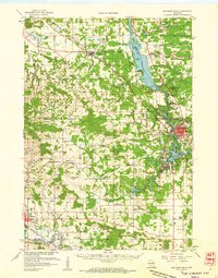
 1958 Briggsville1959 Print · USGSThe rural landscapes of south-central Wisconsin are captured here in the late fifties, showcasing the crossroads of three counties. You can trace family history through numerous country schools like Stafford Sch and landmarks such as Douglas Ch.3 unique versions available
 - 1958 Map of North Freedom, 1960 Print
 1958 North Freedom1960 Print · USGSSauk County's rural landscape is captured here in the late fifties, defined by its traditional farmsteads and a massive industrial military presence. Researchers can find numerous country landmarks like Free Thinkers Hall, Stones Pocket Sch, and the Lodi Mill.4 unique versions available
 - 1958 Map of La Crosse, 1979 Print
 1958 La Crosse1979 Print · USGSThe Driftless Area of Wisconsin and Iowa is captured here during the late seventies, showing the intricate river valleys and ridge-top settlements. Genealogists and historians can trace the rail corridors of the Soo Line or locate landmarks like Grandad Bluff and Effigy Mounds National Monument.2 unique versions available
 - 1959 Map of Baraboo, 1961 Print
 1959 Baraboo1961 Print · USGSThe Baraboo Range and the winding Wisconsin River meet in this late-fifties study of Sauk and Columbia counties. Researchers can locate rural landmarks like Man Mound, the massive Badger Ordnance Works, and the grounds of Devils Lake State Park.4 unique versions available
 - 1960 Map of Madison
 1960 Madison1960 Print · USGSCentral and Southern Wisconsin are captured in the late fifties, showing the region as its rail-and-river network matured. Trace the paths of the Soo Line RR or locate family roots near Lake Mendota and Horicon National Wildlife Refuge.2 unique versions available
 - 1960 Map of Plain, 1961 Print
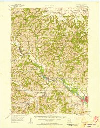
 1960 Plain1961 Print · USGSCentral Sauk County and eastern Richland County appear here in the early sixties, characterized by a dense network of hill-country hollows and rural settlements. Family historians can trace rural school districts like Puckertown Sch and Hickory Grove Sch or locate the Our Lady of the Fields Chapel.2 unique versions available
 - 1960 Map of Spring Green, 1962 Print
 1960 Spring Green1962 Print · USGSThe Wisconsin River valley and surrounding Driftless Area uplands are captured here in the early sixties. Researchers can trace rural lineages through numerous country landmarks like Unity Chapel, Gold Mine Sch, and the quiet crossroads at Clyde.2 unique versions available
 - 1961 Map of La Crosse
 1961 La Crosse1961 Print · USGSThe Driftless Area at the start of the 1960s reveals a complex network of river towns and rail lines along the Mississippi River. Genealogists and historians can trace old settlements like New Amsterdam and Wyattville or locate major landmarks like Camp McCoy Military Reservation and Effigy Mounds National Monument.
 - 1962 Map of Cross Plains, 1964 Print
 1962 Cross Plains1964 Print · USGSWestern Dane County in the early sixties shows a landscape of deep valleys and rising ridges between Cross Plains and Mt Horeb. Genealogists and historians can trace family locations through numerous rural sites like St Marys Cem, Richardson Cave, and the Pine Bluff Observatory.2 unique versions available
 - 1962 Map of Black Earth, 1964 Print
 1962 Black Earth1964 Print · USGSDane County's ridge-and-valley landscape is documented here in the early sixties, showing the rural crossroads and rail corridors of the Driftless Area. You can locate family history at St Johns Ch or trace the old rail line near Black Earth and Table Bluff.2 unique versions available
 - 1962 Map of Blue Mounds, 1964 Print
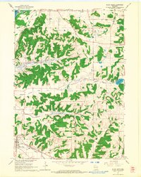
 1962 Blue Mounds1964 Print · USGSThe Wisconsin River valley and the driftless hills of Dane County are captured here in the early sixties. Genealogists and hikers can trace old ridge roads to Little Norway, the White Church Cem, and the underground wonders of Cave of the Mounds.3 unique versions available
 - 1962 Map of Mazomanie, 1964 Print
 1962 Mazomanie1964 Print · USGSThe Wisconsin River valley comes alive in the early sixties, showing the vital rail-and-river connection between local settlements. Genealogists and historians can locate St Barnabas Ch, the Cassell Cem, and the tracks of the Chicago Milwaukee St Paul and Pacific railroad.3 unique versions available
Showing maps 1-25 of 65
Top cities of Sauk County
- Baraboo historical maps
- Reedsburg historical maps
- Prairie du Sac historical maps
- Lake Delton historical maps
- Sauk City historical maps
- West Baraboo historical maps
See more
Frequently asked questions
- What are the different types of historical maps available for Sauk County?
- What is the oldest map of Sauk County?
- Where can I purchase historical maps of Sauk County for my home or office?
- Where can I download high-res historical maps of Sauk County?
- Are there historical topographic maps available for Sauk County?
- Is there historical aerial imagery available for Sauk County?
- Where are historical maps of Sauk County sourced from?