Old Maps of Franklin, Wisconsin for Academic Research
Study the evolution of Franklin with 28 high-resolution historic maps. Whether you're teaching, researching, or modeling changes in land use, these maps provide essential visual documentation of urban, environmental, and geographic change.
- Analyze long-term change: Track patterns in development, transportation, and natural features.
- Ideal for environmental or urban studies: Support academic projects with primary historical map data.
- Use in the classroom or lab: Educators and researchers rely on these maps to bring historical context to life.
These maps are a powerful tool for teaching, research, and visualizing how Franklin has changed over the decades.
Franklin, WI maps
(28)- 1901 Map of Denzer
 1901 Denzer1901 Print · USGSSauk County at the turn of the century shows a landscape of narrow valleys and early rail corridors along the Baraboo River. Researchers can trace old crossroads like Pains Corners and Lodi Mill or find landmarks like Pewits Nest.7 unique versions available
 - 1905 Map of Richland Center
 1905 Richland Center1905 Print · USGSRichland and Sauk Counties at the turn of the century show a landscape defined by the winding Wisconsin River and early rail expansion. Genealogists and historians can trace the foundations of local commerce through early post offices like Beach P.O. and rail hubs at Lone Rock and Richland Center.2 unique versions available
 - 1920 Map of Blue Mounds, 1959 Print
 1920 Blue Mounds1959 Print · USGSThe Driftless Area of Dane and Iowa counties comes to life in the years following the Great War, showing a landscape of ridge-top towns and river-valley rails. Genealogists can locate dozens of rural landmarks, from the Hyde Church to schools like Seitz School and Larsonville School.
 - 1922 Map of Blue Mounds
 1922 Blue Mounds1922 Print · USGSThe Wisconsin River valley and the Driftless Area uplands meet here in the early nineteen-twenties, showing a landscape defined by rail corridors and rural school districts. Researchers can pinpoint historic family landmarks like Hyde Church, the Coon Rock Mill, and Fairview School.3 unique versions available
 - 1957 Map of Madison, 1967 Print
 1957 Madison1967 Print · USGSSouth-central Wisconsin in the mid-fifties reveals a landscape of industrial hubs and glacial lakes linked by a dense rail and highway network. Genealogists and historians can trace the development of lakeside communities and find notable sites like Badger Ordnance Works and the Horicon National Wildlife Refuge.3 unique versions available
 - 1958 Map of North Freedom, 1960 Print
 1958 North Freedom1960 Print · USGSSauk County's rural landscape is captured here in the late fifties, defined by its traditional farmsteads and a massive industrial military presence. Researchers can find numerous country landmarks like Free Thinkers Hall, Stones Pocket Sch, and the Lodi Mill.4 unique versions available
 - 1958 Map of La Crosse, 1979 Print
 1958 La Crosse1979 Print · USGSThe Driftless Area of Wisconsin and Iowa is captured here during the late seventies, showing the intricate river valleys and ridge-top settlements. Genealogists and historians can trace the rail corridors of the Soo Line or locate landmarks like Grandad Bluff and Effigy Mounds National Monument.2 unique versions available
 - 1960 Map of Madison
 1960 Madison1960 Print · USGSCentral and Southern Wisconsin are captured in the late fifties, showing the region as its rail-and-river network matured. Trace the paths of the Soo Line RR or locate family roots near Lake Mendota and Horicon National Wildlife Refuge.2 unique versions available
 - 1960 Map of Plain, 1961 Print
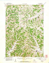 1960 Plain1961 Print · USGSCentral Sauk County and eastern Richland County appear here in the early sixties, characterized by a dense network of hill-country hollows and rural settlements. Family historians can trace rural school districts like Puckertown Sch and Hickory Grove Sch or locate the Our Lady of the Fields Chapel.2 unique versions available
 - 1960 Map of Spring Green, 1962 Print
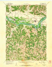 1960 Spring Green1962 Print · USGSThe Wisconsin River valley and surrounding Driftless Area uplands are captured here in the early sixties. Researchers can trace rural lineages through numerous country landmarks like Unity Chapel, Gold Mine Sch, and the quiet crossroads at Clyde.2 unique versions available
 - 1961 Map of La Crosse
 1961 La Crosse1961 Print · USGSThe Driftless Area at the start of the 1960s reveals a complex network of river towns and rail lines along the Mississippi River. Genealogists and historians can trace old settlements like New Amsterdam and Wyattville or locate major landmarks like Camp McCoy Military Reservation and Effigy Mounds National Monument.
 - 1962 Map of Blue Mounds, 1964 Print
 1962 Blue Mounds1964 Print · USGSThe Wisconsin River valley and the driftless hills of Dane County are captured here in the early sixties. Genealogists and hikers can trace old ridge roads to Little Norway, the White Church Cem, and the underground wonders of Cave of the Mounds.3 unique versions available
 - 1962 Map of Arena, 1964 Print
 1962 Arena1964 Print · USGSIowa and Sauk Counties are captured in the early sixties as the rail-and-river economy defined local life. Researchers can trace family roots at Arena Cem and Davis Cem or locate old landmarks like Coon Rock Cave and Cassell.2 unique versions available
 - 1965 Map of La Crosse
 1965 La Crosse1965 Print · USGSThe Driftless Area and the Upper Mississippi valley are captured here during a period of steady mid-century growth. Researchers can trace the rail lines of the Chicago and North Western or locate riverfront sites like Effigy Mounds National Monument and the Camp McCoy Military Reservation.
 - 1975 Map of North Freedom NW, 1976 Print
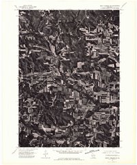
 1975 North Freedom NW1976 Print · USGSSauk County farmlands and river bends are captured in this mid-seventies aerial survey. Genealogists and researchers can trace the rural layouts of Rock Springs and La Rue or follow the path of the Baraboo River.2 unique versions available
 - 1975 Map of North Freedom SW, 1976 Print
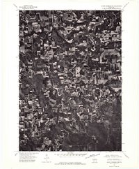
 1975 North Freedom SW1976 Print · USGSSauk County's rural landscape is documented with aerial precision in the mid-1970s, showcasing the agricultural rhythm of the Driftless Area. Local historians can pinpoint the exact building layouts and field boundaries surrounding Leland, Black Hawk, and Witwen.2 unique versions available
 - 1976 Map of La Crosse
 1976 La Crosse1976 Print · USGSThe Driftless Area and Mississippi River valley are captured here in the mid-seventies, showing a landscape of deep coulees and river commerce. Genealogists can trace family footprints from La Crosse to smaller hamlets like Newburg Corners and Witoka.
 - 1983 Map of Loganville
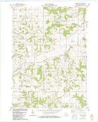 1983 Loganville1983 Print · USGSSauk County in the early eighties shows a settled landscape of family farms and rural parishes. Researchers can trace historic local boundaries and find sites like Tuckertown Cem, the County Home, and the winding Narrows Creek.
 - 1983 Map of Spring Green
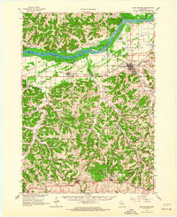
 1983 Spring Green1983 Print · USGSThe Wisconsin River valley in the early eighties shows a landscape defined by braided waterways and cultural landmarks. Genealogists can locate family sites like Old Helena Cem and Big Hollow Cem, or trace the grounds of Taliesin and Hillside Sch.
 - 1983 Map of Plain
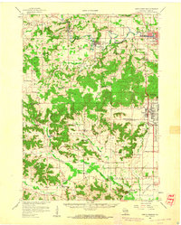
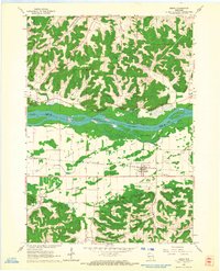
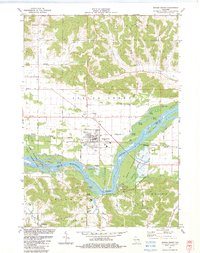
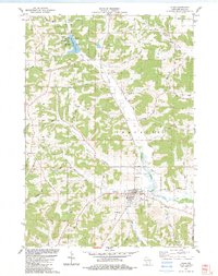 1983 Plain1983 Print · USGSIn the early 1980s, the village of Plain and the surrounding township of Franklin reveal a landscape of steep valleys and rural homesteads. Genealogists and local historians can trace family locations through St Lukes Cem, Whitemound Cem, and the notable St Anna Shrine.
 - 1985 Map of Richland Center, 1991 Print
 1985 Richland Center1991 Print · USGSSouthwest Wisconsin’s driftless landscape in the mid-1980s is defined by its deep river valleys and tight agricultural settlements. Researchers can trace family-named landmarks like Mickelson Ridge or find remote churches and schools near Richland Center and Dodgeville.
 - 1991 Map of Madison
 1991 Madison1991 Print · USGSMadison and its iconic glacial lakes are captured here during a time of steady urban expansion and regional growth. Researchers can trace the mid-century development of the University of Wisconsin, locate family sites near Forest Hill Cem, or explore the footprint of the Badger Army Ammunition Plant.
 - 2022 Map of Rock Springs, 2022 Print
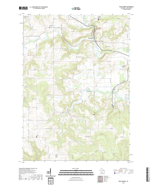 2022 Rock Springs2022 Print · USGSSauk County's river valleys and ridgelines are shown here in the 2020s, centered on the confluence of the Baraboo River and Narrows Cr. Genealogists and historians can locate family burial sites at Saint Paul Cem and Maple Hill Cem or explore the terrain around LaRue and Rock Springs.
 - 2022 Map of Black Hawk, 2022 Print
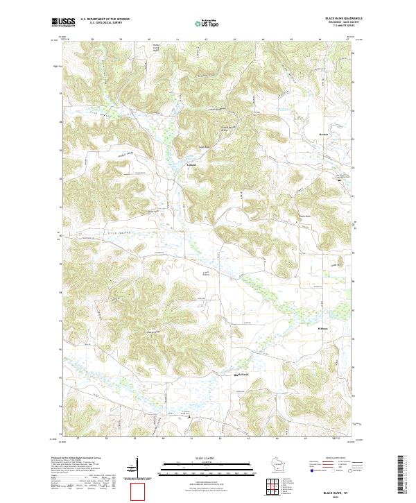 2022 Black Hawk2022 Print · USGSSauk County's rural heartland is captured here in the early twenty-first century, showing the enduring network of valleys and crossroads. Genealogists and local historians can trace family ties through Union Grove Cem, the landmark Leland Natural Bridge, and the community of Witwen.
 - 2022 Map of Arena, 2022 Print
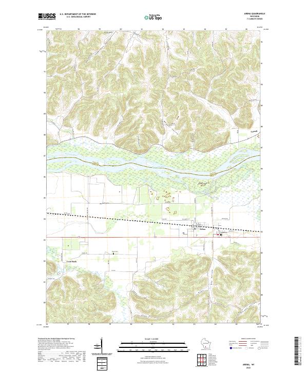 2022 Arena2022 Print · USGSThe Wisconsin River valley comes into sharp focus here as it divides Sauk and Iowa Counties. Researchers can trace the layout of Arena and Cassell, locate family plots at Arena Cem or Davis Cem, and explore landmarks like Coon Rock.
Showing maps 1-25 of 28
Top cities near Franklin
- Reedsburg historical maps
- Spring Green historical maps
- Lone Rock historical maps
- Arena historical maps
- Plain historical maps
- Ithaca historical maps
See more
Frequently asked questions
- What are the different types of historical maps available for Franklin?
- What is the oldest map of Franklin?
- Where can I purchase historical maps of Franklin for my home or office?
- Where can I download high-res historical maps of Franklin?
- Are there historical topographic maps available for Franklin?
- Is there historical aerial imagery available for Franklin?
- Where are historical maps of Franklin sourced from?