2000s (21st Century) Maps of Meadowbrook, Wisconsin
Explore 2 historic maps of Meadowbrook from the 2000s (21st Century). These maps offer a rare glimpse into what life looked like during the 2000s — showing old roads, neighborhoods, homes, and landmarks that have changed or disappeared over time.
Whether you're researching your family's past, planning a metal detecting trip, or studying how Meadowbrook's landscape evolved across the 2000s, these high-resolution maps are a powerful tool for exploring the history of this region.
- Focus on a specific era: All maps on this page are from the 2000s, giving you a focused view of this time period.
- See what’s changed: Compare century-old streets, trails, and buildings to today's modern landscape using overlays and satellite layers.
- Research with precision: Use these maps for genealogy, historical research, land use analysis, or educational projects.
- View, download, or print: Maps are fully viewable online in high resolution, and can be downloaded or printed for your own records.
Start exploring Meadowbrook's history through authentic maps from the 2000s. This is your window into the past.
Meadowbrook, WI maps
(2)- 2022 Map of Hogsback Creek, 2022 Print
 2022 Hogsback Creek2022 Print · USGSSawyer County at the start of the 2020s remains a wilderness of winding rivers and timber roads. Researchers can trace the complex drainage of the Brunet River and find old logging-era routes like Bissell Grade Rd and W Old D Rd.
 - 2022 Map of Exeland, 2022 Print
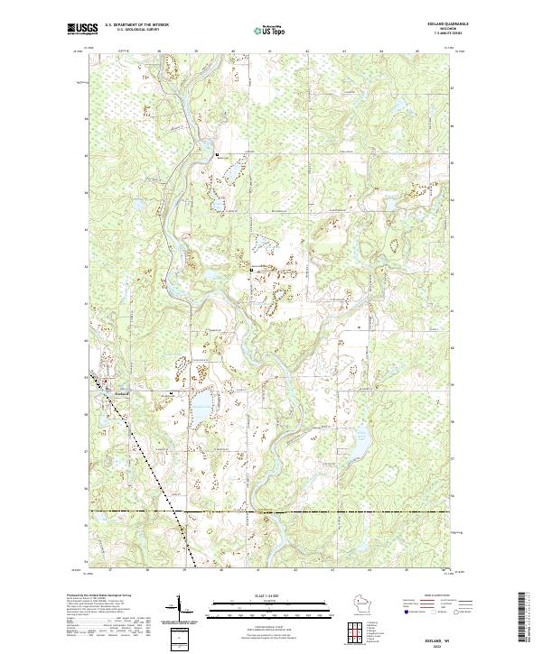 2022 Exeland2022 Print · USGSExeland and the surrounding lake country of Sawyer County are captured here in the early twenty-first century. Genealogists can locate family sites near Windfall Cem or Bellile Cem, while researchers trace the waterways of the Couderay River and Windfall Lake.
End of results
Showing maps 1-2 of 2
Top cities near Meadowbrook
- Ladysmith historical maps
- Thornapple historical maps
- Bruce historical maps
- Weirgor historical maps
- Winter historical maps
- Ojibwa historical maps
See more
Frequently asked questions
- What are the different types of historical maps available for Meadowbrook?
- What is the oldest map of Meadowbrook?
- Where can I purchase historical maps of Meadowbrook for my home or office?
- Where can I download high-res historical maps of Meadowbrook?
- Are there historical topographic maps available for Meadowbrook?
- Is there historical aerial imagery available for Meadowbrook?
- Where are historical maps of Meadowbrook sourced from?