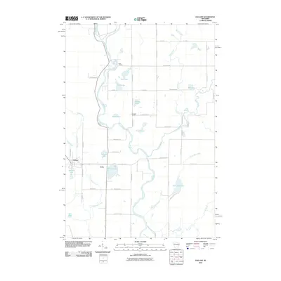
2010 Map of Exeland
USGS Topo · Published 2010About this map
Exeland serves as the primary community in this northwoods Wisconsin landscape, situated near the confluence of several significant waterways. The Chippewa River meanders through the central terrain, joined by the Brunet River and the Couderay River, creating a complex network of wetlands and drainage basins. This 2010 survey highlights the rural character of the region, where a grid of local roads like N Dantzman Rd and W County Hwy-D provides access to numerous glacial lakes, including Windfall Lake, Murphy Lake, and Jacques Lake. Genealogists and local historians can find several important burial sites, including Bellile Cemetery in the north and the Mennonite Cemetery located along W Stankowski Rd. The presence of White Birch Lake and South Lakes further defines the water-rich topography of this area in Sawyer County.
Find a feature on this map
67 named features on this map. Tap any name to fly to it.
Don’t see what you’re looking for? This feature index may not catch every label — zoom into the map to look around manually.
Map Details
Editions of this 2010 Exeland Map
This is the sole edition of this map. No revisions or reprints were ever made.
Other maps of this area

1944 · Exeland
USGS Topo · 1:48,000

1944 · Couderay
USGS Topo · 1:48,000

1944 · Radisson
USGS Topo · 1:48,000

1945 · Meteor
USGS Topo · 1:48,000

1947 · Exeland
USGS Topo · 1:48,000

1948 · Couderay
USGS Topo · 1:48,000

1949 · Radisson
USGS Topo · 1:48,000

1949 · Meteor
USGS Topo · 1:48,000

1953 · Rice Lake
USGS Topo · 1:250,000

1959 · Rice Lake
USGS Topo · 1:250,000