2020s Maps of Radisson, Wisconsin
Explore 8 historic maps of Radisson from the 2020s. These maps offer a rare glimpse into what life looked like during the 2020s — showing old roads, neighborhoods, homes, and landmarks that have changed or disappeared over time.
Whether you're researching your family's past, planning a metal detecting trip, or studying how Radisson's landscape evolved across the 2020s, these high-resolution maps are a powerful tool for exploring the history of this region.
- Focus on a specific era: All maps on this page are from the 2020s, giving you a focused view of this time period.
- See what’s changed: Compare century-old streets, trails, and buildings to today's modern landscape using overlays and satellite layers.
- Research with precision: Use these maps for genealogy, historical research, land use analysis, or educational projects.
- View, download, or print: Maps are fully viewable online in high resolution, and can be downloaded or printed for your own records.
Start exploring Radisson's history through authentic maps from the 2020s. This is your window into the past.
Radisson, WI maps
(8)- 2022 Map of Couderay, 2022 Print
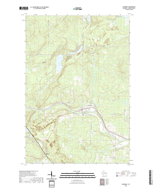 2022 Couderay2022 Print · USGSSawyer County at the start of the 2020s shows a landscape of glacial lakes and river-valley settlements. Researchers can trace local history from the Couderay Evergreen Cem to the banks of the Couderay River or follow the route of the Tuscobia State Trl.
 - 2022 Map of Hogsback Creek, 2022 Print
 2022 Hogsback Creek2022 Print · USGSSawyer County at the start of the 2020s remains a wilderness of winding rivers and timber roads. Researchers can trace the complex drainage of the Brunet River and find old logging-era routes like Bissell Grade Rd and W Old D Rd.
 - 2022 Map of Winter, 2022 Print
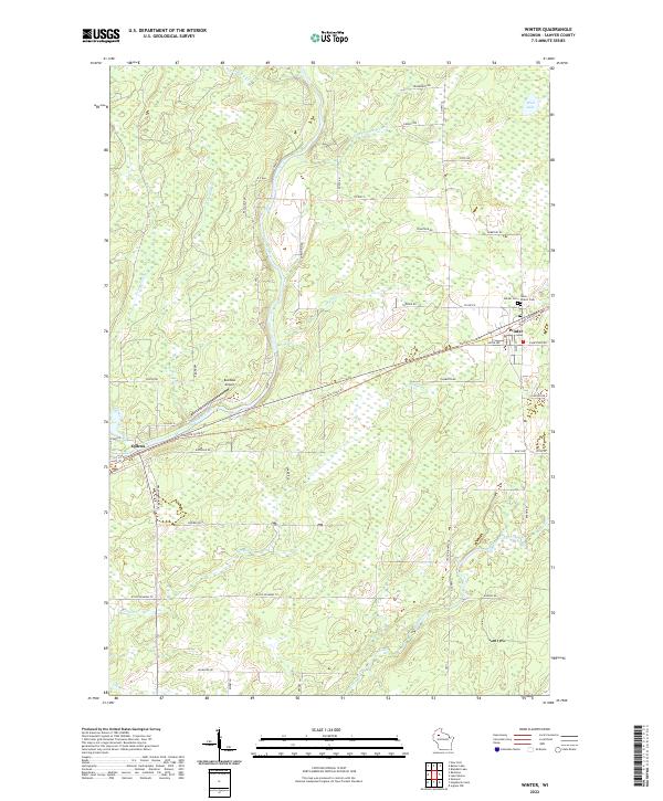 2022 Winter2022 Print · USGSThe village of Winter and the settlement of Ojibwa are documented in this recent survey of Sawyer County’s river valleys. Trace local roots at Winter Cem, follow the course of the Chippewa River, or map the Tuscobia State Trl through the Northwoods.
 - 2022 Map of Radisson, 2022 Print
 2022 Radisson2022 Print · USGSSawyer County's river valleys and recreational corridors come to life in this recent study of the northern Wisconsin woods. Researchers can trace the town grid of Radisson, follow the Tuscobia State Trl, and locate local landmarks like Radisson Cem and Belille Falls.
 - 2022 Map of Weirgor, 2022 Print
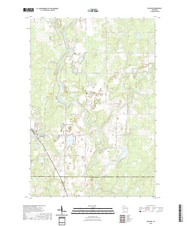
 2022 Weirgor2022 Print · USGSThe rural landscape around Exeland and Weirgor comes into focus in this modern survey of Sawyer County. Genealogists and local historians can trace family road names and remote landmarks like Kitty-Wompus Airport, Bobcat Hill, and the many springs feeding Little Weirgor Cr.
 - 2022 Map of New Post, 2022 Print
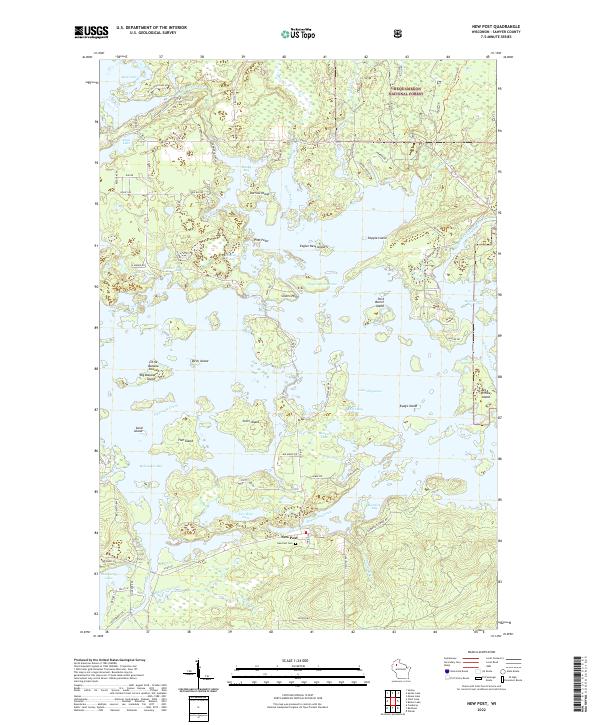 2022 New Post2022 Print · USGSThe settlement of New Post and the sprawling waters of Lake Chippewa define this Sawyer County landscape in the early twenty-first century. Genealogists and local historians can locate the New Post Cem and trace old timber routes through the Chequamegon National Forest.
 - 2022 Map of Exeland, 2022 Print
 2022 Exeland2022 Print · USGSExeland and the surrounding lake country of Sawyer County are captured here in the early twenty-first century. Genealogists can locate family sites near Windfall Cem or Bellile Cem, while researchers trace the waterways of the Couderay River and Windfall Lake.
 - 2023 Map of Chief Lake, 2023 Print
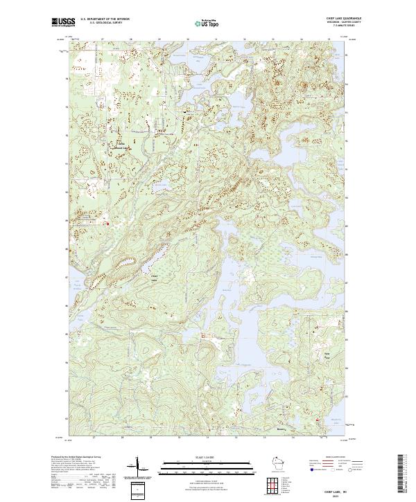 2023 Chief Lake2023 Print · USGSSawyer County’s intricate lake systems and tribal lands are meticulously detailed in this recent survey. Local historians can trace the communities of Reserve and New Post alongside the Lac Courte Oreilles Ojibwa Community College and Round Lake Cem.
End of results
Showing maps 1-8 of 8
Top cities near Radisson
- Weirgor historical maps
- Winter historical maps
- Ojibwa historical maps
- Murry historical maps
- Radisson historical maps
- Exeland historical maps
See more
Frequently asked questions
- What are the different types of historical maps available for Radisson?
- What is the oldest map of Radisson?
- Where can I purchase historical maps of Radisson for my home or office?
- Where can I download high-res historical maps of Radisson?
- Are there historical topographic maps available for Radisson?
- Is there historical aerial imagery available for Radisson?
- Where are historical maps of Radisson sourced from?