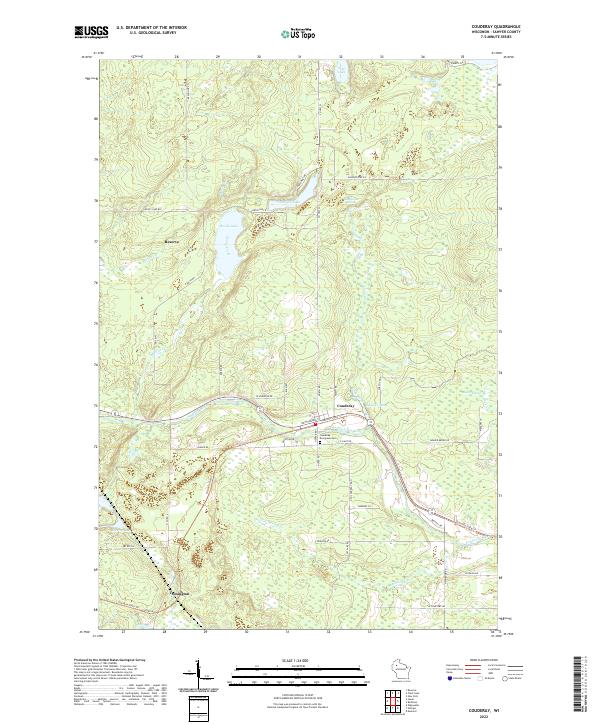
2022 Map of Couderay
USGS Topo · Published 2022About this map
The Couderay River snakes across the center of this Sawyer County landscape, anchoring the village of Couderay and the rural junction of Lemington. This region is defined by its glacial hydrology, featuring numerous water bodies such as Devils Lake, Pike Lake, and Ashegon Lake, alongside extensive wetlands like Biernit Swamp. The presence of the Tuscobia State Trl, which follows a clear corridor through the terrain, suggests a rail-to-trail conversion that links these Northwoods settlements. To the north, the community of Reserve sits near the headwaters of Devils Creek. Local genealogy and history are anchored at the Couderay Evergreen Cem, while the surrounding road network, including Resyn Hwy 3 and N Co Rd C, provides a modern framework for exploring these long-established Wisconsin townships.
Find a feature on this map
56 named features on this map. Tap any name to fly to it.
Don’t see what you’re looking for? This feature index may not catch every label — zoom into the map to look around manually.
Map Details
Editions of this 2022 Couderay Map
This is the sole edition of this map. No revisions or reprints were ever made.
Other maps of this area

1944 · Exeland
USGS Topo · 1:48,000

1944 · Couderay
USGS Topo · 1:48,000

1944 · Radisson
USGS Topo · 1:48,000

1945 · Meteor
USGS Topo · 1:48,000

1947 · Exeland
USGS Topo · 1:48,000

1948 · Couderay
USGS Topo · 1:48,000

1949 · Radisson
USGS Topo · 1:48,000

1949 · Meteor
USGS Topo · 1:48,000

1953 · Rice Lake
USGS Topo · 1:250,000

1959 · Rice Lake
USGS Topo · 1:250,000