Old Maps of Holland, Wisconsin for Hiking & Exploration
Hike through history with 40 historic maps of Holland. Explore old trails, ghost towns, and forgotten backroads — perfect for outdoor adventurers and local explorers.
- Rediscover forgotten places: Map out old mining camps, roads, and footpaths that no longer exist on modern maps.
- Layer with modern tools: Combine with LiDAR or satellite views to plan hikes through historical terrain.
- Made for exploration: Popular among hikers, overlanders, and local history lovers.
Use these maps to find adventure and explore the hidden past of Holland.
Holland, WI maps
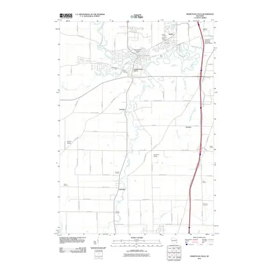
(40)- 1954 Map of Sheboygan Falls, 1956 Print
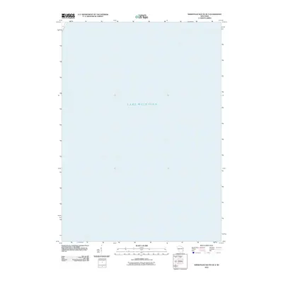
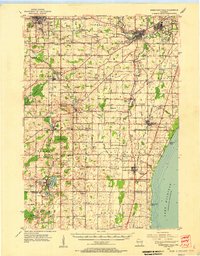 1954 Sheboygan Falls1956 Print · USGSCoastal Sheboygan and Ozaukee counties appear here in the mid-1950s, showing a landscape of dairy farms, mill ponds, and emerging industrial centers. Genealogists can trace family names at St Patrick Ch, find rural schoolhouses like Hoard Sch, or locate the lakefront Sauk Trail Beach.2 unique versions available
 - 1954 Map of Sheboygan South, 1956 Print
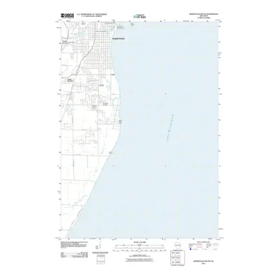
 1954 Sheboygan South1956 Print · USGSThe Sheboygan shoreline in the mid-1950s shows a balance between industrial utility and lakeside recreation. Genealogists and historians can locate Southside Cemetery, early schools like Jackson School, and the industrial footprint of Kohler.
 - 1954 Map of Sheboygan Falls, 1956 Print
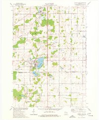
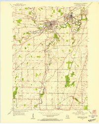 1954 Sheboygan Falls1956 Print · USGSSheboygan County's industrial and rural heart comes into focus during the mid-fifties, centered on the confluence of three rivers. Genealogists and local historians can trace family-named sites like Jansen Cem and Madison Sch or explore the early layout of Kohler and Ourtown.3 unique versions available
 - 1954 Map of Sheboygan South, 1956 Print
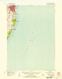
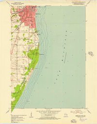 1954 Sheboygan South1956 Print · USGSThe Lake Michigan shoreline south of Sheboygan is captured here in the mid-1950s as industry and recreation began to shape the coastal landscape. Genealogists and researchers can trace urban landmarks like Central High Sch, local burial grounds including Wildwood Cem, and lakefront features like the Sunken Caisson.3 unique versions available
 - 1954 Map of Milwaukee, 1967 Print
 1954 Milwaukee1967 Print · USGSCoastal life and maritime commerce across Lake Michigan are seen here during the mid-fifties, bridging Wisconsin's industrial hubs and Michigan's timberlands. Genealogists and historians can trace the rail lines of the Grand Trunk Western and find long-established ports like Ludington, Port Washington, and Muskegon.3 unique versions available
 - 1958 Map of Milwaukee
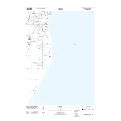
 1958 Milwaukee1958 Print · USGSThe shorelines of Lake Michigan in the late fifties reveal a landscape of bustling ferry ports and growing industrial suburbs. Genealogists and historians can trace rail networks like the Chesapeake & Ohio and locate landmarks such as Little Sable Point and Holy Cross Church.
 - 1974 Map of Random Lake, 1977 Print
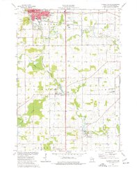
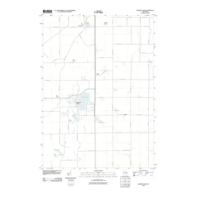
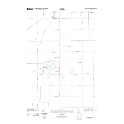
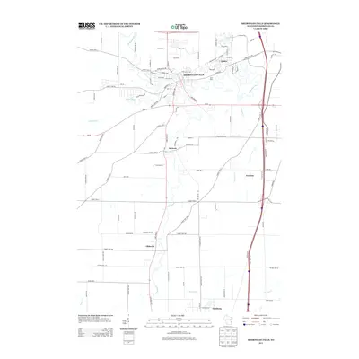
 1974 Random Lake1977 Print · USGSSheboygan and Ozaukee counties are shown here in the 1970s, as traditional rail corridors and rural townships began to accommodate new parks and utilities. You can trace family roots at Emmanuel Cem, locate the Indian Mound, or follow the Milwaukee Road rail line.
 - 1974 Map of Plymouth South, 1977 Print
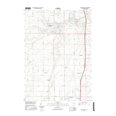
 1974 Plymouth South1977 Print · USGSSheboygan County's agricultural heartland was well-established by the mid-seventies, centered on the river-fed villages of Waldo and Hingham. Researchers can trace historic family landmarks like Lyndon Cem, rural schools such as Willow Glen Academy, and the milling heritage found at Hingham Mill Pond.2 unique versions available
 - 1974 Map of Cedar Grove, 1977 Print
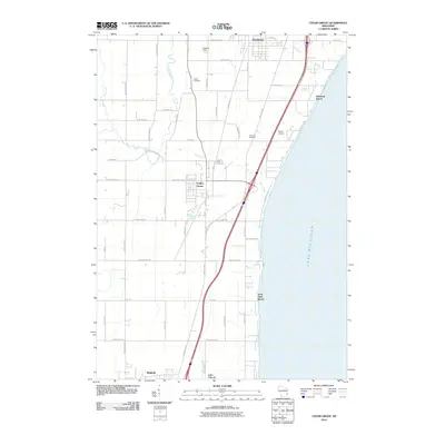
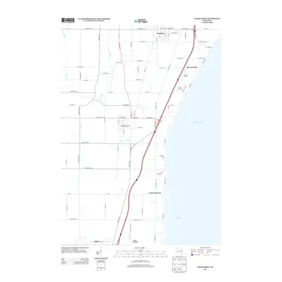
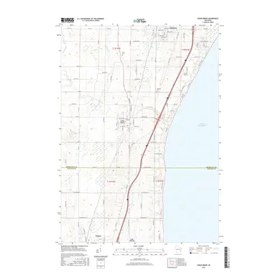
 1974 Cedar Grove1977 Print · USGSThe Lake Michigan coast in the mid-1970s reveals a blend of Dutch-settled farmsteads and growing lakeshore villages. Trace local family roots and early infrastructure through features like Oostburg Cem, Lake Church, and the Chicago and North Western rail line.
 - 1989 Map of Sheboygan, 1990 Print
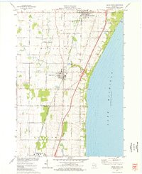
 1989 Sheboygan1990 Print · USGSCoastal Wisconsin thrived in the late eighties as the industrial corridor between Sheboygan and Belgium expanded along the lake. Genealogists and local researchers can trace old township lines and small settlements like Howards Grove, Hingham, and Gibbsville.
 - 2010 Map of Plymouth South, 2010 Print
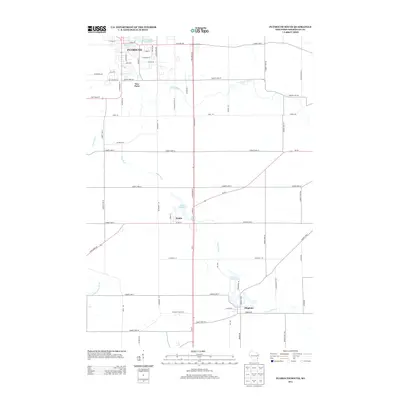
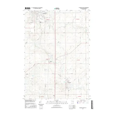
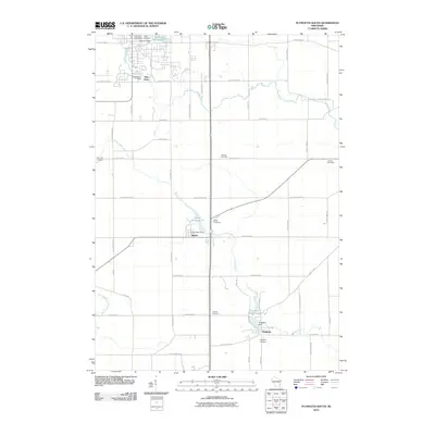 2010 Plymouth South2010 Print · USGSCovers Holland, including Plymouth, Adell, and other nearby areas
 - 2010 Map of Sheboygan South OE S, 2010 Print
 2010 Sheboygan South OE S2010 Print · USGSCovers Holland, including Sheboygan County, Ozaukee County, and other nearby areas
 - 2010 Map of Sheboygan South, 2010 Print
 2010 Sheboygan South2010 Print · USGSCovers Holland, including Sheboygan, Kohler, and other nearby areas
 - 2010 Map of Random Lake, 2010 Print
 2010 Random Lake2010 Print · USGSCovers Holland, including Random Lake, Adell, and other nearby areas
 - 2010 Map of Cedar Grove, 2010 Print
 2010 Cedar Grove2010 Print · USGSCovers Holland, including Oostburg, Belgium, and other nearby areas
 - 2010 Map of Sheboygan Falls, 2010 Print
 2010 Sheboygan Falls2010 Print · USGSCovers Holland, including Sheboygan, Sheboygan Falls, and other nearby areas
 - 2013 Map of Cedar Grove, 2013 Print
 2013 Cedar Grove2013 Print · USGSCovers Holland, including Oostburg, Belgium, and other nearby areas
 - 2013 Map of Random Lake, 2013 Print
 2013 Random Lake2013 Print · USGSCovers Holland, including Random Lake, Adell, and other nearby areas
 - 2013 Map of Sheboygan South, 2013 Print
 2013 Sheboygan South2013 Print · USGSCovers Holland, including Sheboygan, Kohler, and other nearby areas
 - 2013 Map of Plymouth South, 2013 Print
 2013 Plymouth South2013 Print · USGSCovers Holland, including Plymouth, Adell, and other nearby areas
 - 2013 Map of Sheboygan Falls, 2013 Print
 2013 Sheboygan Falls2013 Print · USGSCovers Holland, including Sheboygan, Sheboygan Falls, and other nearby areas
 - 2013 Map of Sheboygan South OE S, 2013 Print
 2013 Sheboygan South OE S2013 Print · USGSCovers Holland, including Sheboygan County, Ozaukee County, and other nearby areas
 - 2016 Map of Cedar Grove, 2016 Print
 2016 Cedar Grove2016 Print · USGSCovers Holland, including Oostburg, Belgium, and other nearby areas
 - 2016 Map of Plymouth South, 2016 Print
 2016 Plymouth South2016 Print · USGSCovers Holland, including Plymouth, Adell, and other nearby areas
 - 2016 Map of Sheboygan Falls, 2016 Print
 2016 Sheboygan Falls2016 Print · USGSCovers Holland, including Sheboygan, Sheboygan Falls, and other nearby areas
Showing maps 1-25 of 40
Top cities near Holland
- Sheboygan historical maps
- Port Washington historical maps
- Plymouth historical maps
- Town of Sheboygan historical maps
- Sheboygan Falls historical maps
- Saukville historical maps
See more
Top neighborhoods of Holland
Frequently asked questions
- What are the different types of historical maps available for Holland?
- What is the oldest map of Holland?
- Where can I purchase historical maps of Holland for my home or office?
- Where can I download high-res historical maps of Holland?
- Are there historical topographic maps available for Holland?
- Is there historical aerial imagery available for Holland?
- Where are historical maps of Holland sourced from?